Credit: Credits: NASA/NOAA/Goddard Rapid Response Team
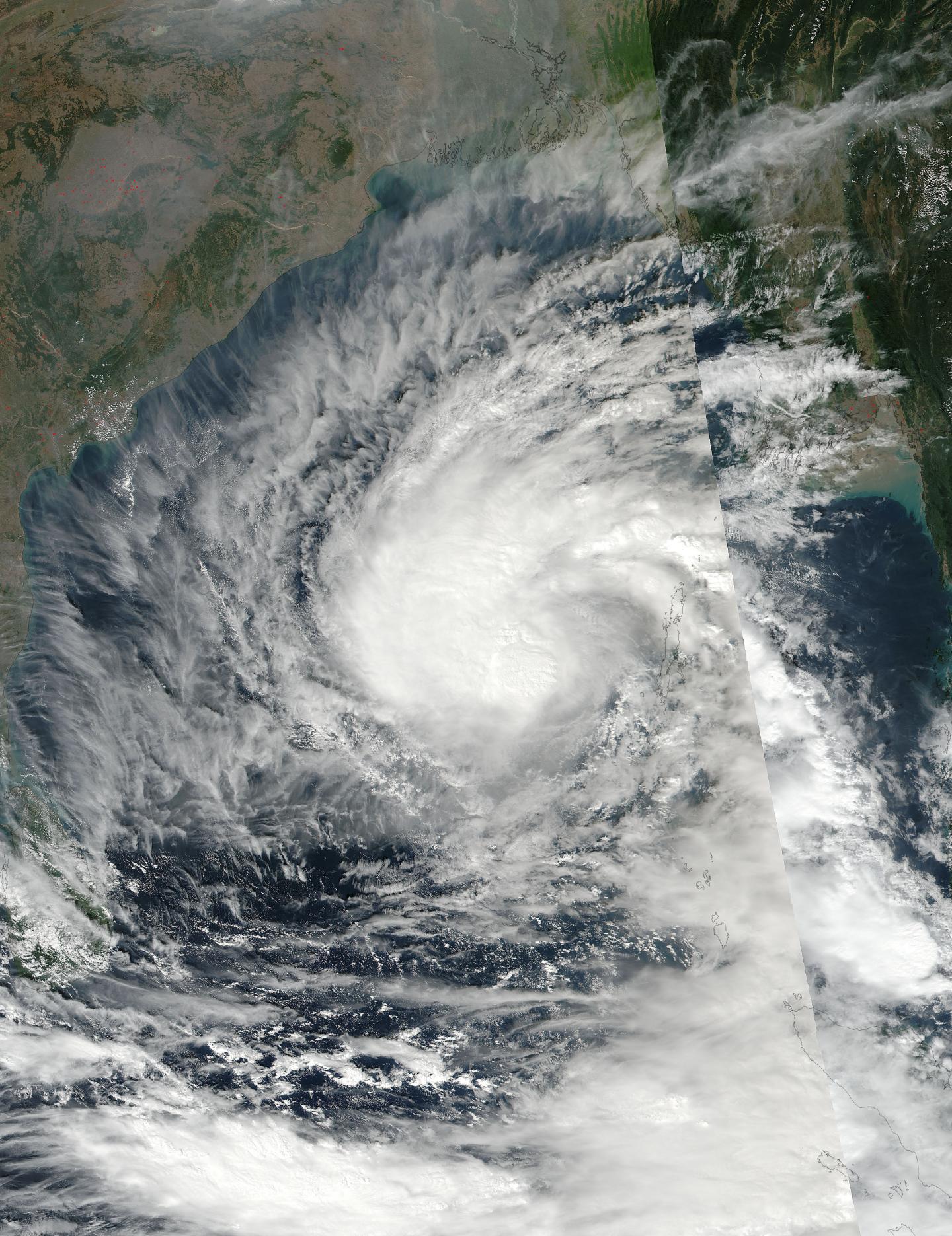
NASA-NOAA's Suomi NPP satellite captured an image of Tropical Cyclone Vardah that showed strongest storms expanding west of the center.
On Dec. 9 the Visible Infrared Imaging Radiometer Suite (VIIRS) instrument aboard the NASA-NOAA Suomi NPP satellite captured a visible image of Tropical Cyclone Vardah in the central Bay of Bengal, Northern Indian Ocean. The VIIRS image showed thunderstorms wrapping around the low level center and expanding and becoming more persistent just to the northwest of the low-level circulation center. Moderate vertical wind shear is the reason for the displacement of the strongest storms. Despite the wind shear Vardah has become more organized over the previous 24 hours and had strengthened.
The Joint Typhoon Warning Center or JTWC noted that the vertical wind shear is expected to decrease as the storm moves toward India. The decrease in wind shear is expected to allow the storm to intensify and reach hurricane-force on Dec. 10 before weakening to tropical storm force.
At 10 a.m. EST (1500 UTC) on Dec. 9 Tropical Cyclone Vardah had maximum sustained winds near 51.7 mph (45 knots/83.3 kph). Vardah was located near 12.1 degrees north latitude and 89.7 degrees north longitude, about 632 nautical miles south of Chittagong, India. The tropical storm was moving to the west-northwest at 8 mph (7 knots/13 kph).
The JTWC forecast expects Vardah to continue moving to the west-northwest toward India, where it is expected to make landfall as a tropical storm by Dec. 12 south of Visakhapatnam, India.
###
Media Contact
Rob Gutro
[email protected]
@NASAGoddard
http://www.nasa.gov/goddard
############
Story Source: Materials provided by Scienmag


