Credit: Credits: NASA/NOAA
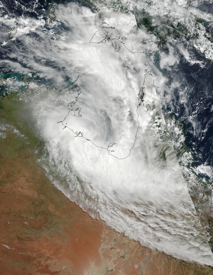
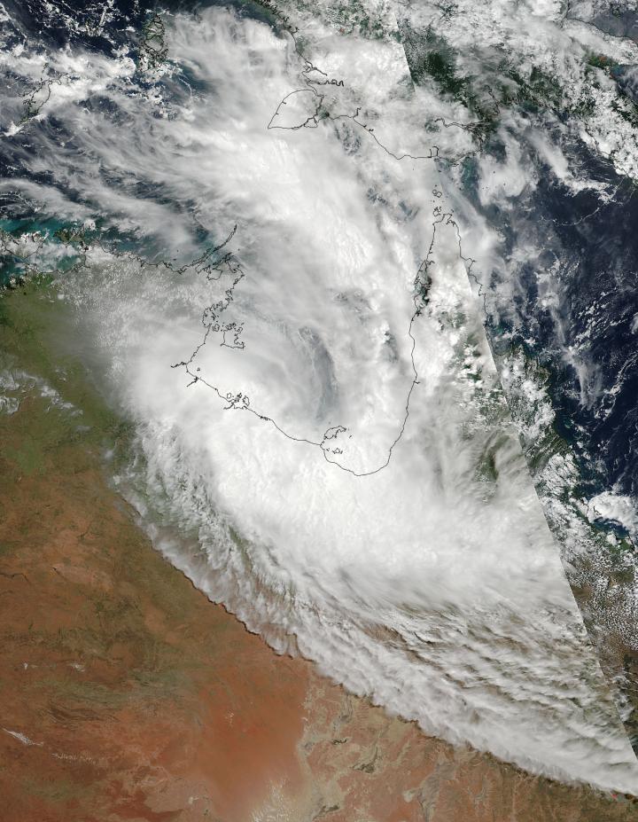
NASA-NOAA's Suomi NPP satellite captured a visible image of the Southern Pacific Ocean's newly formed tropical cyclone in the Gulf of Carpentaria. By the next day Alfred made landfall and weakened to a remnant low pressure area.
The Gulf of Carpentaria is a body of water between Australia's Northern Territory and Queensland. The Arafura Sea lies to the north of the Gulf.
On Feb. 20 the Visible Infrared Imaging Radiometer Suite (VIIRS) instrument aboard NASA-NOAA's Suomi NPP satellite provided a visible image of Alfred that showed half of the storm was over land, and half in the Gulf of Carpentaria.
Tropical Cyclone Alfred developed from a tropical low pressure area previously known as System 91P. As the low pressure area briefly moved off the coast of the Northern Territory and into the warm waters of the Gulf it consolidated and strengthened into a tropical cyclone.
When Alfred developed around 0300 UTC on Feb. 20 (10 p.m. EST on Feb. 19) the Joint Typhoon Warning Center noted Alfred's maximum sustained winds were near 46 mph (40 knots/74 kph. At that time, Alfred was centered near 15.3 degrees south latitude and 137.1 degrees east longitude in the southwestern Gulf of Carpentaria. Alfred was moving to the south-southeast 3.4 mph (3 knots/5.5 kph) and was crossing the Gulf of Carpentaria coast, between Borroloola and the Northern Territory/Queensland border.
By Feb. 21, Alfred had made landfall near the Queensland and Northern Territory border and weakened to a remnant low pressure area. At 8 p.m. AEST local time in Queensland, The Australian Bureau of Meteorology (ABM) noted that ex-tropical cyclone is expected to remain slow moving over land before shifting westward on Feb. 22.
###
There are currently no tropical cyclone warnings in effect for Alfred. For additional weather advisories, visit the ABM website: http://www.bom.gov.au/qld/warnings/.
Media Contact
Rob Gutro
[email protected]
@NASAGoddard
http://www.nasa.gov/goddard
############
Story Source: Materials provided by Scienmag


