Credit: Credits: NASA
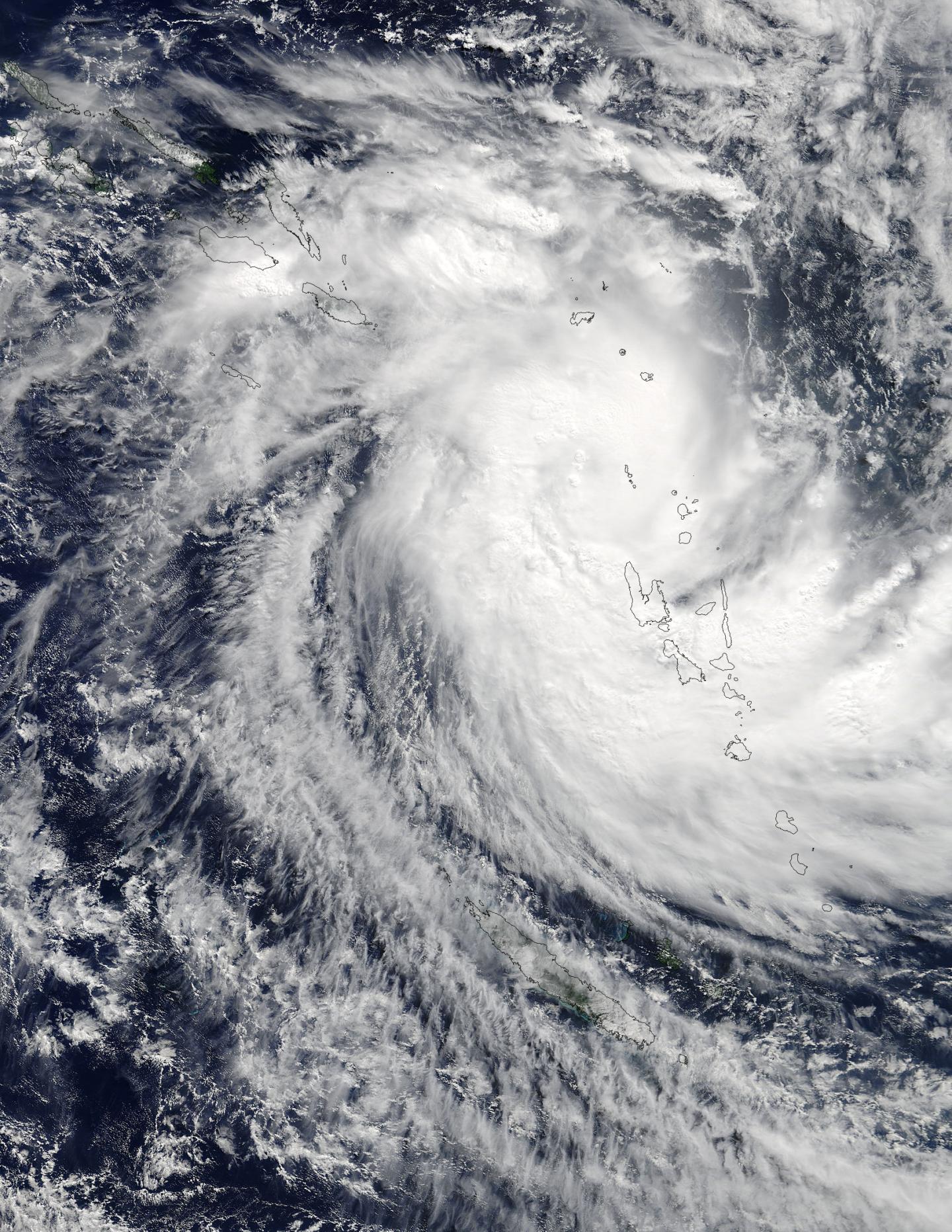
The 80 plus islands that make up the nation of Vanuatu were blanketed by the clouds of Tropical Cyclone Donna when NASA's Terra satellite passed overhead. NASA's Aqua satellite provided an infrared look at Donna that showed strong storms with heavy rain potential.
The Moderate Resolution Imaging Spectroradiometer instrument aboard NASA's Terra satellite captured a visible image of Tropical Cyclone Donna on May 4 at 2330 UTC (7:30 p.m. EDT) as it covered Vanuatu in the South Pacific Ocean. Powerful thunderstorms circled the center of the storm and a large, thick band of thunderstorms wrapped into the center from the south-southwest.
On May 5, warnings were in effect for Vanuatu and New Caledonia. The Vanuatu Meteorology and Geo-Hazards Department issued warnings for Torba, Sanma and Malampa. A Red Alert was in effect for the Torba Province and a Yellow Alert was in effect for the Sanma and Malampa provinces.
The New Caledonia Meteorological and Climatological Department issued a Yellow Strong Wind Alert for the northwestern area of the territory.
An infrared image from the Atmospheric Infrared Sounder instrument aboard NASA's Aqua satellite on May 5 at 02:17 UTC (May 4 at 10:17 p.m. EDT) showed very cold cloud top temperatures in thunderstorms around Donna's center. Coldest cloud tops were as cold as minus 63 degrees Fahrenheit or minus 53 degrees Celsius. Cloud top temperatures that cold have been shown to generate heavy rainfall.
On May 5, 2017 at 1500 UTC (11 a.m. EDT), Tropical Cyclone Donna has maximum sustained winds near 90 knots (103 mph/166.7 kph). Donna was a Category 2 hurricane on the Saffir-Simpson Hurricane Wind Scale. Donna was centered near 13.9 degrees south latitude and 164.8 degrees east longitude, about 302 nautical miles (347.8 miles/ 559.7 km) northwest of Port Vila, Vanuatu. Donna was moving to the west-southwest at 6 knots (7 mph/11 kph).
Donna is expected to peak in intensity on May 7 and 8 at 115 knots. A trough or elongated area of low pressure moving toward the storm from the west is expected to turn the direction of the storm from the southwest to the southeast. After May 8, increasing vertical wind shear and cooling sea surface temperatures will gradually weaken the cyclone. By May 10, the Joint Typhoon Warning Center expects Tropical Cyclone Donna to begin extra-tropical transition.
###
Media Contact
Rob Gutro
[email protected]
@NASAGoddard
http://www.nasa.gov/goddard
############
Story Source: Materials provided by Scienmag


