Credit: Credits: NASA JPL/Ed Olsen
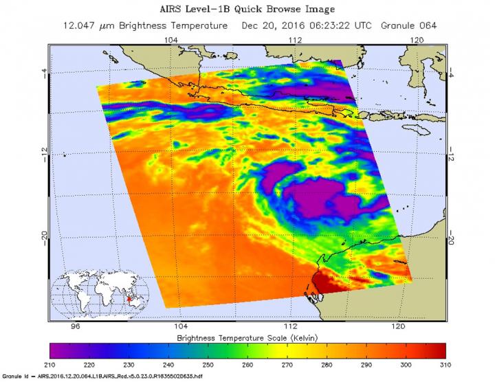
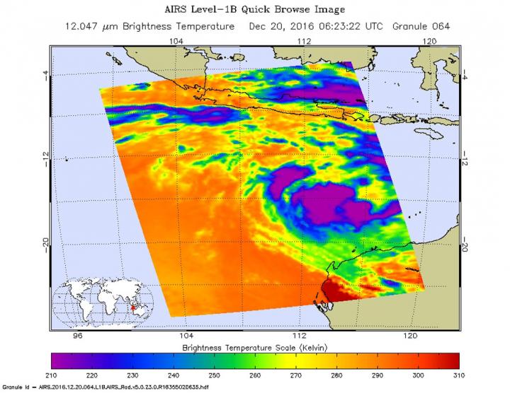
NASA's Aqua satellite flew over Tropical Cyclone 02S in the Southern Indian Ocean and infrared imagery showed that the storm had developed some strong thunderstorms. The new tropical cyclone developed northwest of Western Australia.
The Atmospheric Infrared Sounder or AIRS instrument aboard Aqua provided temperature data on 02S on Dec. 20 at 1:23 a.m. EST (0623 UTC) At the time of the overpass, there was a concentrated area of cold cloud top temperatures (indicating strong thunderstorms) near minus 63 Fahrenheit (minus 53 degrees Celsius) around the center of circulation. A band of strong thunderstorms had also developed in the northwestern quadrant.
The Joint Typhoon Warning Center (JTWC) issued a warning on 02S on Dec. 20 at 4 a.m. EST (0900 UTC). At that time, 02S's maximum sustained winds were near 35 knots (40 mph/62 kph). The storm was centered near 14.3 degrees south latitude and 114.0 degrees east longitude, about 480 nautical miles north of Learmonth, Australia. Although the storm is moving to the northeast, it is expected to curve toward the southeast and head toward Western Australia.
JTWC noted "Current environmental conditions show favorable sea surface temperatures in the range of 28 to 29 Celsius but marginal upper-level conditions as the dominant easterly flow is creating some [vertical wind] shear over the system."
A separate low pressure system designated System 90S is developing just northwest of Darwin, Australia and is expected to pass to the south of Tropical Cyclone 02S and possible interaction is possible, according JTWC, which would complicate the forecast track for the storm. 02S is currently forecast make landfall south of Broome on Dec. 25.
###
Media Contact
Rob Gutro
[email protected]
@NASAGoddard
http://www.nasa.gov/goddard
############
Story Source: Materials provided by Scienmag


