Credit: Credits: NASA MODIS Rapid Response/NOAA
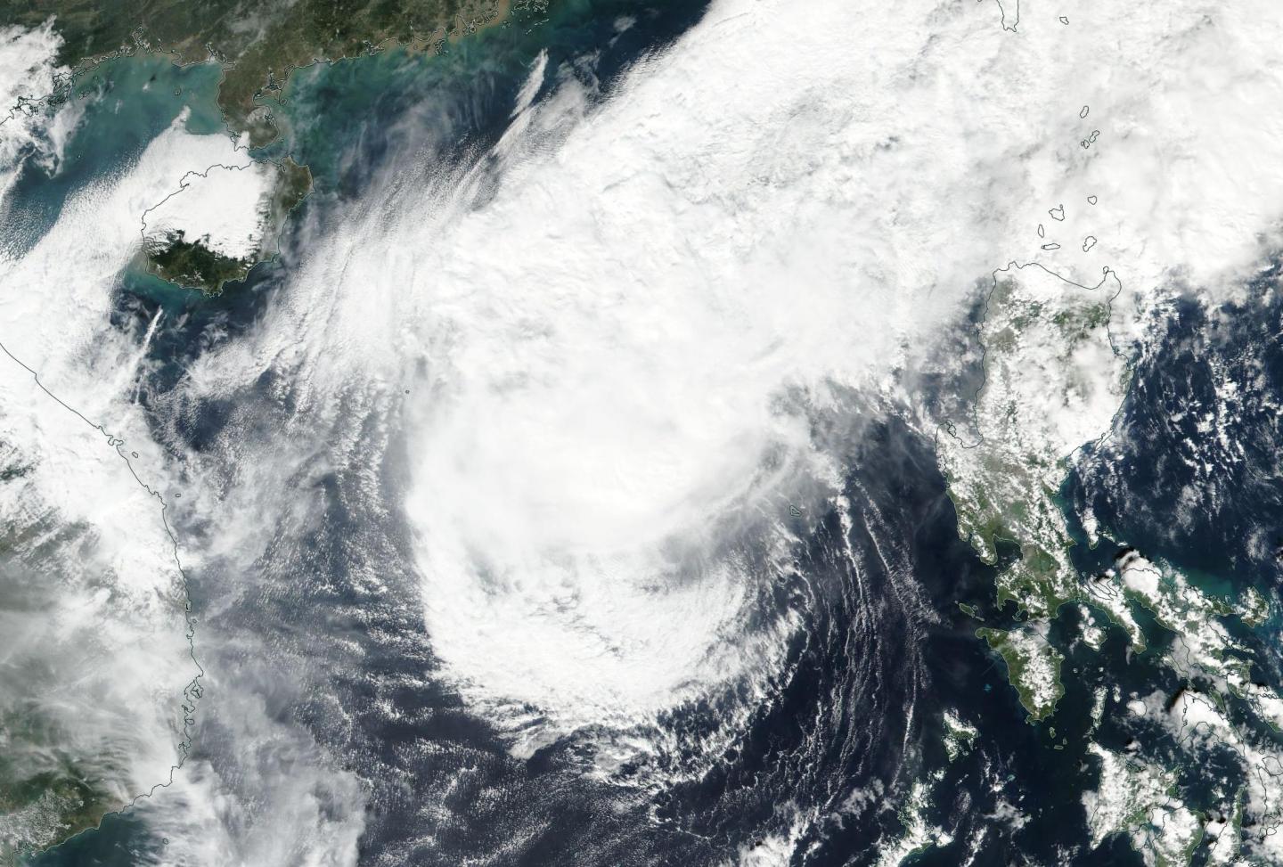
NASA-NOAA's Suomi NPP satellite flew over the South China Sea and captured a visible image of Tropical Storm Nock-ten elongating as it continued getting weaker from wind shear.
On Dec. 27 the Visible Infrared Imaging Radiometer Suite (VIIRS) instrument aboard NASA-NOAA's Suomi NPP satellite provided a visible-light image of the Nock-ten. The image showed that the storm was elongating and starting to look more like a frontal system. The low-level center is located south of a large area of convection and thunderstorms indicating strong vertical wind shear.
The image also showed an intrusion of cooler, drier air with cold-air stratocumulus clouds along the western and southern edges of the storm.
The Joint Typhoon Warning Center (JTWC) issued a bulletin on Nock-ten on Dec. 27 at 10 a.m. EST (1500 UTC). At that time, Nock-ten's maximum sustained winds had dropped to 40 mph (35 knots/64.2 kph). The storm was centered near 14.2 degrees north latitude and 115.4 degrees east longitude, about 326 nautical miles west of Manila, Philippines. Tropical Storm Nock-ten is moving to the southwest at 7 mph (6 knots /11 kph).
JTWC's forecast track carries Tropical Storm Nock-ten in a southwesterly direction where it is expected to dissipate in a day or two.
###
Media Contact
Rob Gutro
[email protected]
@NASAGoddard
http://www.nasa.gov/goddard
############
Story Source: Materials provided by Scienmag


