On the volcanic island of Jeju, South Korea’s largest island and home to the towering Hallasan mountain, an unwanted guest has quietly taken hold. The wild boar, a species that once vanished from the island, was deliberately released and escaped from farms around the year 2000, and it has since established a self-sustaining population that continues to defy control efforts. Now, a new study published in the journal Ecology and Evolution has mapped, with remarkable fine-scale precision, exactly where these animals live, which parts of the landscape they prefer, and how they might move across the island in the years to come. The findings offer one of the most detailed portraits yet of an island invasion in progress, and they arrive at a critical moment for conservation managers struggling to contain a species that has already proven resistant to culling programs.
The research team, led by Binod Kunwar and colleagues, combined two powerful modeling approaches: species distribution modeling using the Maximum Entropy algorithm, known as MaxEnt, and landscape connectivity analysis using least-cost pathways. The study drew on three years of intensive fieldwork between 2023 and 2025, during which 120 camera traps were deployed across Jeju Island in a systematic 1-by-1-kilometer grid. Each trap, positioned at least 30 meters from its neighbors, recorded bursts of three 20-megapixel photographs followed by 30 seconds of video whenever its passive infrared sensors detected movement. Combined with opportunistic sightings and field signs such as rubbing trees, feces, wallowing, and soil rooting, the surveys yielded 94 georeferenced wild boar occurrences, which were spatially filtered so that only one record was retained per 30-by-30-meter grid cell.
The environmental backbone of the model consisted of ten carefully selected variables, all resampled to a crisp 30-meter resolution. These included Euclidean distances to built-up areas, agriculture, forest, barren land, and water, all derived from the Ministry of Environment’s high-resolution land cover data, alongside elevation, slope, and a terrain ruggedness index calculated from the Shuttle Radar Topography Mission digital elevation model. Satellite-derived indices added another layer of ecological detail: the normalized difference vegetation index captured vegetation greenness, the modified normalized difference water index detected open water, and the normalized difference built-up index quantified development. Spearman’s rank correlation analysis screened out redundant variables, ensuring that multicollinearity would not distort the model’s predictions. To correct for uneven sampling intensity, the team generated a Gaussian kernel density from the occurrence records and used it to probabilistically draw 10,000 bias-weighted background points.
Rather than accepting MaxEnt’s default settings, the researchers tuned the model exhaustively, testing combinations of linear, quadratic, hinge, and product feature classes against regularization multipliers ranging from 0.5 to 5. The configuration that minimized the Akaike Information Criterion, a measure that balances goodness of fit against model complexity, emerged as the winner: linear, quadratic, and hinge features with a beta multiplier of 2.5. The final model, run in ten replicates with 70 percent of data for training and 30 percent for testing, delivered strong performance metrics, with an area under the curve of 0.76, a True Skill Statistic of 0.46, and a Continuous Boyce Index of 0.82, indicating reliable discrimination between suitable and unsuitable habitat.
The results were striking. Wild boar potential habitat covers 661.82 square kilometers, roughly 36 percent of Jeju Island’s entire surface. Of this, 265 square kilometers qualify as highly suitable and 396 square kilometers as moderately suitable. More than half of Hallasan National Park, the island’s ecological crown jewel with its unique vertical ecosystems, was projected as potential wild boar habitat, a finding that raises serious conservation concerns for the park’s native flora and fauna. The habitat overlapped overwhelmingly with forest, which accounted for nearly 62 percent of predicted suitable areas, followed by grassland at 28 percent. Notably, built-up areas also contributed to suitable habitat, underscoring the species’ notorious ecological flexibility and its capacity to thrive in human-modified environments.
Which environmental factors matter most? Distance to agriculture dominated the model, contributing a permutation importance of 0.64, far ahead of distance to built-up areas at 0.22, elevation at 0.14, and distance to water at 0.13. The response curves tell a vivid story: wild boar suitability rises sharply within 500 meters of agricultural land, reflecting the abundance and easy accessibility of forage in crop fields, and remains elevated near human settlements, a behavioral adaptation that inevitably increases the risk of human-wildlife conflict. The animals showed a strong preference for low elevations between sea level and 500 meters, moderately rugged terrain, proximity to forests that provide forage, shelter, and thermal refuge, and nearby water sources, with suitability declining exponentially as distance to inland water increases. Dense vegetation, indicated by NDVI values around 0.6, further enhanced habitat quality, likely offering both food and concealment.
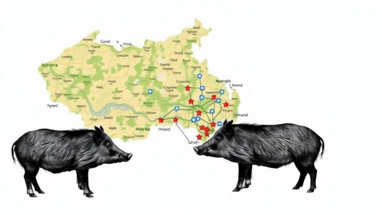
Beyond mapping where the boars are, the study tackled a question that is arguably more important for management: how connected are their populations? The team converted the habitat suitability surface into a landscape resistance model using a nonlinear transformation calibrated for ecologically plastic species, then identified six core habitat patches larger than 3 square kilometers, a threshold based on known wild boar home range sizes. Patches separated by less than a kilometer, within the daily movement capacity of the animals, were merged. The result was a network of six patches totaling 181.51 square kilometers, dominated by the vast Hallasan patch at 123.88 square kilometers, with smaller strongholds at Saekdal-dong, Manjanggul, Geumakseo-gil, Gotjwal, and Aewol.
Least-cost pathway analysis revealed eight linkages threading through the island’s landscape. The mean least-cost path between patches stretched 11.41 kilometers, with individual corridors ranging from a short 1.92-kilometer hop between Geumakseo-gil and Gotjwal to a demanding 12.23-kilometer route between Saekdal-dong and Gotjwal. Connectivity was weakest between the Manjanggul area and Hallasan, where high landscape resistance impedes movement, while the Saekdal-dong area emerged as the most permeable landscape. Centrality analysis, which measures each patch’s contribution to overall network connectivity, crowned the Hallasan and Geumakseo-gil areas as the linchpins of the entire system. The corridor connecting Hallasan to Saekdal-dong, traversing mountainous forest, proved the most robust pathway, consistent with the species’ documented affinity for forested cover that offers food, shelter, and reduced human disturbance.
The practical implications are considerable. By pinpointing the corridors and core patches that sustain the invasion, the study gives South Korean managers a strategic map for intervention: targeted population monitoring, focused removal efforts, strategic fencing, and habitat modification concentrated where they will do the most good. Similar approaches, integrating fencing with population control along key movement routes, have been deployed in European countries grappling with expanding boar populations and the looming threat of African swine fever, though their success depends heavily on fence design, maintenance, and landscape configuration. On an island free of large predators and harboring four invasive mammal species, including sika deer and Siberian chipmunks, such spatially informed strategies may be the best hope for protecting Jeju’s vulnerable native ecosystems.
The authors are candid about their model’s limitations. Climatic variables were excluded because downscaling them to the island’s fine spatial scale would have introduced additional uncertainty, and independent validation of the connectivity analysis was not performed. Small, isolated habitat patches, which may serve as stopover sites, were left out of the network. Least-cost modeling identifies optimal pathways but cannot fully capture the stochastic, dynamic nature of real animal dispersal. The researchers recommend that future work integrate telemetry-based movement data, long-term population monitoring, and genetic assessments of gene flow to validate and refine the picture. Even so, the study stands as a template for proactive invasive species management: by predicting where an invader will thrive and how it will spread before it does, conservationists gain the precious commodity of time, and on an island as ecologically isolated and biodiverse as Jeju, time is everything.
Subject of Research: Habitat suitability and landscape connectivity modeling of invasive wild boar on Jeju Island, South Korea
Article Title: Modeling the Invasion: Habitat Suitability and Landscape Connectivity of Wild Boar (Sus scrofa) on Jeju Island, South Korea
Article References: Kunwar, B., Baral, S., Jeong, Y.-H., & Oh, H.-S. (2026). Modeling the Invasion: Habitat Suitability and Landscape Connectivity of Wild Boar ( Sus scrofa ) on Jeju Island, South Korea. Ecology and Evolution, 16(10), Article e74398. https://doi.org/10.1002/ece3.74398
Image Credits: AI Generated
DOI: 10.1002/ece3.74398
Keywords: wild boar, invasive species, Jeju Island, species distribution modeling, MaxEnt, landscape connectivity, least-cost pathways, habitat suitability, Hallasan National Park, island ecology, human-wildlife conflict, South Korea
Cite Scienmag News
APA MLA Chicago
Margaret Porter. (October 3, 2026). Mapping the Wild Boar Invasion: New Models Reveal Where Pigs Rule Jeju Island. Scienmag. https://scienmag.com/mapping-the-wild-boar-invasion-new-models-reveal-where-pigs-rule-jeju-island/
Margaret Porter. “Mapping the Wild Boar Invasion: New Models Reveal Where Pigs Rule Jeju Island.” Scienmag, 3 October 2026, https://scienmag.com/mapping-the-wild-boar-invasion-new-models-reveal-where-pigs-rule-jeju-island/. Accessed 3 October 2026.
Margaret Porter. “Mapping the Wild Boar Invasion: New Models Reveal Where Pigs Rule Jeju Island.” Scienmag. October 3, 2026. https://scienmag.com/mapping-the-wild-boar-invasion-new-models-reveal-where-pigs-rule-jeju-island/
Copy citation Download RIS
Tags: conservation challenges of invasive speciescontrol and management of invasive mammalsecological impact of wild boars in South Koreaecological modeling techniques for conservationeffects of introduced species on island ecosystemshabitat preferences of wild boarshabitat suitabilityHallasan National Parkhuman-wildlife conflictInvasive Speciesisland ecologyisland invasion ecologyJeju Islandlandscape connectivitylandscape connectivity and animal movementleast-cost pathwaysMaxEntMaxEnt modeling for invasive species predictionSouth Koreaspecies distribution modelingspecies distribution modeling of invasive pigsuse of camera traps in wildlife researchwild boarWild boar invasion on Jeju Island