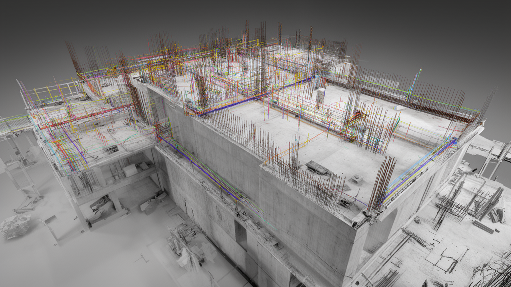
In a systematic evaluation of 51 terrestrial laser-scan scenes from two Rohbau3D construction sites, researchers demonstrated that balanced information-aware selection preserves critical minority elements while maintaining necessary data decimation rates. The investigation highlights how conventional global distortion metrics often obscure severe data losses among sparsely represented structural categories during routine site data processing.
The study established a controlled testing framework where every analytical outcome was conditional on a class-aware reference sample of 150,000 points per scene, totaling 7.65 million points, rather than native full-resolution scans. The investigative team evaluated multiple reduction strategies against a naïve NPZ and Deflate storage baseline, which reduced the sampled payload size by 10.13 percent. In addition to storage compression, the benchmark examined voxel grid filtering across resolutions of 0.05, 0.10, and 0.20 meters, alongside five archived fixed-rate selection policies tested at retention levels of 25 percent, 10 percent, and 5 percent.
Testing across the voxel grid configurations revealed monotonic changes across all measured outcomes as cell dimensions expanded. Applying a 0.05-meter voxel grid successfully eliminated 69.83 percent of the sampled points while generating a mean nearest-neighbour error of 1.470 centimeters and maintaining a 99.32 percent nearest-neighbour class agreement. However, coarser voxel filters exposed critical limitations regarding minority elements. When the voxel grid was widened to 0.20 meters, 83.77 percent of rare class–scene records retained less than 10 percent of their sampled points, although no evaluated class disappeared entirely from the records.
Geometric registration stability showed distinct trade-offs under voxel filtering during controlled Iterative Closest Point evaluations. Implementing a 0.05-meter voxelisation did not cause a statistically significant change in the archived control root-mean-square error measure when compared directly to the sampled-reference condition. Despite this stability in overall error, the proportion of surface points achieving fitness within 10 centimeters declined sharply by 13.62 percentage points, a shift verified as statistically significant at p less than .001.
In comparative testing of fixed-rate downsampling algorithms, balanced information-aware selection delivered consistent advantages over standard class-aware selection routines. While both strategies operated under identical class quotas and therefore maintained identical rare-class retention levels, the balanced approach significantly bolstered small-instance presence across all evaluated thresholds. Specifically, balanced information-aware selection improved small-instance presence over class-aware selection by 2.10 percentage points at 25 percent retention, 7.21 percentage points at 10 percent retention, and 15.47 percentage points under an aggressive 5 percent retention setting.
To ensure robust conclusions across diverse scanning environments, the research team replaced conventional point-pooled statistical inference with scene-level bootstrap confidence intervals and repeated-measures tests. The resulting metrics track the actual information retained within construction point clouds following geometric reduction, providing quantitative measurements that operate on top of downstream semantic segmentation or automated object-detection performance.
By detailing the specific trade-offs between scene-level fidelity, minority-class preservation, and geometric registration precision, the study delivers a transparent, construction-specific benchmark for engineering workflows.
Subject of Research: Information-aware reduction of construction LiDAR point clouds
Article Title: Information-Aware Reduction of Construction LiDAR Point Clouds: Scene-Level Fidelity, Minority-Class and Registration Trade-offs
Article References: Banihashemi, S., Kalantari, M., & LeNguyen, K. (2026). Information-Aware Reduction of Construction LiDAR Point Clouds: Scene-Level Fidelity, Minority-Class and Registration Trade-offs. Journal of Intelligent & Robotic Systems. https://doi.org/10.1007/s10846-026-02490-x
Image Credits: AI Generated
DOI: 10.1007/s10846-026-02490-x
Keywords: LiDAR point clouds, terrestrial laser scanning, point cloud reduction, Rohbau3D, voxel grid filtering, iterative closest point, rare class retention, minority-class preservation, small-instance presence, construction point clouds, geometric registration, nearest-neighbour error, scene-level fidelity, fixed-rate selection, information-aware reduction, class agreement, control-RMSE, NPZ Deflate storage
News Source: Denise Maddox. (November 18, 2026). Information-Aware Reduction Preserves Minority Classes in Construction LiDAR Scans. Scienmag.