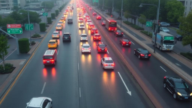
Traffic engineers have long struggled with a stubborn enemy: haze. When atmospheric haze settles over a city, the cameras and drones that monitor its roads lose the crisp detail they need to count vehicles accurately, and the congestion data that feeds intelligent transportation systems quietly degrades. Now, researchers at Amrita Vishwa Vidyapeetham in Coimbatore, India, have unveiled a deep learning framework that promises to keep urban traffic monitoring sharp even when the air itself is working against it. The system, called TDE-RYOLO, was described in the journal Neural Computing and Applications by H. Haritha and T. Senthil Kumar, and it reports an overall accuracy of 99.15 percent in estimating traffic density from drone imagery captured in hazy conditions.
The problem the researchers set out to solve is deceptively simple to state but notoriously difficult in practice. Unmanned aerial vehicles, or UAVs, have become one of the most flexible tools for watching traffic flow across wide urban areas, covering intersections and arterial roads that fixed cameras cannot see. Yet aerial images taken through haze suffer from reduced contrast, washed-out colors, and blurred edges, all of which undermine the computer vision models that detect and count vehicles. Small cars become faint smudges, overlapping vehicles merge into single blobs, and low-contrast scenes cause detection networks to miss objects entirely. Any traffic density estimate built on such degraded detections inherits those errors, which can cascade into poor signal timing decisions and unreliable congestion warnings.
TDE-RYOLO attacks the problem in stages, beginning before a single vehicle is detected. The framework first pre-processes the UAV-acquired traffic images using two complementary image enhancement techniques. The first is Dark Channel Prior, or DCP, a dehazing method grounded in the observation that in most outdoor images free of sky, at least some color channels contain very dark pixels in local patches; haze disrupts this pattern, so estimating and reversing the haze’s contribution restores contrast and color fidelity. The second is Contrast Limited Adaptive Histogram Equalization, known as CLAHE, which boosts local contrast in small regions of the image rather than globally, preventing the over-amplification of noise that plain histogram equalization can cause. Together, these steps suppress haze-induced distortions and hand the downstream detector a far cleaner view of the roadway.
At the heart of the system sits the detection network, a modified version of YOLOv9 that the authors call REP-YOLOv9. YOLO-family models perform object detection in a single forward pass, making them fast enough for real-time applications, but the researchers leaned on two architectural innovations specific to YOLOv9 to make the detector robust under occlusion and low contrast. The first is Programmable Gradient Information, or PGI, a mechanism designed to combat the information bottleneck that occurs as data passes through deep networks. In conventional architectures, gradient information flowing backward during training can become unreliable or lossy, causing the network to lose track of what matters in the input. PGI provides an auxiliary, reversible pathway that preserves critical features across layers, reducing information loss and improving multi-scale feature extraction, which is essential when vehicles appear at wildly different sizes depending on their distance from the drone.
The second innovation is Generative Latent Embedding with the rather memorable acronym GELAN, a network design that blends architectural elements to generalize well across different detection scenarios. Combined with PGI, GELAN helps the detector maintain reliable performance when vehicles overlap one another in dense traffic or fade into low-contrast backgrounds, precisely the conditions that haze creates. The authors report that this combination allowed TDE-RYOLO to detect vehicles robustly across dynamic urban scenes, where lighting, density, and viewing geometry change from moment to moment.
Detecting individual vehicles, however, is only half the task. To convert a scatter of bounding boxes into a meaningful picture of congestion, the framework employs Kernel Density Estimation, or KDE, a non-parametric statistical technique that transforms discrete vehicle detections into a continuous spatial distribution map. Each detected vehicle contributes a smooth kernel to the map, and the sum of these kernels produces a density surface over the road network. This continuous representation makes it possible to assess vehicle counts and traffic flow accurately across large and changing scenes, smoothing out the jitter that raw point detections can introduce and giving traffic managers a spatially intuitive view of where vehicles are clustering.
The final analytical stage classifies the resulting density into three congestion levels: Low, Moderate, and High. Rather than applying arbitrary thresholds, the researchers adopted a Poisson-based probabilistic density classifier. The Poisson distribution is a natural model for count data, describing the probability of a given number of events, in this case vehicles, occurring in a fixed area when those events happen independently at a stable average rate. By framing congestion classification probabilistically, the system can categorize traffic in a way that reflects the inherent randomness of vehicle arrivals, which the authors argue yields more reliable level assignments across dynamic urban conditions.
The performance numbers are striking. Evaluated with a battery of standard metrics including accuracy, precision, recall, specificity, F1-score, RMSE, and MAE, TDE-RYOLO achieved an overall accuracy of 99.15 percent, with significantly reduced estimation error. In head-to-head comparisons, the framework outperformed existing approaches by meaningful margins: it improved accuracy by 3.99 percent over IDOD-YOLOv7, a dehazing-focused YOLOv7 variant designed for foggy traffic environments; by 5.24 percent over TAU, a video-based traffic analytics framework leveraging artificial intelligence and unmanned aerial systems; and by 6.28 percent over C-ITS YOLOV, a vehicle detection system built for cooperative intelligent transport applications. In a field where incremental gains of a fraction of a percent are often celebrated, those margins represent a substantial leap.
The implications extend well beyond an academic benchmark. Accurate traffic density estimation is a cornerstone of intelligent transportation systems and urban mobility management. Density estimates feed adaptive traffic signal control, congestion pricing schemes, route guidance applications, and emergency vehicle prioritization. When those estimates are corrupted by weather, the entire management stack suffers. A framework that maintains near-perfect accuracy in hazy environments could make aerial traffic monitoring dependable in cities where smog, fog, or dust are routine rather than exceptional, and the UAV-based approach offers coverage that fixed roadside sensors cannot match without expensive infrastructure buildout.
The work also fits into a broader wave of research applying YOLO-family detectors to transportation problems, from pothole detection to vehicle speed estimation and smart city crowd monitoring, and it arrives alongside a growing literature on UAV-based traffic state estimation using probabilistic and Gaussian process methods. What distinguishes TDE-RYOLO is the end-to-end integration of atmospheric correction, information-preserving detection, continuous density mapping, and probabilistic classification into a single pipeline purpose-built for degraded visibility. The authors, who conducted the study at Amrita’s School of Computing, report no financial support and no competing interests, and they note that the framework was developed specifically for intelligent transportation and urban mobility management applications. As cities grow denser and the demand for real-time, weather-resilient traffic intelligence intensifies, systems like TDE-RYOLO suggest that the view from above is about to get a great deal clearer, even when the air below refuses to cooperate.
Subject of Research: Deep learning-based traffic density estimation from UAV images in hazy environments
Article Title: TDE-RYOLO: haze environment in traffic density estimation using deep learning-based REP-YOLOV9 network
Article References: TDE-RYOLO: haze environment in traffic density estimation using deep learning-based REP-YOLOV9 network. (n.d.). https://doi.org/10.1007/s00521-026-12345-z
Image Credits: AI Generated
DOI: 10.1007/s00521-026-12345-z
Keywords: traffic density estimation, deep learning, UAV, haze removal, YOLOv9, computer vision, intelligent transportation systems, Dark Channel Prior, CLAHE, Kernel Density Estimation, Poisson classifier, smart cities
Cite Scienmag News
APA MLA Chicago
Blake Davidson. (October 1, 2026). Haze-Proof AI: Drone-Powered Deep Learning Hits 99% Accuracy in Traffic Density Estimation. Scienmag. https://scienmag.com/haze-proof-ai-drone-powered-deep-learning-hits-99-accuracy-in-traffic-density-estimation/
Blake Davidson. “Haze-Proof AI: Drone-Powered Deep Learning Hits 99% Accuracy in Traffic Density Estimation.” Scienmag, 1 October 2026, https://scienmag.com/haze-proof-ai-drone-powered-deep-learning-hits-99-accuracy-in-traffic-density-estimation/. Accessed 1 October 2026.
Blake Davidson. “Haze-Proof AI: Drone-Powered Deep Learning Hits 99% Accuracy in Traffic Density Estimation.” Scienmag. October 1, 2026. https://scienmag.com/haze-proof-ai-drone-powered-deep-learning-hits-99-accuracy-in-traffic-density-estimation/
Copy citation Download RIS
Tags: atmospheric haze impact on traffic surveillanceCLAHEcomputer visionDark Channel Priordeep learningdeep learning for urban traffic density estimationdrone imagery processing in adverse weatherdrone-based vehicle countinghaze removalhaze-resistant computer vision modelshaze-robust vehicle detection algorithmshigh-accuracy drone traffic monitoring systemintelligent transportation systemsintelligent transportation systems robustnessKernel Density Estimationneural network applications in traffic congestion analysisPoisson classifiersmart citiesTDE-RYOLO deep learning frameworktraffic density estimationtraffic monitoring under hazy conditionsUAVUAV imagery analysis for traffic managementYOLOv9