A comprehensive geospatial multi-criteria analysis evaluating the entirety of Egypt has determined that approximately 1.60 percent of the nation’s territory, representing roughly 15,985 square kilometers, possesses high suitability for wind energy development. The research, carried out using an integrated Geographic Information System and Analytic Hierarchy Process framework, combined recent remote-sensing observations with updated national infrastructure networks to evaluate technical, environmental, and socio-economic siting factors. The findings demonstrate that prime wind development zones are intensely concentrated along the Red Sea coast and the Gulf of Suez corridor, where exceptional wind regimes coincide with vital road and transmission infrastructure. At the same time, the investigation identified that 91.25 percent of the national landmass, or about 914,144 square kilometers, is subject to strict developmental constraints or exclusions under established planning criteria.
The study was designed to address a critical planning challenge facing lower-middle-income countries seeking to expand renewable power generation while relying on clear, reproducible decision-support tools. In Egypt, national power generation reached 229,284 gigawatt-hours in the 2023/2024 fiscal year, reflecting a 6.03 percent increase over the preceding year, while peak electricity demand climbed to 37.2 gigawatts in August 2024. The country currently relies heavily on fossil fuels, with natural gas and oil generating the vast majority of its electricity supply, and the power sector contributes approximately 35.5 percent of Egypt’s total carbon dioxide emissions. Under the updated Integrated Sustainable Energy Strategy, known as ISES 2035, the government has accelerated its targets to achieve a 42 percent renewable share in the national electricity mix by 2030, with wind energy slated to supply 14 percent of total generation. Achieving these ambitions requires identifying viable deployment zones that balance raw wind quality against accessibility and land-use constraints.
To evaluate land suitability across Egypt’s 1,001,840 square kilometer analytical domain, the researchers compiled multiple spatial datasets to represent eight core evaluation criteria. Topographic slope was derived from a 30-meter resolution NASA Shuttle Radar Topography Mission digital elevation model mosaicked across 114 tiles, while wind resources were characterized using 50-meter elevation mean annual wind speeds from the Global Wind Atlas 3.0, where national values ranged between 0.63 and 19.74 meters per second. Infrastructure layers incorporated major roads and highways totaling approximately 37,090 kilometers and high-voltage transmission lines spanning 8,409 kilometers, both updated to reflect actual conditions as of 2021. Land use and land cover data were adapted from FAO Africover and updated using 2020/2021 Egyptian General Survey Authority maps, capturing 67 major cities, 24 airports, coastlines, agricultural lands, urban footprints, and water bodies, with all spatial data projected to the common WGS 1984 UTM Zone 36N coordinate system.
Each criterion layer was reclassified onto a standardized suitability scale ranging from 0 for restricted or entirely unsuitable areas to 10 for optimal conditions. The scoring rules assigned a score of zero to wind speeds below 1 meter per second, with speeds above 10 meters per second earning the top score of 10. For terrain slope, areas steeper than 30 degrees were designated as completely unsuitable due to construction complexity, turbine instability, and turbulent airflows, whereas slopes below 3 degrees received the maximum score. Proximity metrics prioritized infrastructure access to minimize project interconnection capital, awarding the highest score to zones within 1,000 meters of transmission lines and roads, while classifying lands beyond 20 kilometers from transmission lines and 10 kilometers from highways as unsuitable. Setbacks were applied to safeguard civilian communities and infrastructure, enforcing a mandatory 2-kilometer exclusion buffer around cities, a 3-kilometer exclusion radius around airports, and a 500-meter buffer along coastlines, while assigning agricultural land, urban areas, and water bodies an exclusion score of zero.
Assigning relative weights to the eight criteria was accomplished through the Analytic Hierarchy Process, using judgments elicited from a six-member panel of cross-sector experts possessing at least 12 years of professional experience in renewable energy, spatial planning, grid engineering, and environmental policy. The experts completed independent pairwise comparisons across 28 unique criterion pairs using Saaty’s standard 1 to 9 numerical scale without iterative consensus rounds, and individual judgment matrices were synthesized using the geometric mean method. Statistical evaluation demonstrated strong, statistically significant concordance among the six panelists, yielding a Kendall’s coefficient of concordance of 0.93. The principal eigenvalue of the aggregated matrix reached 8.286, resulting in a Consistency Index of 0.0408 and an overall Consistency Ratio of 0.029, safely below the conventional 0.10 threshold and verifying that the panel’s evaluations maintained robust internal mathematical consistency.
The resulting eigenvector weights demonstrated that average wind speed was the most decisive factor, receiving an importance weight of 29.4 percent. Proximity to high-voltage transmission lines and proximity to major roads were judged equally critical to practical development, each securing a weight of 17.6 percent, while terrain slope received 12.3 percent. The remaining factors accounted for smaller shares: land use and land cover received 9.8 percent, buffers from airports and coastlines each garnered 4.6 percent, and distance from urban population centers accounted for 4.1 percent. After overlaying the weighted criteria and removing restricted areas that violated absolute developmental cutoffs, non-restricted scores were categorized using the Jenks Natural Breaks classification method, which minimizes internal class variance while maximizing differences between categories. The resulting score thresholds divided the terrain into low suitability for scores between zero and 3.12, medium suitability between 3.12 and 6.08, and high suitability for composite scores above 6.08.
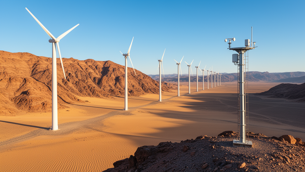
The geographical distribution produced by the weighted overlay demonstrated that high-suitability terrain is heavily clustered along the Red Sea coast, stretching from the northern Gulf of Suez down through sectors of the Eastern Desert. In this corridor, high annual wind speeds exceeding 8 to 10 meters per second overlap with flat desert topography and established parallel transportation and power transmission lines. In total, the national screening model classified 15,985 square kilometers as highly suitable, 65,594 square kilometers as moderately suitable representing 6.55 percent of Egypt, and 6,117 square kilometers as low suitability representing 0.61 percent. Conversely, 914,144 square kilometers were classified as restricted. The Nile Valley and Delta were largely excluded due to intense agricultural land use, high population densities, and lower wind resources, while mountainous sectors of the southern Sinai Peninsula and Red Sea ranges were constrained by steep slopes exceeding 30 degrees and limited roadway accessibility.
The study evaluated the stability of its suitability model through a One-at-a-Time sensitivity analysis that systematically adjusted the weights of the three dominant criteria—wind speed, distance to transmission lines, and distance to roads—by plus and minus 10 percent and 20 percent while proportionally renormalizing the remaining factors. Across all twelve tested perturbation scenarios, the spatial configurations demonstrated high stability, with every cell-by-cell Kappa coefficient of agreement exceeding 0.93 compared to the baseline map. Agreement was highest in the transmission line scenario adjusted upward by 10 percent, with a Kappa of 0.981, and lowest in the road distance scenario increased by 20 percent, which yielded a Kappa of 0.932. While the overall geographic distribution remained stable, the areal footprint of the high-suitability class showed moderate sensitivity specifically to wind speed weighting, expanding to 1.95 percent under a 20 percent reduction in wind speed weight and contracting to 1.28 percent when wind speed weight was increased by 20 percent.
To evaluate the external plausibility of the framework, the model’s mapped suitability zones were compared against the geographic coordinates of Egypt’s five major operating commercial wind farms: Zafarana, Ras Ghareb, West Bakr, Gabal El-Zeit, and Gulf of Suez II. Together, these five installations represent approximately 2,290 megawatts of generation capacity, accounting for roughly 76 percent of the nation’s operational wind capacity, which surpassed 3,000 megawatts following the commissioning of the 650-megawatt Red Sea Wind Energy project in mid-2025. The spatial overlay positioned four of the five operational farms squarely inside the high-suitability class, achieving an 80 percent agreement rate by facility count, while all five facilities fell within either the high or medium suitability classes. The Gabal El-Zeit facility plotted within the medium class because its representative database point sat just outside the high boundary due to conservative multi-factor constraints and wide project boundaries.
The authors emphasized that the screening tool carries distinct structural limitations and is designed strictly as a high-level spatial filter rather than a replacement for detailed local feasibility assessments. Crucially, the model omitted legally protected nature reserves and key wildlife corridors from its exclusion mask due to the absence of dedicated, standardized national spatial datasets at the time of analysis. This limitation is particularly significant along the Gulf of Suez and Red Sea coastal plain, which intersects the Rift Valley and Red Sea flyway, the world’s second-most critical migration corridor for soaring birds. More than two million migratory birds representing 37 species traverse this corridor annually, including threatened raptors such as the Egyptian Vulture and Steppe Eagle. Existing operational farms within this flight path currently implement Shutdown on Demand operational protocols to halt spinning turbines during peak migration pulses, highlighting the necessity of conducting mandatory field-based environmental impact assessments, bird tracking surveys, and economic appraisals before executing final site development.
Subject of Research: National GIS-AHP multi-criteria assessment of wind energy site suitability in Egypt
Article Title: Optimal wind energy site selection in Egypt using a GIS–AHP and remote sensing-based approach
Article References: Maklad, M. A., Tawfeek, H., El-Fiky, G., & Zahran, E. M. M. (2026). Optimal wind energy site selection in Egypt using a GIS–AHP and remote sensing-based approach. Journal of Engineering and Applied Science, 73(1), Article 436. https://doi.org/10.1186/s44147-026-01283-1
Image Credits: AI Generated
DOI: 10.1186/s44147-026-01283-1
Keywords: wind energy, Egypt, GIS, Analytic Hierarchy Process, renewable energy, Red Sea corridor, Gulf of Suez, spatial multicriteria analysis, remote sensing, grid infrastructure, energy planning, ISES 2035, site suitability, sensitivity analysis, environmental screening, wind farms
News Source: Faith Mcneil. (November 20, 2026). Geospatial Screening Identifies Key High Suitability Wind Corridors Across Egypt. Scienmag.