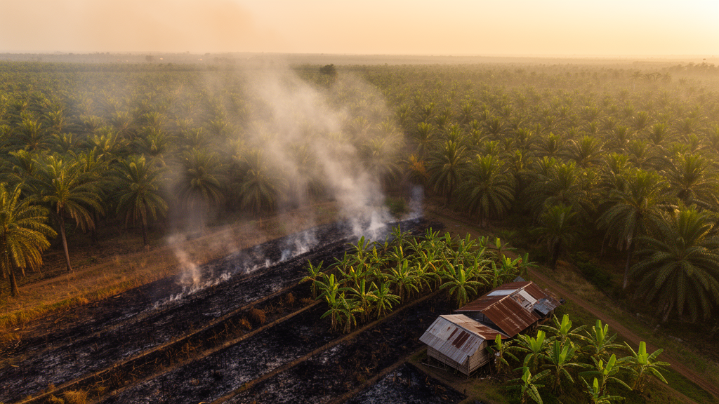
Forest and land fires that burned inside two oil palm concessions in West Kalimantan, Indonesia, all occurred on community-controlled enclave land rather than on areas the companies themselves manage, according to a case study published in the journal Fire Ecology. Ground verification by researchers mapped roughly 1,047 hectares of burned land across 20 locations between 2019 and 2024, and every recorded fire fell within enclaves — community-owned parcels or designated conservation zones that sit inside the companies’ formal location permit boundaries but outside the land the companies are authorized to cultivate. The fires were primarily associated with slash-and-burn practices by local communities, initially carried out for rice cultivation, and many of the burned areas were later converted into smallholder oil palm plantations.
The study, led by Rijal Ramdani and colleagues, examined two RSPO-certified oil palm companies operating in Nanga Tayap District, Ketapang Regency. The researchers combined semi-structured interviews, focus group discussions in two villages, field observations, document analysis, and geographic information system mapping of burned sites, with fieldwork conducted between 1 October and 20 December 2024. Using Q-GIS software, the team merged coordinates taken with local guides at 20 burned areas with concession boundary data drawn from the RSPO concession map database and satellite hotspot records. The authors stress that the two case-study landscapes were purposively selected because they contain extensive enclave areas and a documented history of repeated fires, so the sites represent specific cases rather than a statistically representative sample of Indonesian oil palm concessions.
The distinction between the two kinds of enclaves is central to the findings. The first type consists of land that communities occupied and managed before location permits were granted to company 1 in 2016 and company 2 in 2011. Under Indonesia’s Basic Agrarian Law No. 5 of 1960, land rights require a legal basis and registration, and where owners decline to transfer land inside a location permit boundary, the company cannot treat that parcel as part of the area it controls when applying for a Plantation Business Permit for Cultivation or a Right to Cultivate. Company 2’s location permit covers 13,000 hectares, but its IUP-B covers 11,765 hectares and its HGU only 6,309.73 hectares, of which 4,836 hectares are planted with oil palm. Approximately 6,944 hectares remain under community control. Government maps commonly show the larger location permit boundary, which can give the false impression that a company controls the entire area.
The second enclave type comprises High Conservation Value and High Carbon Stock areas designated for conservation within the permit boundaries. Publicly available assessment data indicate that 8,577 hectares, or 90.8 percent of the HCV and HCS areas within company 1’s location permit, consist predominantly of peat swamp forests and riparian zones, and since 2020 about 8,000 hectares of peat swamp forest there have been managed through biodiversity conservation projects that received an RSPO Conservation Leadership Award in 2023. Company 2 holds roughly 2,459 hectares of such areas, mainly watershed ecosystems. Some community members nevertheless use these designated conservation zones for agriculture, and in some cases cultivation expands into them through burning to prepare land for rice or oil palm. Unclear boundaries and limited signage between community land and conservation areas contribute to the contestation, according to the focus group discussions.
The fires themselves were traced largely to deliberate ignition rather than spontaneous causes. Focus groups in both villages indicated that El Niño was not the primary cause of fires in the enclaves; instead, dry conditions extended the period during which communities could carry out slash-and-burn clearing. Fires during the 2019 and 2023 El Niño events burned about 1,008 hectares of HCV and HCS areas within company 1’s boundaries, attributed to intentional burning by communities clearing land to plant oil palm. Reduced rainfall dried the peat ecosystem, creating abundant combustible biomass that allowed fires to spread more easily. Company representatives reported conducting fire prevention, monitoring, patrol, and suppression activities in the conservation areas, but said their capacity was limited by dry peat conditions during prolonged drought and by the risk of conflict with communities continuing to use the land. During the 2015 El Niño event, slash-and-burn fires in company 2’s enclaves spread beyond control and burned part of the company’s own oil palm plantations.
Interviews with subdistrict army and police officers, NGO representatives, village officials, and local government authorities consistently indicated that neither company used fire for land clearing. Company land development followed a zero-burning procedure involving HCV assessment, mechanical clearing with heavy equipment, vegetation stacking for natural decomposition, and construction of terraces and drainage where required, applied to new planting, replanting, and other development. RSPO requirements prohibit fire-based land clearing, and Indonesian Law No. 32/2009 and Ministry of Agriculture Regulation No. 5/2018, as amended by Regulation No. 6/2025, prohibit burning for plantation land clearing, with penalties under Law No. 32/2009 of up to 10 years’ imprisonment and fines of up to IDR 10 billion. Company management stated that proven slash-and-burn practices could jeopardize RSPO certification.
The community burning practices are deeply embedded in local livelihoods and culture. In Kayong Utara and Nanga Tayap villages, Dayak Kayong and Malay communities maintain a long-standing tradition of controlled burning to cultivate rice mixed with cucumbers, vegetables, and chilies. Rice cultivation carries ceremonial significance, including the production of fermented rice beer used in rituals before and after harvest, and communities perform shaman-led rituals asking permission from ancestral spirits before burning. Farmers cut vegetation and leave it to dry for one to two months, create firebreaks, and burn collectively while monitoring wind direction, believing the remaining biochar improves soil nutrients and that excavators damage soil fertility. West Kalimantan’s Governor Regulation No. 1/2022 formally recognizes the practice, allowing each household to clear up to two hectares for rice and vegetable cultivation using controlled burning, provided village authorities are notified beforehand.
Economics strongly shape the persistence of burning. Mechanized land clearing with excavators costs approximately US$300 to 450 per hectare, which local farmers described as prohibitively expensive, whereas burning is perceived as the fastest and cheapest method of preparing peatland for cultivation. Ground-check mapping showed that 16 of the 20 burned areas, covering approximately 1,046 hectares, were subsequently planted with oil palm or a combination of oil palm and rice; 1,008 hectares of the burned area lie in company 1’s peatland enclaves and 38.2 hectares on mineral soils in company 2’s enclaves, while only three burned areas were planted exclusively with rice. Slash-and-burn activities between 2019 and 2024 were initially intended for rice cultivation, but many areas were later converted to oil palm as households shifted crops for higher income, moving away from the rubber that Dayak Kayong farmers previously planted after rice. All burned areas within company 1’s HCV and HCS zones were subsequently planted with oil palm.
Peatland conditions amplified the risks. Company 1’s concession contains 4,867 hectares of peat swamp forest and 1,881 hectares of peatland with depths of one to five meters within the Sungai Pawan and Sungai Tolak peat hydrological units. This ecosystem generally remains wet because of limited artificial drainage, but dried during the 2019 and 2023 El Niño events as rainfall declined. Local communities sometimes spray pesticides to clear grass on peatlands, causing underlying shrubs to dry and become highly flammable. Although Dayak communities usually avoid burning peatlands because the soil is unsuitable for rice, fires have occurred through negligence, including a 2015 incident caused by a fisherman who forgot to extinguish a fire after burning fish, and agarwood hunters have set small fires to detect the smell of agarwood beneath peat soils, which can spread uncontrollably. Villagers and company fire brigade members noted that cigarette butts rarely ignite peatlands based on field experiments.
The authors conclude that fires recorded within corporate concession boundaries cannot automatically be attributed to company operations without examining actual land control and management, while emphasizing that their evidence from two certified companies does not support broader conclusions about the dominant causes of fires across Indonesia and does not represent non-certified companies or those actively undertaking initial land preparation. They argue that clarifying the spatial and legal status of enclave lands, including their exclusion from concession boundaries, could improve accountability and strengthen fire management among companies, communities, and local authorities. Proposed measures include participatory mapping to distinguish corporate operational land, retained community land, and conservation areas, alongside community fire patrols, conflict resolution, affordable non-burning land preparation, and support for smallholder access to Indonesian Sustainable Palm Oil and RSPO Independent Smallholder certification, since smallholder plantings within enclaves may remain outside company sustainability controls despite being connected to the wider palm oil supply chain.
Subject of Research: Drivers of forest and land fires within oil palm concession enclaves in West Kalimantan, Indonesia
Article Title: Beyond the slash-and-burn narrative: evidence on forest and land fire drivers from oil palm enclaves in West Kalimantan, Indonesia
Article References: Ramdani, R., Fatchurrochman, A., Purnomo, E. P., Amin, A. M., Al Hifdhi, H., Ariesca, R., Asamoah, O., Darsono, S. N. A. C., Praja, D. I., Imron, B. A., & Nasrulhaq (2026). Beyond the slash-and-burn narrative: evidence on forest and land fire drivers from oil palm enclaves in West Kalimantan, Indonesia. Fire Ecology, 22(1), Article 168. https://doi.org/10.1186/s42408-026-00600-6
Image Credits: AI Generated
DOI: 10.1186/s42408-026-00600-6
Keywords: Indonesia, West Kalimantan, oil palm, forest fires, slash-and-burn, enclaves, land tenure, peatlands, El Niño, RSPO, smallholders, fire governance
News Source: Drew Townsend. (October 27, 2026). Fires in Indonesian oil palm concessions traced to community enclaves, not company land. Scienmag.