Three traditional Fijian bure houses in the village of Navala have been digitally captured in high-resolution three-dimensional detail, in what researchers describe as the first comprehensive digital documentation of these bure types. The work, published in the journal Built Heritage, combined terrestrial laser scanning, drone-based imaging, and photogrammetry to produce metrically accurate point clouds, textured 3D models, orthophotos, and CAD drawings suitable for long-term archiving and, potentially, post-disaster reconstruction.
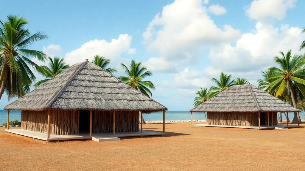
The bure is the indigenous house of the iTaukei people of Fiji: a timber-framed dwelling typically raised on a stone foundation, with walls of reed or bamboo and a steeply pitched thatched roof. Its construction encodes generations of locally sourced, environmentally adapted building knowledge, and its structural performance during cyclones has attracted scientific attention. Studies following Tropical Cyclone Winston in 2016 found that bure in Navala with interlocking joinery, central posts, flexible materials, and aerodynamic roof forms showed notable structural resilience. Yet the continued construction of these houses is declining, driven by urbanisation, changing housing preferences, and the gradual loss of traditional craftsmanship, placing both surviving structures and the knowledge embedded within them at risk.
The research team, led by Mohamed Elkharboutly and Masoud Mahmoodi, worked in Navala village in Ba Province on Viti Levu Island, one of the few places in Fiji where traditional bure construction is still practised. A field assessment identified three bure typologies for documentation: a rectangular bure with a central king post supporting the roof ridge, a rectangular bure without a central post whose ridge is carried by wall posts, and a square bure without a central post. The three were selected for their prevalence, structural condition, and owner consent, and the researchers report that they represent the full typological range of bure construction in the village, with other houses largely repeating one of the three models.
The data capture relied on a FARO Focus3D X 150 terrestrial laser scanner, which uses phase-shift measurements to achieve a manufacturer-specified accuracy of plus or minus 2 millimetres over 150 metres, capturing up to 976,000 points per second. Exterior scans were taken from each corner of each building, with one or two interior scans depending on obstructions; each scan took roughly seven minutes plus five minutes of setup and calibration. Terrestrial imagery came from a Canon EOS 90D DSLR producing 32.5-megapixel stills and 4K video, with videogrammetry loops at 45, 90, and 135 degrees ensuring full coverage of walls, openings, and roof edges. A DJI Mini 2 drone recorded roof geometry and site context through orbital spiral flights ascending in three to four levels, supplemented by grid-based passes over roof surfaces.
Processing the three data streams was a substantial undertaking in itself. Laser scans were registered in FARO SCENE, with exterior scans requiring manual alignment because overlaps were insufficient for automatic registration. Video frames were extracted at one frame per ten, reviewed for blur, and adjusted in Lightroom to compensate for inconsistent ambient light. Photogrammetric point clouds from terrestrial and aerial imagery were generated in RealityCapture and merged with the LiDAR data, with the scanner-derived cloud locked as the true-scale reference. Meshes of roughly 40 million triangles were created for each model, unwrapped, and textured, with photographic imagery prioritised over laser-scanned colour to achieve photorealistic surfaces.
The accuracy figures reported for the final dataset reflect the challenges of documenting thatched-roof buildings with thin bamboo walls under variable field conditions. Scan registration achieved a mean alignment error of 6.5 millimetres with a minimum scan overlap of 30.4 percent, which the authors consider acceptable for heritage structures of this kind. The fusion of LiDAR and photogrammetry improved completeness and consistency, particularly in areas affected by occlusions or complex organic materials. Visual validation compared site photographs with model renders, showing strong correspondence between the physical structures and their digital counterparts.
Beyond the archival outputs, the models yielded structural and architectural insights. In the rectangular bure with a central post, the post supports the ridge beam and transfers roof loads directly to the stone foundation, while regularly spaced wall posts 1 to 1.2 metres apart reduce roof spans. The rectangular bure without a central post relies entirely on wall and corner posts, producing longer spans and greater dependence on post spacing and lashing connections. The square bure lacks a ridge beam altogether; bamboo canes form a radial, purlin-like roof resting on a central post, with loads transferring radially in a compact, symmetrical system. All three models share two posts forming the door frame, raised stone foundations 500 to 700 millimetres high, and steep hipped roofs pitched at 60 degrees for rain runoff and wind resistance.
Construction details visible in the digital models align with previously documented cyclone-resilient features of Fijian architecture. Roof thatching across all models consists of flattened bamboo reeds organised into woven bundles and lashed to bamboo canes forming a purlin network connected to the primary roof structure. All joints are secured with coconut-husk rope known as magimagi, which allows controlled flexibility and energy dissipation under dynamic loading. The authors are careful to note that no structural simulations were conducted in this study; the models provide an empirical basis for future structural analysis rather than demonstrating performance themselves.
The efficiency of the workflow is a key part of its argument. Field data capture across all three bure, encompassing drone imaging, terrestrial photogrammetry, and LiDAR scanning, was completed within two working days by a single operator, with data processing estimated at approximately 160 hours across all three models. By comparison, the authors estimate that conventional manual documentation would require a significantly larger team and several weeks of fieldwork and drafting to achieve equivalent coverage and metric accuracy. The researchers present this as evidence that the integrated approach is practically viable for resource-limited heritage documentation in remote Pacific settings.
The team frames the work as a foundational step from digitisation toward digitalisation: the active mobilisation of digital records in disaster response, reconstruction planning, and community engagement. The urgency is grounded in Fiji’s recent history, since the absence of comprehensive digital records when Cyclone Winston struck in 2016 left reconstruction reliant on fragmented manual documentation. The authors also acknowledge limitations: the digital models capture physical geometry with high fidelity but cannot fully represent the embodied knowledge and cultural meaning transmitted through mataisau master builders, and the documentation covers a single village. The datasets are not publicly available due to cultural sensitivity and community ownership considerations, though selected models and video renders will be made accessible through an open-access 3D heritage repository following publication, and future work will extend the workflow across the Pacific region while integrating oral histories through culturally appropriate engagement with traditional builders.
Subject of Research: Digital 3D documentation of traditional Fijian bure houses in Navala village for heritage preservation and disaster preparedness
Article Title: Digital preservation of Fijian Indigenous architecture: 3D modelling for disaster preparedness and heritage conservation
Article References: Elkharboutly, M., & Mahmoodi, M. (2026). Digital preservation of Fijian Indigenous architecture: 3D modelling for disaster preparedness and heritage conservation. Built Heritage, 10(1), Article 71. https://doi.org/10.1186/s43238-026-00314-3
Image Credits: AI Generated
DOI: 10.1186/s43238-026-00314-3
Keywords: Fiji, bure, indigenous architecture, 3D documentation, LiDAR, photogrammetry, UAV imaging, heritage conservation, disaster preparedness, Navala village, digital preservation, vernacular architecture
News Source: Courtney Benton. (October 28, 2026). Fijian bure houses digitally preserved in 3D for heritage and disaster resilience. Scienmag.