Wheat is the quiet workhorse of the global food system, supplying more than twenty percent of the calories and protein that humanity consumes. Yet one of the most important numbers in a wheat field—the density of tillers, the leafy shoots that ultimately determine how many grain-bearing spikes a crop will produce—has long been measured the slow way: by hand, one small quadrat at a time. A new study published in Smart Agricultural Technology shows that this laborious ritual can now be replaced by a drone flight and a deep learning model, with an attention-enhanced neural network estimating tiller density across entire fields with an accuracy that rivals careful manual counting.
Tiller density, defined as the number of tillers per square meter, is set during a narrow window of crop development that runs roughly from the three-leaf stage to jointing, corresponding to the Feekes 3 through 6 growth stages. During this period, genetics, weather, soil conditions, and management decisions all interact to shape how many shoots survive. Because tiller density directly influences spike number at harvest, kernels per spike, and kernel weight, and is closely tied to the crop’s nitrogen status, knowing it early gives breeders and farmers a powerful lever. Breeders can use the information to select genotypes with optimal tillering behavior, while farmers can fine-tune nitrogen applications before the crop locks in its yield potential.
The problem has always been scale. Manual counting is accurate but punishingly slow, and point-scale sampling misses the spatial variability that defines real fields. Ground-based tools such as handheld spectrometers and terrestrial LiDAR offer richer data but remain labor-intensive across large or multi-site trials. Unmanned aerial vehicles have emerged as the natural middle ground, capturing high-resolution multispectral imagery over breeding nurseries and commercial fields in a fraction of the time. Previous UAV studies of wheat tillering, however, leaned heavily on a small set of hand-crafted vegetation indices, leaving the full information content of drone imagery largely untapped.
The research team, led by scientists at South Dakota State University, set out to close that gap with a framework that fuses two complementary families of image features. The first is spectral: five reflectance bands from a MicaSense Altum-PT multispectral sensor, transformed into forty-eight vegetation indices that capture canopy greenness, chlorophyll content, pigment composition, and stress responses. The second is textural: forty Gray-Level Co-occurrence Matrix statistics—mean, variance, homogeneity, contrast, dissimilarity, entropy, second moment, and correlation—computed for each band, which describe the spatial structure, patchiness, and uniformity of the canopy in ways that average reflectance alone cannot.
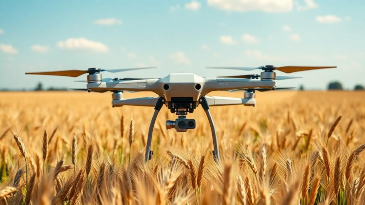
The field campaign was ambitious in its breadth. The team collected 721 ground-truth samples across five South Dakota wheat fields between 2023 and 2024, spanning two university breeding sites and three commercial farmer fields in Brookings, Hayes, and Winner. At each sampling point, PVC quadrats of roughly 0.15 square meters were placed in the plots, tillers were counted by hand at the Feekes 4 or 5 stage, and a DJI Matrice 210 RTK drone flew overhead at 45 meters with eighty percent image overlap, producing orthomosaics with a ground sampling distance of 1.35 centimeters per pixel. Reflectance panels and a downwelling light sensor handled radiometric calibration, while survey-grade ground control points delivered centimeter-level geometric accuracy. The measured tiller densities ranged from 156 to nearly 1,356 tillers per square meter, with a mean of 628.9 and a coefficient of variation of 35.7 percent—a wide dynamic range that any predictive model would need to master.
With 88 predictors per sample in hand, the researchers benchmarked four regression architectures: Random Forest Regression, a fully connected Deep Neural Network, a one-dimensional Convolutional Neural Network, and an attention-enhanced CNN dubbed Atten-CNN. The attention module was a multi-head self-attention block with four heads and a key dimension of 32, inserted after the convolutional feature extractor. Rather than treating all inputs equally, the attention mechanism dynamically reweights the 88 spectral and texture features, amplifying the informative ones and suppressing noise—a capability that standard CNNs, which excel at local patterns but struggle with long-range dependencies, lack. Hyperparameters were tuned with five-fold cross-validation, and the models were trained with the Adam optimizer under a step-decay learning rate schedule.
The results were decisive. On the held-out test set, Atten-CNN achieved a coefficient of determination of 0.81 with a relative root mean square error of 15.97 percent, outperforming the baseline CNN (R² of 0.77), Random Forest (0.71), and the DNN (0.70). The convolutional architectures also showed tighter, less biased residuals across the tiller density gradient, while Random Forest and DNN exhibited a stronger tendency to overestimate low densities and underestimate high ones. To probe spatial generalizability, the team ran a leave-one-location-out validation in which the model was trained on three sites and tested on a completely unseen fourth. Performance in commercial fields was striking—R² values of 0.95, 0.88, and 0.86 in Brookings, Hayes, and Winner, with relative errors as low as 7 percent—but dropped to 0.34 when extrapolating to the genetically diverse Aurora breeding nursery, a signal that breeding plots with their extreme phenotypic variability carry spectral-textural signatures that production-field training data do not fully cover.
Interpretability came from SHAP analysis, which quantifies each feature’s contribution to individual predictions. The red-edge sensitive indices CRI_2 and NDRE emerged as the two most influential predictors for the convolutional models, consistent with the physiology of tillering: denser stands produce more green leaf area and a stronger canopy chlorophyll signal early in the season. Supporting players included the MERIS Terrestrial Chlorophyll Index, the TCARI/OSAVI ratio, and the Datt Index. Notably, the attention mechanism elevated band-wise GLCM Correlation in the green, red, and blue bands to the top of the importance ranking, immediately behind the red-edge indices—evidence that the model was exploiting within-canopy spatial patterns, pixel co-occurrence structure, and canopy patchiness as indirect proxies for tiller distribution and stand uniformity.
The study is candid about its limits. All models underestimated tiller density at the high end of the range, a classic saturation effect in optical remote sensing where reflectance signals lose sensitivity as canopies close. The authors propose three remedies: adding three-dimensional structural features from LiDAR or Structure-from-Motion point clouds, incorporating thermal imagery that responds to transpiration-driven cooling in dense stands, and applying weighted loss functions that penalize errors in the upper density quartile more heavily. The random train-test split also reflects within-distribution performance rather than true temporal transferability, and the framework’s validity is currently bounded by the soils, management systems, and density ranges of the eastern and central Great Plains. Future work will pursue multi-year datasets, end-to-end models that learn directly from raw imagery, and transfer learning across regions and wheat classes.
Even with those caveats, the implications are substantial. A drone flight lasting minutes can now deliver plot-level tiller density estimates that once required days of fieldwork, at an accuracy sufficient to guide early-season nitrogen management and to rank thousands of breeding genotypes for tillering behavior. Because the framework is built on extracted features rather than raw image patches, it remains data-efficient in a domain where labeled samples are scarce, and it can be readily adapted to other traits and crops. As attention-based architectures continue to prove their worth in agricultural remote sensing—from yield prediction to disease detection—this study marks another step toward digital phenotyping at scale, where the field itself becomes a continuously monitored, data-rich experiment.
Subject of Research: UAV-based estimation of wheat tiller density using spectral and texture features with attention-based deep learning
Article Title: High-throughput estimation of wheat tiller density using UAV-derived spectral-textural features and attention-based deep learning
Article References: Kaushal, S., Maimaitijiang, M., Subedi, S., Thapa, S., Janjua, U. U. R., Koupal, D. J., Singh, M., Kaur, K., Kumar, P., Sitaula, P. R., Billah, M. M., Halder, J., Irshad, M. A., & Sehgal, S. K. (2026). High-throughput estimation of wheat tiller density using UAV-derived spectral-textural features and attention-based deep learning. Smart Agricultural Technology, 15, Article 102521. https://doi.org/10.1016/j.atech.2026.102521
Image Credits: AI Generated
DOI: 10.1016/j.atech.2026.102521
Keywords: wheat, tiller density, UAV remote sensing, deep learning, attention mechanism, high-throughput phenotyping, multispectral imagery, vegetation indices, GLCM texture features, SHAP interpretability, precision agriculture, crop breeding
Cite Scienmag News
APA
MLA
Chicago
Alan Morgan. (October 1, 2026). Drones and Attention-Powered AI Count Every Wheat Tiller From the Sky. Scienmag. https://scienmag.com/drones-and-attention-powered-ai-count-every-wheat-tiller-from-the-sky/
Alan Morgan. “Drones and Attention-Powered AI Count Every Wheat Tiller From the Sky.” Scienmag, 1 October 2026, https://scienmag.com/drones-and-attention-powered-ai-count-every-wheat-tiller-from-the-sky/. Accessed 1 October 2026.
Alan Morgan. “Drones and Attention-Powered AI Count Every Wheat Tiller From the Sky.” Scienmag. October 1, 2026. https://scienmag.com/drones-and-attention-powered-ai-count-every-wheat-tiller-from-the-sky/
Copy citation
Download RIS
Tags: agricultural drone applicationsAI in sustainable agricultureAI-powered crop monitoringattention mechanismattention neural networks for plant analysisautomated crop density estimationcrop breedingcrop yield prediction through AIdeep learningdeep learning in agricultureDrone-based wheat tiller countingGLCM texture featureshigh-throughput phenotypinginnovative methods in crop phenotypingmachine learning for crop managementmultispectral imageryprecision agricultureprecision farming technologyremote sensing for wheat growth stagesSHAP interpretabilitytiller densityUAV remote sensingvegetation indiceswheat