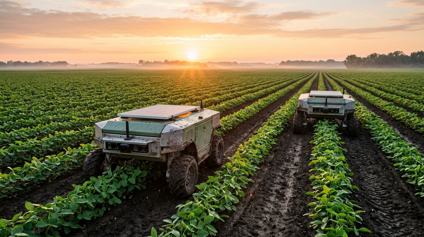
Agricultural engineers have developed an integrated field monitoring framework combining a decentralized Swarm Aware Internet of Things communication protocol with lightweight computer vision to evaluate crop quality across commercial fields in real time. Deployed across Intelligent Autonomous Mobile Robots, the architecture eliminates the dependency on centralized cloud servers and high-latency base stations by shifting computational intelligence directly to field devices. Conventional precision agriculture platforms frequently channel field imagery and telemetry to distant remote infrastructure for heavy analysis, introducing operational bottlenecks, severe bandwidth consumption, and single-point failure vulnerabilities. The newly formulated framework reorganizes mobile robotic units into an autonomous peer-to-peer Internet of Robots architecture where every moving rover functions simultaneously as a field data collector, local computing processor, and independent decision-making agent. Extensive simulation trials and field tests demonstrate that a coordinated five-robot swarm achieves up to a 4.75-fold improvement in area coverage efficiency compared to traditional single-agent systems while providing continuous fault-tolerant self-healing.
The motivation behind the framework stems from escalating global agricultural pressures, with the worldwide human population projected to reach 9.7 billion individuals by 2050, requiring unprecedented yield optimization alongside stringent conservation of energy and chemical inputs. Conventional farming techniques reliant on extensive manual labor and broad-spectrum chemical treatments face mounting labor shortages, elevated operating expenses, and severe environmental strain. While precision agriculture offers dynamic responsiveness to spatial variability within fields, deploying autonomous mobile machinery has historically encountered persistent computational and infrastructural bottlenecks. Advanced deep learning models developed for crop disease classification demand dedicated graphical processing units and substantial electrical power, rapidly exhausting the battery reserves of mobile field machinery. Simultaneously, standard agricultural communication networks such as LoRaWAN and ZigBee provide inadequate bandwidth and elevated transmission latency, whereas conventional Wi-Fi configurations struggle with handoffs and packet drops across vast, obstacle-rich crop canopies, impeding cooperative multi-agent operations.
To overcome these physical constraints, researchers engineered the Swarm Aware Internet of Things protocol directly atop the IEEE 802.11n physical layer in Ad-Hoc Independent Basic Service Set mode. Operating at a 2.4 gigahertz frequency, the radio configuration exploits longer wavelength propagation characteristics that penetrate dense agricultural foliage, moist vegetative canopies, and physical terrain obstacles far more effectively than higher-frequency alternatives. The network dispenses entirely with centralized routing hardware, establishing a peer-to-peer distributed mesh where each robot maintains direct wireless links with adjacent neighbors within an estimated fifty-meter operational radius. Rather than utilizing connection-oriented transport mechanisms, the communication architecture adopts connectionless User Datagram Protocol broadcasts operating at a strict update rate of ten hertz. Because the physical rovers travel at speeds up to 1.0 meter per second, spatial coordinates decay in practical value within milliseconds, making rapid transmission of current state data substantially more critical for collision mitigation than delayed data retransmissions.
Telemetry and control information are encapsulated within compact, fixed-length sixty-four-byte binary packets designed to circumvent the parsing latency and processing overhead associated with text formats such as JSON. Each structured packet incorporates a synchronization header containing the unique robot identifier and timestamp, followed by an operational payload encoding two-dimensional global positioning coordinates, velocity vectors, ongoing task progress, and remaining battery percentage. The packet terminates with a sixteen-bit cyclical redundancy check trailer to ensure rigorous message integrity across noisy field conditions. Transmitted at ten hertz, the broadcast guarantees an updated coordinate exchange for every ten centimeters of linear forward movement, providing sufficient spatial granularity for neighbor rovers to execute smooth trajectory adjustments. By exchanging these state vectors continuously, each rover shares its linear velocity, linear acceleration, physical heading, localized disease index measurements, storage memory utilization, and active path segment identifiers with surrounding units.
Swarm motion across unstructured crop rows is governed by a distributed consensus control law modeled on second-order double-integrator dynamics, synchronizing robot movement through virtual physical forces. The operational algorithm calculates a target velocity combining pre-assigned coverage path trajectories with local flocking adjustments composed of separation and cohesion forces. The repulsive separation force scales inversely with inter-agent distance to prevent mechanical collisions and avoid redundant scanning overlap, while the attractive cohesion force maintains an optimal boundary spacing to prevent sensor coverage gaps between adjacent rovers. Mathematically, the control input functions as an acceleration command comprising a formation maintenance component that acts like a virtual spring toward designated neighbor offsets and a velocity consensus component that behaves as a virtual damper. In simulated field trials, the velocity consensus algorithm eliminated inter-agent velocity disparities within ten seconds, suppressing mechanical oscillations across uneven terrain through an overdamped gain ratio where velocity damping parameters strictly exceeded position stiffness gains.
Visual evaluation of crop health is achieved without computationally demanding convolutional neural networks by utilizing a dedicated edge vision pipeline anchored in Hue, Saturation, Value color space transformations. Standard Red-Green-Blue imagery captured by onboard cameras remains sensitive to ambient illumination swings and fluctuating solar shadows, whereas the decoupled Hue channel isolates authentic chromatic tones of vegetative foliage. Operating on an onboard Raspberry Pi 3B processor equipped with a quad-core 1.2 gigahertz ARM Cortex-A53 central processing unit and one gigabyte of random-access memory, the algorithm applies binary thresholding across predefined healthy green Hue boundaries. The edge routine calculates a quantitative Green Area Index by dividing the detected healthy green pixel count by the total segmented plant pixel count, generating an objective numerical score without loading bulky deep learning weights. The vision pipeline requires only 0.02 GFLOPS of computational processing, contrasting sharply with deep learning models demanding between four and six GFLOPS, and sustains processing speeds of thirty frames per second.
To evaluate the resilience of the vision system against natural lighting variations, researchers tested the algorithm against a manually annotated dataset of 500 images captured across heterogeneous field conditions. Under diffused light, the lightweight model demonstrated an overall accuracy of 95.1 percent, maintaining precise leaf segmentation. Under high-intensity direct noon sunlight, accuracy decreased to 87.2 percent as specular reflection from waxy foliage surfaces drove saturation metrics toward zero, causing localized false-negative exclusions of bleached leaf segments. In partially shaded regions, visual recall dropped to 81.2 percent because diminished lightness values complicated differentiation between dark foliage and shadowed topsoil. In complex environments containing weeds, precision fell to 82.4 percent due to non-crop foliage sharing identical green hue bands. To stabilize performance across fluctuating weather conditions, rovers incorporate ambient light sensors that detect illumination shifts greater than 15 percent, automatically triggering dynamic calibration routines that adjust upper and lower threshold boundaries before evaluating incoming video frames.
The system integrates an autonomous fault-tolerance mechanism designed to sustain uninterrupted scanning operations when individual units experience mechanical, computational, or electrical failure. Each mobile rover continually tracks its operational status, identifying storage memory capacity reaching 95 percent, battery levels falling to or below 10 percent, or hardware fault flags signaling structural or electrical breakdown. If physical mobility remains intact, the affected rover initiates an autonomous return-to-base sequence to offload captured spatial data or recharge; if mobility is compromised, the robot enters a dormant state at its current coordinates. In both contingencies, the rover broadcasts an emergency state message containing its unfinished path segment. Surrounding operational neighbors evaluate a localized cost function that minimizes Euclidean physical distance to the abandoned waypoint, incorporates inverse remaining battery life, and factors in current workload utilization, allowing the most suitable adjacent rover to merge the orphaned path segment into its active mission queue without central oversight.
Comparative efficiency assessments demonstrate pronounced performance advantages for the decentralized swarm over single-robot and centralized IoT architectures. When tasked with scanning a commercial twenty-hectare agricultural field, an individual autonomous robot traveling at 1.0 meter per second with a two-meter scanning swath requires more than 27 hours of continuous operation, exceeding battery capacity and necessitating multiple recharging delays. In contrast, the five-robot swarm executing parallel coverage paths completes the identical acreage in under 6 hours, representing an approximate 4.75-fold reduction in operational duration. In benchmark comparisons against a decentralized random-walk model lacking formation control, which required 118 minutes and produced over 150 percent path overlap to achieve 95 percent sector coverage, the structured protocol completed the task in 38 minutes. Furthermore, by executing image analysis locally on edge hardware, the swarm curtails energy-intensive long-range transmissions, avoiding the escalating energy consumption and network congestion observed in centralized streaming frameworks.
Field validation of the integrated platform across 33 distinct crop samples confirmed its practical capacity to construct geo-tagged health maps and identify localized canopy anomalies. Analyzed crop scores revealed that the majority of monitored plants exceeded an 80 percent health threshold corresponding to excellent physiological vigor, while highlighting isolated specimens displaying lower percentages for targeted human inspection. Diagnostic anomaly evaluations successfully flagged nineteen occurrences of low planting coverage and two instances of foliar browning, verifying the dual utility of the edge vision model for monitoring biological health alongside physical planting distribution. Furthermore, physical kinematic trials established that limiting operational forward velocity to 0.8 meters per second avoided rolling shutter distortions on onboard cameras, preventing the 15 percent segmentation accuracy degradation observed at speeds exceeding 1.0 meter per second due to motion blur.
The authors identified practical constraints and outlined clear future trajectories to advance the operational scope of the agricultural swarm framework. Although Hue thresholding provides exceptional processing velocity and energy conservation on low-cost edge microprocessors, extreme solar occlusion, deep shadows, and visually identical weed infestations represent persistent analytical limitations. Future work will investigate hybrid edge intelligence architectures that selectively trigger lightweight TinyML deep learning models exclusively when initial color thresholding detects anomalous foliage regions, conserving battery reserves while elevating diagnostic specificity. Researchers also plan to expand the protocol to coordinate heterogeneous robotic networks incorporating both autonomous ground rovers and unmanned aerial vehicles, integrate multimodal sensory arrays encompassing thermal and soil probes, implement cryptographic trust-aware verification for peer transmissions, and validate coordination resilience across diverse crop types and irregular planting topographies.
Subject of Research: Decentralized peer-to-peer robotics protocol and edge computer vision for real-time agricultural crop monitoring
Article Title: Decentralized Swarm Aware Internet of Things (IOT) protocol for real time crop quality prediction by Intelligent Autonomous Mobile Robots (IAMRs)
Article References: Bhattacharya, S., & Biswas, A. (2026). Decentralized Swarm Aware Internet of Things (IOT) protocol for real time crop quality prediction by Intelligent Autonomous Mobile Robots (IAMRs). Discover Robotics, 2(1), Article 11. https://doi.org/10.1007/s44430-026-00024-6
Image Credits: AI Generated
DOI: 10.1007/s44430-026-00024-6
Keywords: precision agriculture, swarm robotics, autonomous mobile robots, Internet of Things, computer vision, edge computing, distributed consensus, fault tolerance, Decentralized, Swarm, Aware, Internet
News Source: Alan Morgan. (November 6, 2026). Decentralized Swarm Protocol Coordinates Autonomous Agricultural Robots for Real-Time Crop Monitoring. Scienmag.