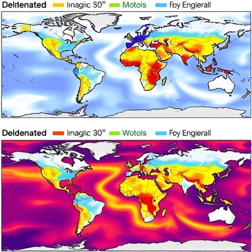

In the ceaseless quest to understand Earth’s dynamic crust and better prepare for its unpredictable upheavals, recent advances in seismic hazard mapping have opened new doors for scientists and policymakers alike. A groundbreaking study by Feng, Hong, and Xu, soon to be published in International Journal of Disaster Risk Science, compares two pivotal approaches to seismic hazard modeling: the delineated seismic source model and the spatially smoothed seismic source model. This comparative investigation challenges traditional paradigms and promises to refine how we anticipate future seismic threats, potentially reshaping disaster preparedness strategies worldwide.
Seismic hazard mapping serves as a cornerstone for seismic risk mitigation. It aims to estimate the likelihood and severity of ground shaking that might occur over a given geographic area in a specified time frame. The accuracy and resolution of these hazard maps directly influence building codes, emergency response plans, and insurance frameworks. Historically, delineated seismic source models have dominated this field. These models divide the Earth’s crust into discrete fault sources, each characterized by specific seismicity parameters such as fault length, slip rates, and maximum earthquake magnitudes. While effective in mapping well-studied faults, these models often struggle to encapsulate the complexity and uncertainties of seismic sources, especially in regions with limited direct fault data.
Contrastingly, spatially smoothed seismic source models adopt a fundamentally different philosophy. Instead of confining seismicity to rigidly defined fault lines, these models employ statistical techniques to ‘smooth’ seismicity patterns over space, capturing both known faults and diffuse seismic zones. By integrating earthquake catalogs and considering seismic events with a spatial smoothing kernel, this approach generates continuous seismic hazard fields. It can reveal hidden seismic potential beyond mapped faults and accommodates uncertainties in fault delineation, thus offering a more holistic view of seismic hazard distributions.
The study by Feng and colleagues leverages comprehensive seismic datasets, advanced computational algorithms, and rigorous validation metrics to juxtapose these two modeling frameworks. Their analysis spans various tectonic settings, from well-characterized active fault zones to regions with diffuse seismicity. By comparing predicted ground motion intensities, hazard probabilities, and spatial extents, they examine the strengths, limitations, and practical implications of each model type.
One of the compelling revelations from this research is that spatially smoothed models often produce broader, more encompassing hazard zones compared to the sharply bounded areas delineated by traditional source models. This difference arises from the smoothing process that accounts for uncertainty and incomplete knowledge of seismic sources. While the delineated models may underestimate hazard in less understood areas, the smoothed models tend to be more conservative, highlighting potential risks beyond established faults. This insight has profound consequences for risk assessment in poorly studied or complex geological regions.
However, the more conservative nature of spatially smoothed models is not without trade-offs. Feng et al. emphasize the potential for increased false alarms or overly cautious building requirements, especially in areas where seismicity is genuinely low but diffuse. The balance between sensitivity and specificity in hazard prediction emerges as a critical point of discussion. The study suggests that integrating geological and geophysical data with statistical smoothing can refine model performance, preventing unnecessary overestimation while retaining hazard awareness.
Technically, the researchers implemented a meticulous workflow. Detailed earthquake catalogs spanning multiple decades were processed to establish frequency-magnitude distributions. For the delineated source model, faults were mapped and parameterized based on geological surveys and GPS measurements. In contrast, the spatial smoothing approach applied kernel density estimation, adjusting smoothing bandwidths to capture seismicity clustering without overgeneralization. Both models were subjected to ground motion prediction equations to convert seismicity into hazard metrics, enabling side-by-side comparisons.
Further, the team evaluated the models against recorded seismic events and historical earthquake damage patterns. Validation through retrospective testing demonstrated that spatially smoothed models better captured certain seismic hazards previously underestimated by delineated sources. Notably, in areas like the complex plate boundary faults, smoothed models identified hazard hotspots consistent with recent unexpected earthquake occurrences, underlining their practical benefits.
Beyond model evaluation, the study explores how seismic hazard maps derived from these approaches influence societal decision-making. Building code enforcement, insurance premiums, and urban planning can hinge dramatically on the choice of model. Feng and colleagues advocate for a hybrid strategy harnessing the precision of delineated sources where data are robust, complemented by spatial smoothing in ambiguous regions. This integrated framework could optimize hazard representation and foster resilience.
Moreover, the implications extend into early warning system design. Accurate and spatially resolved hazard forecasts enable better sensor placement and reaction strategies. The study discusses how smoothed source models can enhance real-time hazard estimation by accommodating seismicity uncertainties dynamically, thereby improving warning reliability and public safety.
Critically, the researchers address computational challenges inherent in both modeling schemes. While delineated models require intensive geological mapping and parameter estimation, spatial smoothing demands robust earthquake datasets and significant computational resources for kernel density estimation and hazard simulation. Feng et al. acknowledge advancements in high-performance computing and data sharing as key enablers for applying these methods at larger scales.
The article also delves into epistemic uncertainty quantification—a pivotal aspect when seismic hazard informs high-stakes infrastructure projects and emergency planning. It highlights Bayesian frameworks and ensemble modeling as promising tools to characterize and communicate uncertainties inherent in seismic hazard assessments derived from both delineated and smoothed sources.
Furthermore, the study invites the seismic research community to reconsider standard practices. It challenges the exclusive reliance on fault-based hazard mapping, advocating for methodological pluralism. This philosophy resonates with the emerging trend toward data-driven and probabilistic seismic risk frameworks, reflecting the complex reality of Earth’s seismic behavior.
Interestingly, Feng and colleagues also touch upon the implications for global seismic hazard models and their underlying databases, such as those maintained by international agencies. The adoption of spatial smoothing techniques might reconcile disparate regional models, fostering better comparability and integration into global risk assessments.
In conclusion, this seminal work proffers a nuanced understanding of seismic hazard modeling by meticulously comparing delineated and spatially smoothed seismic source models. It underscores that no single approach dominantly suffices across all tectonic contexts, advocating for adaptive, integrated methodologies to safeguard lives and infrastructures from earthquake risks. As researchers and policymakers grapple with increasing urbanization and climate-linked vulnerabilities, these insights are timely and transformative.
With the anticipated publication of Feng, Hong, and Xu’s study in 2025, the field stands poised for a paradigm shift in seismic hazard assessment—one embracing complexity, uncertainty, and innovation to fortify human settlements against Earth’s restless tectonics.
Subject of Research: Earthquake hazard mapping methodologies comparing delineated seismic source models with spatially smoothed seismic source models.
Article Title: Mapping Seismic Hazard: A Comparison by Using Delineated Source Model and Spatially Smoothed Seismic Source Model.
Article References:
Feng, C., Hong, H. & Xu, W. Mapping Seismic Hazard: A Comparison by Using Delineated Source Model and Spatially Smoothed Seismic Source Model.
Int J Disaster Risk Sci (2025). https://doi.org/10.1007/s13753-025-00629-2
Image Credits: AI Generated
Tags: delineated seismic source modelsdisaster preparedness strategiesearthquake risk assessmentemergency response planningfault source characterizationground shaking likelihoodinsurance frameworks for earthquakesseismic hazard mappingseismic hazard modeling comparisonseismic risk mitigationseismicity parameterssmoothed seismic source models


