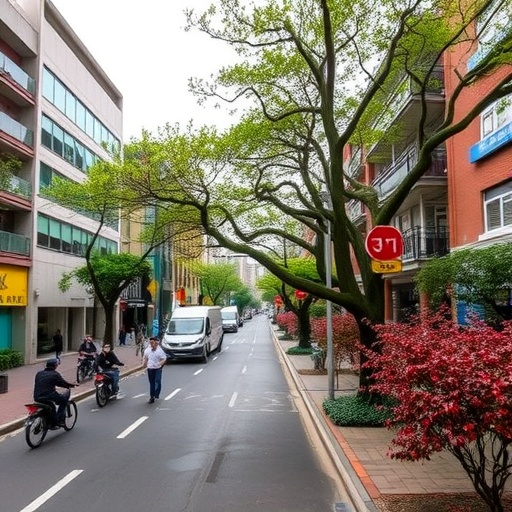

In recent years, the vital importance of urban trees has garnered widespread attention from scientists, policymakers, and urban planners alike. These living components of cityscapes provide invaluable ecosystem services, from air purification and microclimate regulation to the enhancement of mental well-being for urban residents. Despite the recognized value of urban greenery, accurately quantifying and monitoring urban tree cover on a large scale remains a formidable challenge due to rapidly evolving urban landscapes and the limitations of traditional data-gathering methods. A groundbreaking study now sheds new light on the extent and dynamics of urban tree cover across China’s major cities through the innovative use of nanosatellite imagery, revealing significant but uneven patterns of green expansion over the last decade.
China, as the world’s most populous country and a rapidly urbanizing society, has been actively pursuing urban greening initiatives aimed at improving living conditions and ecological resilience. The government has launched a suite of policies designed to increase urban tree cover, including large-scale planting campaigns, green infrastructure investments, and incentives for incorporating vegetation into urban design. However, measuring the effectiveness and progression of such policies nationwide has been hindered by the sheer scale of the task and the lack of consistent, high-resolution data sources. This study bridges that gap by leveraging state-of-the-art nanosatellite technology capable of capturing ultra-high-resolution images of urban environments, thus allowing researchers to conduct a comprehensive, city-by-city assessment of urban tree cover in China.
The results are compelling. In 2019, urban tree cover across the studied cities reached an average of 11.47% of total urban land area—a significant figure underscoring the expanding footprint of vegetation within city boundaries. Moreover, when tracking changes from 2010 to 2019, 76% of cities experienced an increase in tree cover, signaling a widespread trend of urban greening that aligns with national policy ambitions. These findings are groundbreaking not only for their breadth but also because they are based on objective, fine-scale remote sensing data that circumvents the subjectivity and inconsistent sampling inherent in traditional ground surveys.
One of the study’s most striking revelations addresses the rapid canopy growth in China’s mega-cities. Shanghai, Beijing, Shenzhen, and Guangzhou collectively demonstrated an average increase in tree cover of 6.64% over the decade, exceeding the national average improvements. These metro areas are characterized by dense populations, intense land use pressures, and significant environmental challenges, making their progress in greening particularly noteworthy. The growth in urban canopy in these cities reflects a combination of proactive urban forestry programs, technological advances in planting and maintenance, and increased public awareness regarding the benefits of green spaces.
However, the study also exposes considerable disparities in how tree cover changes manifest across different types of urban land use. Public service areas and residential neighborhoods emerged as hotspots for tree cover gains, with increases of 3.09% and 1.79%, respectively. These land-use categories often host parks, schools, government offices, and housing complexes, all environments where urban trees can be deliberately integrated into planning and landscaping. In contrast, commercial and industrial districts, where impervious surfaces dominate, showed less marked increases, highlighting ongoing challenges in balancing economic activity with urban greening goals.
The methodological innovation of using nanosatellite imagery cannot be overstated. These satellites capture sub-meter resolution data, providing an unprecedented level of detail that enables the distinction of tree canopy from other vegetation or urban materials. This granularity is crucial for accurately mapping urban forest cover, especially in heterogeneous environments where tree coverage may be fragmented and interspersed with buildings, roads, and other infrastructure. The data-driven approach adopted by Zhang et al. thus represents a major advancement in urban ecological monitoring, offering a replicable model for other nations seeking to quantify urban tree dynamics at scale.
Beyond mere quantification, the study sheds light on the ecological and social implications of the observed trends. Urban tree cover is intricately linked to air quality improvements, urban heat island mitigation, noise reduction, and biodiversity conservation within cities. Equally important are the psychological and physical health benefits for residents who gain access to green spaces, which have been shown to reduce stress, encourage physical activity, and foster social cohesion. Therefore, the documented increases in urban tree cover suggest positive trajectories not only for environmental sustainability but also for human well-being and quality of life.
Yet, the unevenness of tree cover growth across cities points to underlying inequalities in urban development and environmental management. Not all cities enjoy equal resources or political will to implement ambitious greening programs, resulting in spatial disparities that may exacerbate existing social and environmental vulnerabilities. Moreover, rapid urbanization continues to impose pressures that can threaten tree survival, such as land conversion, pollution, and infrastructure expansion. This underscores the need for tailored urban forestry policies that consider local context, prioritize vulnerable communities, and incorporate long-term maintenance strategies.
The findings also raise important questions about the resilience of urban forests to climate change and urban stresses. As cities grapple with rising temperatures and extreme weather events, urban trees form a critical line of defense by moderating microclimates and sequestering carbon. However, tree species selection, planting techniques, and management practices must adapt to shifting environmental conditions to ensure that tree cover gains translate into enduring benefits. This study provides a foundational dataset for future research that can evaluate how urban forest composition and functionality evolve alongside coverage metrics.
Importantly, the study’s decade-long perspective offers insights into the temporal dynamics of urban greening. Urban landscapes are not static; tree establishment and growth require time, while urban pressures can lead to losses. Monitoring change over a sufficiently long period permits the differentiation between transient interventions and sustained trends. The observed upward trajectory in China’s urban tree cover reflects a positive balance of these forces over the studied timeframe but also implies the need for continued vigilance to maintain and enhance these gains.
This research exemplifies the power of integrating emerging technologies with ecological and urban studies to tackle complex environmental challenges. By harnessing the potential of nanosatellite remote sensing, it transcends traditional limitations of urban forestry assessments, delivering robust, scalable, and repeatable measurements. The approach paves the way for more responsive and data-informed policy interventions, better urban planning, and enhanced public engagement in greening initiatives.
Furthermore, the study’s comprehensive scope, encompassing a wide range of Chinese cities, enhances its relevance and applicability. It gives policymakers a clearer picture of where to invest resources, which land-use types to prioritize, and how mega-cities can serve as models for smaller urban areas. The granularity of the data also facilitates cross-regional comparisons and the identification of best practices that can inform urban greening efforts beyond China’s borders.
In summary, this pioneering research provides a vital empirical foundation demonstrating that urban tree cover in China is on a steady rise, powered by extensive policy support and urban management strategies. The uneven distribution of gains, however, calls for targeted measures to ensure that all urban residents benefit from the manifold advantages that urban trees confer. As urbanization continues apace worldwide, understanding and enhancing urban green infrastructure will be critical for building sustainable, livable cities.
Looking ahead, integrating such remote sensing datasets with socioeconomic, climatic, and health data could unlock deeper insights into the multifaceted impacts of urban forestry. This holistic perspective is essential for crafting cities that are not only greener but also more equitable and resilient. The study by Zhang and colleagues charts a promising path forward, demonstrating that innovative technologies can empower us to better steward the natural components of our urban futures.
Subject of Research: Urban tree cover dynamics and monitoring in Chinese cities using nanosatellite remote sensing.
Article Title: A strong but uneven increase in urban tree cover in China over the recent decade.
Article References:
Zhang, X., Brandt, M., Tong, X. et al. A strong but uneven increase in urban tree cover in China over the recent decade. Nat Cities 2, 460–469 (2025). https://doi.org/10.1038/s44284-025-00227-9
Image Credits: AI Generated
DOI: https://doi.org/10.1038/s44284-025-00227-9
Tags: challenges in urban tree quantificationecological resilience in urban areasecosystem services of urban treesgovernment policies for urban forestrygreen infrastructure investments in citiesimpact of urban trees on mental well-beinglarge-scale tree planting campaignsnanosatellite imagery for urban monitoringuneven patterns of urban greeneryurban greening initiativesurban planning and vegetation integrationurban tree cover in China

