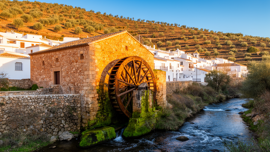
Deep in the mountainous interior of the province of Cádiz, in Andalusia, Spain, a dispersed constellation of ruined stone buildings along rivers and streams is being re-read not as debris of a vanished economy but as a functioning historical infrastructure. A research article published in the journal Built Heritage documents a network of 85 watermills across the Sierra de Cádiz region, arguing that these modest vernacular structures once organised water, movement and production across an entire mountain territory and still hold lessons for sustainable rural development today.
The study, conducted by Gloria Rivero-Lamela and Amadeo Ramos-Carranza, identified and documented the mills through a combination of documentary research, cartographic analysis and architectural fieldwork. Of the 85 hydraulic flour mills in the consolidated inventory, 61 had already been recorded in 18th-century historical sources, and the authors consider it most likely that the mills were introduced with the first Muslim settlements established in the region from the eighth century onwards. The research team frames the buildings as vernacular rural architecture with heritage, territorial and cultural implications, rather than as isolated industrial relics.
The Sierra de Cádiz is one of five agricultural regions defined for the province by the Ministry of Agriculture, Fisheries and Food. It covers 105,435 hectares, some 14.2 percent of the provincial surface, and comprises 14 municipalities, from Alcalá del Valle to Zahara de la Sierra. Situated at the northeastern extremity of the province, it occupies rugged limestone massifs with steep slopes and high altitudes, and an exceptionally high rainfall regime that produces the densest hydrographic network in Cádiz. Part of the territory, the Sierra de Grazalema, was designated a biosphere reserve in 1977 and a natural park in 1984, environmental recognition that underlines the abundance of flowing water on which milling depended.
The methodology unfolded in three phases. The first was a documentary and bibliographical review drawing on eight main historical, geographical and heritage sources, including the Catastro de Ensenada of 1750 to 1754, Miñano’s geographic dictionary of 1826 to 1829, Mellado’s 1845 gazetteer, Madoz’s encyclopaedic dictionary of 1846 to 1850, the planimetric surveys that preceded the first national topographic map in 1873 and 1874, cadastral cartography up to 1962, the 1980 research of Javier Escalera Reyes, and the Andalusian heritage database maintained by the Instituto Andaluz del Patrimonio Histórico. Cross-verifying these records in a comparative database produced the consolidated inventory of 85 mills.
The second phase located each mill in the terrain by combining historical cartography, orthophotography and current topographic planimetry, allowing the researchers to georeference the sites and analyse their relationship with rivers and historical road systems. Fieldwork then verified which structures remained standing and recorded their state of conservation. The third phase used drawing and cartographic representation as analytical tools: the 1873 to 1874 planimetric surveys were deconstructed into linear descriptors, the hydrographic network and road systems, and nodal descriptors, the mills themselves and population centres. New planimetric drawings layered six descriptors, topography, hydrography, transport infrastructure, vegetation and crops, property structure and architecture, onto the base cartography of Andalusia. On a single 1873 survey sheet for the village of Benaocaz, eleven watermills could be identified, and twelve along the nearby Tavizna riverbank.
Architecturally, the mills are strikingly adaptive. Those surviving in the Sierra de Cádiz employ a horizontal wheel or an undershot waterwheel with a vertical bucket, but their forms vary with the terrain, from compact, regular prisms on gently sloping banks to aggregations of irregular volumes on steeper ground along rivers such as the Gaidóvar in Grazalema. Their hydraulic apparatus, whether reservoirs, long irrigation channels serving land and interconnected mills, or single or paired wheels matched to demand, was modified without altering the internal milling mechanism. The buildings were constructed almost entirely from local materials, stone, sand, lime mortar, wood and reed mats, and operated as open surface-water recirculation systems: water was captured, diverted to the mill mechanism, and returned downstream to the natural watercourse, sometimes reused by mills further down the valley or diverted to irrigate nearby fields.
Their positioning was equally deliberate. The mills cluster along riverbanks while spacing themselves to secure spheres of influence, balancing the demand for flour and cereal cultivation, more prevalent in the northern Subbética range, against the availability of watercourses, more abundant in the south in the Sierra de Grazalema. This tension necessitated mobility and thus communication infrastructures. Analysis of the 19th-century planimetric sheets revealed numerous roads named after the mills they served, evidence of how deeply the milling system shaped the region’s circulation network. The authors interpret the mills as active nodes in a system of flows, of water, grain and flour, connected by paths, channels and weirs, and often governed by customary rules for sharing water between millers and farmers.
The present state of the network is fragile. Traditional milling, once the region’s main preindustrial activity, has been abandoned, and the neglect has cascaded through the related landscapes: surrounding lands converted often to olive groves, and the paths and channels that connected the mills deteriorated. The decline is quantified starkly within the Sierra de Grazalema Natural Park, where of 37 mills within the park boundaries only two remain in good condition. On remote riverbanks, vegetation has overtaken the standing remains, producing what the authors describe as de-anthropised environments where pastures have erased old agricultural plots and road layouts.
Against this backdrop, the article argues for recognising the contemporary value of the mills as cultural and territorial infrastructure tied to the rural landscape and to the collective memory of local communities. The authors situate the buildings within international debates on vernacular architecture, citing figures from Bernard Rudofsky to Amos Rapoport, and propose concrete avenues for reactivation: recovering traditional milling where machinery survives, adapting mills as small interpretation centres for the hydraulic landscape, hosting craft workshops or small-scale local production, and linking the sites through pedestrian, cycling or equestrian itineraries along the historical paths and riverbanks. They also point to legislative and international frameworks, from Andalusian heritage law to the possibility of cultural landscape designation under the World Heritage Convention, as instruments that could support protection and adaptive reuse.
The study’s conclusions are careful about what the evidence shows. This is a documentation and interpretation exercise, an inventory, a territorial reading and a critical reflection, not a tested conservation or development programme; the reuse scenarios are proposals whose feasibility would depend on demographic and economic conditions in a region facing depopulation, an ageing population and a shift away from agriculture. What the research establishes is that the 85 mills, read together with their rivers, channels and paths, constitute a coherent territorial system that structured mountain life for centuries. Interpreted that way, the authors contend, the watermills are not merely remnants of the past but potential catalysts for new relationships between heritage, landscape and rural society, latent structures whose apparent obsolescence can be challenged through a contemporary vision of landscape and heritage.
Subject of Research: Historical network of watermills in the Sierra de Cádiz, Spain, documented as vernacular heritage and territorial infrastructure
Article Title: Contemporaneity of an ancient network of watermills in the southern Iberian Peninsula: reflections on its values, territory, and infrastructural role
Article References: Rivero-Lamela, G., & Ramos-Carranza, A. (2026). Contemporaneity of an ancient network of watermills in the southern Iberian Peninsula: reflections on its values, territory, and infrastructural role. Built Heritage, 10(1), Article 59. https://doi.org/10.1186/s43238-026-00304-5
Image Credits: AI Generated
DOI: 10.1186/s43238-026-00304-5
Keywords: watermills, Sierra de Cádiz, vernacular architecture, heritage, hydraulic infrastructure, Andalusia, rural landscape, cultural heritage, industrial heritage, territorial planning, sustainability, Spain
News Source: Courtney Benton. (October 29, 2026). Ancient Watermill Network in Southern Spain Revealed as Living Heritage Infrastructure. Scienmag.