Credit: NASA Worldview, Earth Observing System Data and Information System (EOSDIS)
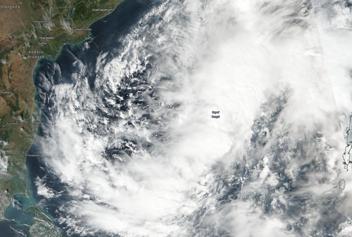
NASA-NOAA's Suomi NPP satellite passed over the Bay of Bengal, Northern Indian Ocean and captured a visible image of Tropical Cyclone Gaja.
Gaja formed on Nov. 10 at 4 p.m. EST (2100 UTC) as tropical cyclone 07B, about 569 miles south-southwest of Chittagong, Bangladesh. It strengthened into a tropical storm and was renamed Gaja.
On Nov. 13, the Visible Infrared Imaging Radiometer Suite (VIIRS) instrument aboard NASA-NOAA's Suomi NPP satellite gathered data on Tropical Cyclone Gaja. Gaja appeared somewhat elongated and had bands of thunderstorms wrapping into the center. Gaja appeared to extend over much of the Bay of Bengal in satellite imagery.
The Joint Typhoon Warning Center or JTWC noted "animated multispectral satellite imagery shows expansive but disorganized and fragmented rain bands loosely wrapping into an obscured low level circulation with the deep central convection sheared northeastward."
On Nov., 13 at 10 a.m. EST (1500 UTC) Gaja's maximum sustained winds were near 40 mph (35 knots/62 kph). It was located approximately 320 nautical miles east of Chennai, India near 13.4 degrees north latitude and 85.6 degrees east longitude. Gaja was moving west-southwest.
JTWC forecasters expect a slow intensification, peaking at 50 knots (57.5 mph/92.6 kph) by landfall in southern India just south of Chennai on Nov. 15.
###
By Rob Gutro
NASA's Goddard Space Flight Center
Media Contact
Rob Gutro
[email protected]
@NASAGoddard
http://www.nasa.gov/goddard
Original Source
https://blogs.nasa.gov/hurricanes/tag/gaja-2018/


