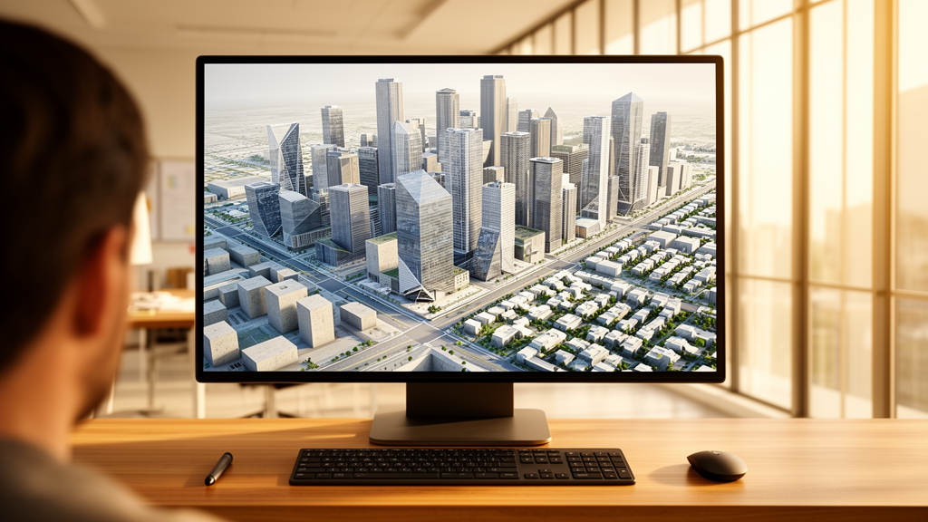
Creating detailed three-dimensional digital city models has traditionally demanded an exhaustive balance between manual geometric construction, airborne scanning campaigns, and automated geographic information system extrusions. In a peer-reviewed investigation published in Computational Urban Science, researchers Farshad Shariatpour, Amir Shakibamanesh, and Morteza Rahbar demonstrated that a grammar-based procedural modeling workflow can assemble high-fidelity three-dimensional urban representations across multiple typologies in minutes rather than weeks. Working within Esri’s CityEngine environment on a standard commodity laptop equipped with an Intel Core i5-3210M processor and six gigabytes of random-access memory, the research team synthesized comprehensive representations of an organic Siena-like street configuration, an orthogonal Barcelona-like raster grid, and a concentric Paris-like radial layout over an area of approximately two square kilometers. The findings establish that algorithmic rule sets executing on consumer-grade desktop hardware can decrease production times by one to two orders of magnitude while preserving geometric integrity, visual realism, and topological coherence across diverse urban fabrics.
Digital three-dimensional city models serve an expanding spectrum of spatial disciplines, ranging from urban policy communication and development scenario testing to predictive environmental simulations of flood inundation, atmospheric pollution dispersion, and operational building energy profiles. Concurrently, broader initiatives surrounding intelligent urban digital twins, interactive game development, cinematic visual effects, and virtual tourism depend on scalable, semantically enriched virtual environments that can reflect real-time updates and evolving infrastructural configurations. However, conventional municipal modeling workflows face persistent practical friction. Manual computer-aided design modeling offers high architectural nuance and unrestricted aesthetic agency, but it remains heavily labor-intensive, costly, and inherently impractical for broader district or citywide initiatives. Photogrammetry and airborne light detection and ranging scanning automate raw geometric surface capture, but the resulting point clouds require intensive manual post-processing, suffer from line-of-sight occlusions, produce massive static datasets, and lack the underlying semantic attribution necessary for analytical simulations. Meanwhile, standard two-dimensional GIS extrusions, while quick to place footprints, yield coarse Level of Detail 1 or 2 volumes devoid of architectural articulation and dynamic mutability.
To overcome these structural limitations, the authors developed and evaluated an end-to-end procedural generation framework structured around a sequential, feed-forward four-stage methodology: data collection and preprocessing, road-network generation, block subdivision, and building geometry generation. Implemented through Computer Generated Architecture scripting rules, the pipeline maintains strict parametric links across all four operational tiers, ensuring that any regulatory, spatial, or architectural modification made upstream instantly propagates throughout the entire synthesized environment. The first stage ingests baseline geospatial inputs, including open vector layers from sources like OpenStreetMap, digital elevation rasters, and municipal zoning envelopes. During preprocessing, the authors performed coordinate-system harmonization, topological boundary repairs, and polygon simplifications to prevent geometric errors and computational bottlenecks from cascading into subsequent procedural calculations. This data preparation phase produces a clean spatial reference frame that directly seeds subsequent generative grammars without hardcoding fixed geometric coordinates into the underlying scene database.
The second stage of the workflow resolves the transportation spine by employing parametric Lindenmayer systems, or L-systems, to generate interconnected street networks outward from defined spatial seeds and primary corridors. Originally formulated in computer graphics to mimic botanical growth processes, L-systems apply recursive formal grammars to construct complex branching hierarchies governed by mathematical parameters. The authors calibrated production rules governing branching angles within a range of 30 to 90 degrees, road segment lengths spanning 10 to 100 meters, and right-of-way widths between 8 and 15 meters, while implementing intersection snapping logic and obstacle-avoidance routines to guarantee topological validity. In the dense scenario runs, these parameters systematically shifted toward shorter segment intervals, increased branching probabilities, and deeper hierarchical layering. This procedural street growth produced realistic connectivity across each test morphology, allowing irregular curvilinear alignments in the organic layout, strict orthogonal intersections in the raster grid, and continuous concentric rings intersected by outward boulevards in the radial archetype.
Once the transportation network is locked, the workflow advances to its third stage: block and parcel subdivision executed through graph-grammar operators. The fixed road vectors delineate contiguous polygonal land boundaries, which the grammar recursively divides into buildable blocks, internal access ways, and discrete land parcels according to municipal design rules and zoning ordinances. Subdivision scripts evaluated structural parameters such as minimum block footprints of 25 by 25 meters, maximum block dimensions of 125 by 125 meters, parcel frontage widths between 5 and 20 meters, specified setback depths, and geometry-specific rules, such as wedge-shaped lots along radial curves. Under dense development configurations, the system automatically reduced targeted parcel surface areas and increased split frequency. Because the entire subdivision stage functions parametrically rather than through static manual parceling, urban designers can instantly simulate revised zoning codes, altered density targets, or updated frontage thresholds by modifying numeric variables and triggering automated scene regeneration.
The fourth stage completes the three-dimensional urban landscape through the application of shape-grammar rules that transform subdivided two-dimensional lot polygons into articulated architectural structures. Expanding upon foundational split-grammar approaches, the CityEngine Computer Generated Architecture rules execute a sequence of volumetric operations, moving from parcel boundary verification and ground-floor extrusion through volumetric splits, floor-level partitioning, roof assembly, and exterior facade detailing. The generation progressively builds through recognized Levels of Detail, stepping from bare lot outlines at LoD0 and unadorned volumetric massing at LoD1 to articulated structural envelopes and roof geometries at LoD2, culminating in LoD3 with fully realized fenestration, wall textures, and ornamental elements. The research team enforced architectural consistency by configuring rule branches according to morphological contexts, constraining floor heights to 3 meters, building elevations between 3 and 12 storeys, roof pitch angles from 15 to 45 degrees, and fenestration ratios between 25 and 50 percent, while holding uniform Level of Detail constraints constant across runs to maintain balanced comparative evaluations.
To evaluate performance and scalability rigorously, the researchers conducted pilot refinement iterations to stabilize scripts against degenerate parcel artifacts or envelope boundary violations, followed by full-scale generation across the common two-square-kilometer test scene under default and dense scenarios. Performance metrics recorded during the experiments demonstrated substantial efficiency advantages over manual alternatives. The orthogonal raster grid generated completely in under 10 minutes, the radial configuration required approximately 12 minutes, and the irregular organic morphology was assembled in roughly 15 minutes. Even under the dense parameter configurations that significantly increased parcel splits and building densities, full-scene generation concluded in under 25 minutes. Compared against traditional manual modeling practices that commonly require 2,400 minutes or several person-weeks for an equivalent footprint, procedural generation demonstrated a speed-up exceeding one hundred times, achieving labor time reductions between 79 and 99 percent while maintaining peak RAM utilization below 10 gigabytes on the aging Core i5 test system.
Beyond computational throughput, the authors verified model quality through quantitative morphological indicators and visual plausibility checks. Output descriptors logged from the generated scenes confirmed that structural properties aligned with empirical urban design guidelines and observed municipal datasets. Road networks exhibited valid connectivity across all three archetypes, with intersection densities falling within standard planning intervals of 40 to 90 intersections per square kilometer. Block areas successfully populated the target range of 2,000 to 5,000 square meters, while building heights remained naturally stratified between 2 and 10 storeys, exhibiting floor-area ratios and lot coverage percentages that complied with assigned zoning boundaries. Crucially, the resulting visual coherence was achieved through distinct grammatical structures: the raster layout required a compact grammar of two road rules and three block-splitting rules, the radial case utilized three road rules and three wedge-oriented lot rules, and the organic archetype leveraged five road rules and four stochastic subdivision rules to induce lifelike morphological variation.
Notwithstanding these operational gains, the authors detailed substantial practical constraints and technical trade-offs inherent to pure procedural pipelines. First, formulating comprehensive Computer Generated Architecture grammars demands specialized scripting proficiency and significant upfront development time, creating an adoption barrier for organizations lacking programming expertise. Second, procedural generation operates through algorithmic abstraction, meaning it excels at establishing harmonious architectural typologies and repetitive municipal fabrics but inherently struggles to reproduce bespoke, culturally unique, or historically irregular structures without dedicated custom scripts. A procedural grammar can enforce zoning setbacks and roof pitches, but it cannot independently infer the authentic architectural anomalies of specific heritage landmarks without extensive manual rule elaboration. Furthermore, procedural modeling introduces an ongoing tension between geometric diversity and authorial control, where overly permissive stochastic parameters risk generating implausible urban conditions, whereas overly rigid constraints produce monotonous, artificial streetscapes.
To resolve these practical tensions, the authors synthesized their findings into an operational decision matrix that positions procedural generation as a powerful middle ground within contemporary urban spatial modeling. Rather than treating procedural algorithms, photogrammetry, GIS extrusion, and manual CAD drafting as mutually exclusive techniques, the study outlines a pragmatic hybrid paradigm. In this recommended workflow, procedural grammars construct the bulk urban background fabric, road hierarchies, and standard building envelopes rapidly on commodity computers. Aerial photogrammetry and targeted manual CAD modeling are reserved for unique civic monuments, historical landmarks, and complex transit hubs where absolute centimeter-level architectural fidelity is essential. Meanwhile, simple two-dimensional GIS extrusion backfills distant peripheral zones where basic contextual massing suffices. The researchers conclude that integrating emerging generative artificial intelligence technologies, such as large language models to automate procedural rule scripting and diffusion models to synthesize photo-consistent facade variations, will further lower technical barriers, paving the way for adaptable, dynamic, and cost-effective intelligent urban digital twins.
Subject of Research: Procedural rule-based generation and computational evaluation of three-dimensional digital city models
Article Title: Procedural generation as an approach for digital representation of a city
Article References: Shariatpour, F., Shakibamanesh, A., & Rahbar, M. (2026). Procedural generation as an approach for digital representation of a city. Computational Urban Science, 6(1), Article 31. https://doi.org/10.1007/s43762-026-00263-8
Image Credits: AI Generated
DOI: 10.1007/s43762-026-00263-8
Keywords: procedural modeling, CityEngine, urban morphology, digital twins, computer-generated architecture, shape grammars, L-systems, graph grammars, urban planning, geographic information systems, 3D city models, computational urban science, procedural content generation, spatial data, geometric modeling, urban simulation
News Source: Denise Maddox. (November 12, 2026). Procedural Modeling Workflow Cuts 3D City Generation Time to Minutes. Scienmag.