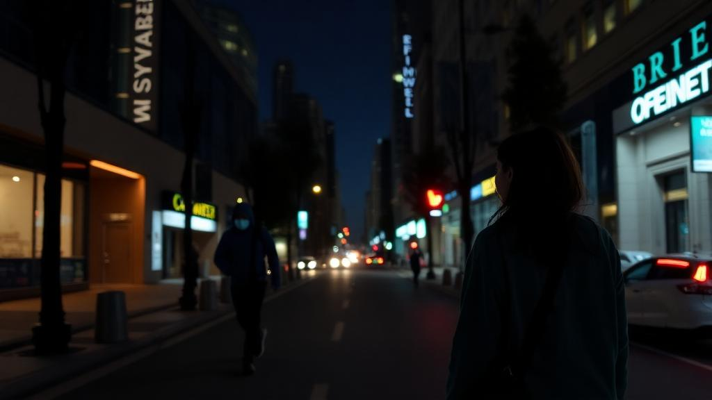
Measuring perceived safety in urban streets has traditionally relied on resource-intensive field surveys, manual data collection and subjective evaluations, which the study's authors describe as costly and sometimes inconsistent. The study, published in Frontiers of Urban and Rural Planning, does not claim to measure fear in the real world. Instead, it provides controlled experimental evidence about which spatial features tend to accompany lower subjective safety and stronger bodily arousal in a specific group of participants.
The research team, led by Yuxuan Liu, Biyi Liu and Xiangmin Guo, built their experiment around a 316-meter route that takes roughly five minutes to walk. The path begins at a bus stop on Xia Street, passes ground-floor storefronts and the Yangjiao Street pocket park, turns into Tangwei Street inside the Huancui residential community, and ends at a residential building. This sequence deliberately stitches together commercial, landscape and residential functions, mimicking the everyday scenario of a woman returning home after work in darkness. The route was filmed with a panoramic camera, and the resulting video was presented to participants through an HTC all-in-one head-mounted display while the Ergolab platform synchronized every incoming signal.
Seventy-five valid participants took part in the formal experiment: 65 young women aged 18 to 30 and a control group of 10 young men. All shared similar educational backgrounds and none was familiar with the site, reducing biases from age, education and spatial familiarity. After giving informed consent, each participant sat quietly for five minutes so researchers could record baseline physiology at rest. They then stood, donned the headset, and walked the virtual route while electroencephalography, electrodermal activity, electrocardiography and eye-tracking data streamed continuously.
Before the virtual experiment could begin, the researchers had to decide how perception should be measured at all. In a preliminary stage, they collected 264 pairs of daytime and corresponding nighttime images from the old town of Licheng and selected 20 representative samples for evaluation using Best–Worst Scaling. Sixty-six university students were recruited for this stage, 43 of them women and 23 men, all with similar educational levels but diverse academic backgrounds. T-tests comparing the safety ratings of the two groups found no statistically significant gender differences under either daytime or nighttime conditions, and the authors are explicit that they do not claim such differences at this stage. The comparison served mainly to justify focusing on nighttime spatial conditions within a young female participant group, rather than to establish that women and men rate spaces differently.
The day–night comparison of the 20 samples revealed a pattern that the authors describe as a shift in dominant explanatory factors. In spaces where perceived safety changed little between day and night, ratings appeared to be shaped primarily by static physical attributes such as road width and interface characteristics, including window-to-wall ratio and visual obstruction. In spaces with moderate day–night differences, the frequency of nighttime social activity emerged as the key determinant, while parked vehicles showed no significant effect. In spaces with the largest differences, lighting conditions and nighttime commercial activity became the dominant drivers, with interface heterogeneity also contributing. Across this gradient, the dominant factors moved from static physical attributes to dynamic human activity and finally to lighting and commercial functions.
The ranking results also sorted the samples into recognizable types. Spaces rated as highly safe tended to have a strong public character, adequate lighting and well-maintained environments, typically commercial areas, landscape spaces and modern residential neighborhoods. The least safe spaces clustered in older residential areas marked by uneven lighting, narrow pathways, visual obstructions and oppressive façade designs. Moderately rated spaces depended on their degree of publicness: landscape spaces lacking sufficient lighting lost perceived safety through shadow effects, whereas those hosting spontaneous commercial activity fared better. From these 20 samples, the team selected a single everyday route in the central old town as the setting for the formal experiment, chosen precisely because it connects commercial, landscape and residential functions in one continuous walk.
The choice of a laboratory-based virtual walkthrough rather than an on-site experiment was itself the product of preliminary testing. In field settings, physiological signals were contaminated by uncontrollable factors such as pedestrian movement, noise and variations in temperature and humidity, producing greater signal variability and less stable EEG recordings. Device battery life and Bluetooth transmission were also more vulnerable to interference outdoors, often requiring extra personnel. On the other side of the ledger, the on-site group reported stronger situational immersion and richer descriptions of spatial perception, though the presence of accompanying researchers may itself have elevated their sense of safety. The virtual group yielded more stable and comparable data, but the laboratory context may have raised participants’ baseline sense of psychological safety. The authors weigh these trade-offs openly and conclude that the VR setting was not intended to replace real nighttime walking but to serve as a controlled environment that reduces external noise.
The conceptual framework underlying the analysis is deliberately modest in its claims. Nighttime spatial attributes such as lighting, visual permeability, greenery, commercial activity, surveillance visibility and obstruction are proposed to influence perception mechanisms including visibility, controllability, natural surveillance, help-seeking potential and exposure risk, which may in turn trigger electrodermal arousal, heart-rate-variability-related stress responses, EEG-based alertness and visual scanning. The authors stress that this is a conceptual and interpretive model, not a fully tested causal or mediation model, and that physiological indicators serve as complementary contextual evidence rather than substitutes for perceived safety itself.
Semantic segmentation of the panoramic video divided the route into 11 spatial nodes and 10 walkthrough segments, allowing the physical elements at each node to be quantified. The nodes differed sharply. Node 1–1 was well lit and highly observable; node 1–2 combined high openness with dense commercial activity, enhancing help-seeking potential and surveillance; node 1–4 showed high greenery visibility but low lighting; node 1–5 was narrow and heavily obstructed; and node 1–10 exhibited the poorest lighting and weakest observability of all. Along the route as a whole, observability remained relatively stable, greenery visibility fluctuated and declined, help-seeking potential showed stable lighting but polarized window-to-wall ratios, surveillance was uneven despite stable commercial density, obstruction increased after node 1–5 as pathways narrowed, and environmental order deteriorated within the residential sections.
The physiological results paint a picture of bodily engagement that rises and falls with the urban fabric. Transitions from open, active spaces into enclosed residential environments were accompanied by heightened beta-band activity and fluctuations in the (α + θ)/β ratio, which the authors interpret as increased cognitive alertness and emotional load. Node-level summaries of electrodermal and heart-rate-variability-based responses showed that higher arousal tended to co-occur with areas characterized by poor lighting, greater visual clutter and weaker natural surveillance. The authors caution, however, that these responses cannot be attributed solely to perceived unsafety, since they may equally reflect visual attention, cognitive load or environmental novelty.
Eye-tracking added a third stream of evidence. Roughly 39 percent of fixations fell on building façades along both sides of the street, suggesting attention to environmental boundaries, light sources and potential spatial cues, while 32 percent concentrated on the ground, consistent with path-oriented navigation. The authors characterize this as a composite pattern of path-oriented navigation plus environmental scanning. In areas with lower perceived safety, fixation trajectories became more dispersed and scanning frequency increased, suggesting higher visual attention demand and environmental uncertainty.
The statistical link between subjective and physiological measures was tested through node-level correlation analyses using BWS safety scores and the relative physiological response indicators. Perceived safety showed a significant negative association with EDA/SCL-based relative change and with the combined physiological response indicator, while the negative association with HRV-based relative change was marginal. In plain terms, nodes rated as less safe tended to co-occur with stronger physiological responses. The authors are careful to note that these correlations do not mean physiological signals can substitute for subjective ratings, nor do they establish a shared construct or causal pathway; third variables such as visual complexity, environmental novelty, attentional demand or spatial disorder could contribute.
Among the substantive findings, one stands out against daytime intuition: green visibility was negatively correlated with perceived safety at night. The authors suggest that unplanned or disordered greenery may weaken the sense of management and surveillance, increase visual obstruction and raise perceived risk, an interpretation they link to extensions of prospect–refuge theory into nighttime contexts. Conversely, moderate and well-maintained greenery may help maintain environmental comfort. Higher-rated spaces generally shared uniform and sufficient lighting, orderly and well-maintained interfaces, and a moderate level of visible commercial activity, whereas lower-rated spaces were associated with insufficient lighting, disordered vegetation causing visual obstruction, deteriorated and chaotic interfaces, and a lack of commercial presence and pedestrian activity.
These observations feed into a set of evidence-informed design suggestions covering lighting improvement, visibility management, surveillance-supportive facilities and help-seeking opportunities. The authors frame these as context-sensitive strategies rather than universal design parameters, and they position the Licheng case against related studies from Seoul, Guangzhou, Milan and campus-street research, noting recurring associations between lighting, visibility, obstruction, active frontages and perceived safety while acknowledging that such consistency does not demonstrate a universal cross-regional mechanism.
The limitations are stated plainly. Physiological signals cannot uniquely identify perceived unsafety. The participants were young adults with similar educational backgrounds, so findings apply primarily to young female university students. The male control group of ten was statistically underpowered and served only as contextual reference, making all gender-related observations exploratory and hypothesis-generating. The VR experiment could not reproduce the physical risk, social uncertainty and bodily vulnerability of real nighttime walking, and no equivalent data were collected from other districts. The authors call for future application of the same measurement framework to additional old-town districts, urban villages, campus streets and other nighttime pedestrian environments, combined with field-based or longitudinal validation.
Subject of Research: A VR-based experiment measuring perceived safety and physiological responses of young female participants walking a simulated nighttime urban route in Guangzhou.
Article Title: Young female participants’ perceived safety responses in nighttime urban pedestrian spaces: a controlled VR-based experiment in the old town of Licheng, Zengcheng District
Article References: Liu, Y., Liu, B., & Guo, X. (2026). Young female participants’ perceived safety responses in nighttime urban pedestrian spaces: a controlled VR-based experiment in the old town of Licheng, Zengcheng District. Frontiers of Urban and Rural Planning, 4(1), Article 27. https://doi.org/10.1007/s44243-026-00099-0
Image Credits: AI Generated
DOI: 10.1007/s44243-026-00099-0
Keywords: perceived safety, virtual reality, nighttime walking, urban design, women-friendly cities, physiological signals, EEG, eye-tracking, Best-Worst Scaling, Guangzhou, pedestrian spaces, gender-sensitive planning
News Source: Denise Maddox. (October 27, 2026). Virtual Night Walks Reveal How Young Women Perceive Urban Streets After Dark. Scienmag.