Fossil fuel carbon began leaving a clear isotopic fingerprint in the surface waters of the Southern California Current around the 1950s, according to a high-resolution analysis of laminated seafloor sediments from San Lazaro Basin off Baja California. The study, published in Biogeosciences, uses roughly 160 years of sedimentary carbon isotope records to show that the ocean there has been absorbing isotopically light atmospheric carbon dioxide since the mid-twentieth century, but at a pace measurably slower than the atmosphere itself has changed.
The research team, led by Yéssica Vanessa Contreras-Pacheco of CICESE in Ensenada, Mexico, measured the ratio of stable carbon isotopes in two distinct archives preserved in the basin’s sediments: the calcite shells of two species of planktic foraminifera, and the organic carbon derived largely from phytoplankton. Both archives reveal a sustained shift toward lighter carbon isotopic compositions over the past seven decades, a pattern that closely mirrors the so-called 13C Suess effect documented in atmospheric records.
The 13C Suess effect arises because carbon dioxide released by fossil fuel combustion is depleted in the heavy isotope carbon-13, with a delta value of roughly −26 to −28 per mil, compared with the preindustrial atmosphere at about −7 per mil. As this isotopically light CO2 accumulates in the air and dissolves into the surface ocean, it drags down the carbon-13 signature of dissolved inorganic carbon, the carbon pool that marine organisms build their shells and tissues from. Tracking that dilution through time therefore offers a way to reconstruct when and how quickly anthropogenic carbon invaded a given ocean region.
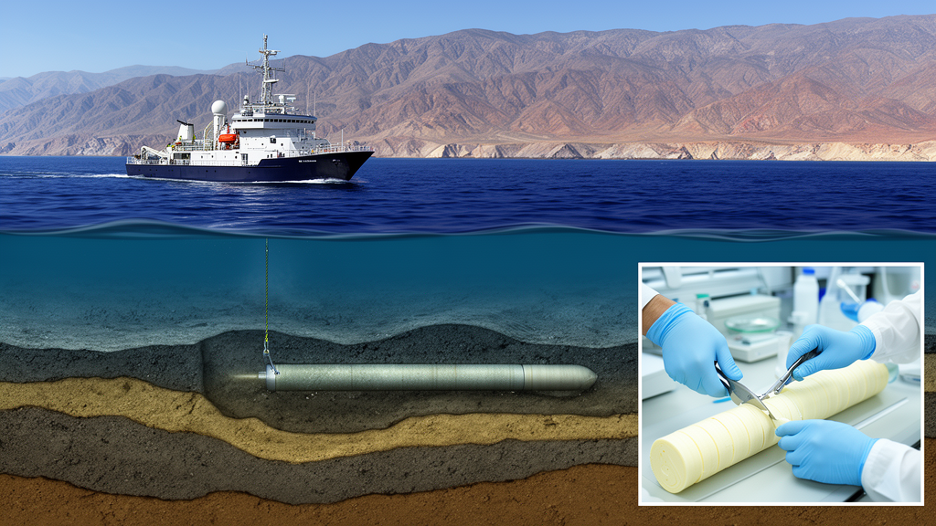
San Lazaro Basin is an unusually good place to do this. The basin, located at about 25 degrees north latitude off the Baja California Peninsula, sits beneath the dynamic boundary where cooler, fresher California Current waters from the north meet warmer, saltier subtropical waters advected poleward from the south. Its restricted circulation, combined with oxygen-poor subsurface waters supplied by the California Undercurrent, keeps the seafloor suboxic and prevents burrowing organisms from mixing the sediment. The result is annually to decadally layered deposits that preserve a chronological archive of surface ocean conditions, with sediment accumulating at roughly 2.5 millimeters per year.
The team analyzed box cores collected in 1996 and 2011, along with the upper section of a Kasten core that extends the record back toward the preindustrial era. Sediment slabs were sampled at 2 to 3 millimeter resolution, corresponding to roughly 1 to 4 year time slices. For the foraminiferal calcite measurements, the researchers handpicked approximately 14 shells per sample of the thermocline-dwelling species Neogloboquadrina dutertrei and the near-surface species Globigerinoides ruber, achieving an analytical precision of plus or minus 0.06 per mil. A total of 330 samples yielded organic carbon isotope measurements, and age models were anchored by lead-210 and cesium-137 profiles and cross-correlated using carbonate minima across cores.
Statistical comparison over the common interval from 1980 to 2011, the period shared by the atmospheric instrumental record and the marine archives, revealed a consistent but attenuated signal. The atmospheric delta value declined at −0.261 per mil per decade, significantly steeper than the −0.120 per mil per decade recorded in foraminiferal calcite and the −0.154 per mil per decade in organic carbon. The difference in slopes between the atmospheric record and each marine proxy was highly significant, while the two marine proxies, remarkably, were statistically indistinguishable from each other, suggesting that both faithfully capture the same upper-ocean carbon evolution.
That attenuation, roughly 0.11 to 0.14 per mil per decade relative to the atmosphere, points to the regional oceanography of an eastern boundary upwelling system. From late winter to early summer, strong equatorward winds drive upwelling of nutrient- and carbon-rich subsurface waters that fuel the region’s famous productivity. Those upwelled waters carry remineralized dissolved inorganic carbon with a relatively heavier isotopic signature than the modern atmosphere, partially buffering the surface ocean against the lightening influence of atmospheric CO2. During the rest of the year, weaker winds allow warm, stratified subtropical waters to intrude, shifting the region’s carbon balance. The sediment record integrates all of these seasonal and interannual dynamics, smoothing the pure atmospheric signal.
The authors also tested whether changes in biological fractionation could explain the discrepancy. Phytoplankton preferentially fix the lighter isotope carbon-12 during photosynthesis, and rising CO2 concentrations can increase this fractionation, pushing organic matter toward even lighter values. A sensitivity calculation applying an additional fractionation of about 0.10 per mil per decade to the atmospheric trend would predict a decline of roughly −0.36 per mil per decade, substantially steeper than anything observed in the sediments. Changes in biological fractionation alone therefore cannot account for the records, confirming that the interplay of upwelling, mixing, and air-sea exchange governs the regional signal.
The mid-century timing of the shift carries particular weight. Both the organic carbon and carbonate records show a marked transition beginning around the 1950s, coinciding with the accelerated postwar rise in fossil fuel emissions recorded in the Law Dome ice core from Antarctica. Because the organic carbon record is immune to the carbonate chemistry effects that can bias foraminiferal calcite under undersaturated conditions, its parallel shift supports the interpretation that the feature reflects a genuine surface-ocean response to rising atmospheric CO2 rather than a calcification artifact. Prior reconstructions from elsewhere in the California Current had detected only weak foraminiferal carbon isotope trends, making this clearer record from the southern boundary especially informative.
Placed in a broader context, the measured declines of −0.12 to −0.15 per mil per decade sit at the low end of the range reported for the North Pacific, which averages −0.20 per mil per decade, and are similar to the rates observed in the equatorial Pacific upwelling zone, another strongly upwelling-influenced region. Both fall well short of the −0.25 to −0.27 per mil per decade seen in subtropical gyres and the atmosphere. The study’s authors emphasize that a quantitative partitioning among subsurface mixing, air-sea exchange, and biological processes is not possible from the proxy records alone, since these mechanisms are tightly coupled in upwelling systems. What the records do establish is the total degree to which the upper ocean modulates the atmospheric signal, and they underscore why eastern boundary upwelling systems, which can swing between carbon sources and sinks depending on season, El Niño conditions, and marine heatwaves, remain among the most challenging regions to represent in global carbon budgets.
Subject of Research: Reconstruction of the 13C Suess effect and anthropogenic carbon invasion in the Southern California Current using sedimentary carbon isotope records
Article Title: Timing of the anthropogenic carbon invasion in the Southern California Current
Article References: Contreras-Pacheco, Y. V., Abella-Gutiérrez, J. L., Vallejo-Espinosa, G., & Herguera-García, J. C. (2026). Timing of the anthropogenic carbon invasion in the Southern California Current. Biogeosciences, 23(20), 7397-7409. https://doi.org/10.5194/bg-23-7397-2026
Image Credits: AI Generated
Keywords: 13C Suess effect, California Current System, San Lazaro Basin, paleoceanography, anthropogenic CO2, upwelling, planktic foraminifera, carbon isotopes, eastern boundary upwelling, ocean carbon cycle, Baja California, sediment cores
News Source: Violet Maxwell. (October 23, 2026). Sediment cores off Baja California trace when fossil fuel carbon reached the California Current. Scienmag.