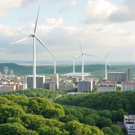
Cities around the world are planting trees at an unprecedented pace, yet many continue to grow hotter. Expanding urban canopies can provide shade, store carbon and improve air quality, but trees alone do not always counteract the heat generated by dense buildings, paved surfaces, traffic and energy consumption. A study published in Nature Cities suggests that one of the most overlooked ingredients in urban cooling may not be located inside the city at all. Instead, strategically preserved or restored green areas upwind could deliver cooler air into built-up districts, creating a broader and more reliable cooling effect than isolated parks or scattered street trees.
The research, led by Yang, Wang, Liu and colleagues, revisits a traditional environmental principle observed in Chinese villages: the coordinated relationship among mountains, water and forests. In these settlements, natural features were not treated as separate amenities but as a connected climatic system. Mountain slopes helped guide air movement, water bodies moderated temperatures, and forests supplied cooler air while protecting landscapes from excessive solar heating. The researchers adapted this “mountain–water–forest” framework to modern megacities, where complex terrain, high-rise development and regional weather patterns interact to shape the distribution of heat.
At the center of the approach is cold-air advection, the horizontal movement of relatively cool air from one location to another. During hot conditions, air that has been cooled over vegetated land can be transported along prevailing wind pathways toward warmer urban districts. This process differs from the localized shade produced by a single tree or park. A tree cools its immediate surroundings through shading and evapotranspiration, the release of water vapor from leaves and soil. Upwind greening can influence the temperature of an incoming air mass before it reaches the city, potentially allowing the cooling signal to extend over a much larger area.
The proposed framework depends on the interaction between land cover and urban airflow. Vegetated zones can remain cooler than heavily built surfaces because plants shade the ground and convert part of the incoming solar energy into latent heat through evapotranspiration. If winds are stable enough, air passing over these areas can carry the resulting thermal advantage downstream. Buildings, streets and other structures then determine how that air enters and moves through the city. In this sense, the strategy is less about adding greenery wherever space is available and more about protecting the spatial connection between cooling landscapes and the neighborhoods that receive their airflow.
According to the study, applying this framework produced an average temperature reduction of 0.4 ± 0.2 degrees Celsius across more than half of the urban area examined. Although the reduction may appear modest, a citywide change of this scale can be significant during heat waves, when even small decreases in air temperature may reduce physiological stress and lower demand for air conditioning. The reported effect also suggests that cooling does not have to be concentrated only around large parks or waterfronts. Under the right conditions, it can be distributed through the urban fabric by atmospheric transport, reaching locations that may have little room for new vegetation.
One of the study’s striking findings is the framework’s limited sensitivity to different synoptic circulation types and terrain settings. Synoptic circulation refers to large-scale atmospheric patterns that influence wind direction, pressure and weather over broad regions. Urban cooling strategies that work only under one particular weather pattern may be difficult to apply consistently. The researchers instead identify two basic prerequisites: stable wind pathways and sufficient upwind greening zones. Where these conditions exist, the mountain–water–forest concept appears to remain useful across a range of climatic and morphological contexts, from cities shaped by mountains to those dominated by more complex urban forms.
The emphasis on upwind landscapes challenges a common assumption in urban climate planning. Many greening policies focus on planting within neighborhoods experiencing the highest temperatures, often prioritizing tree-lined streets, pocket parks and green roofs. These interventions remain valuable, but the new findings indicate that planners may also need to ask where the air arriving in a city has come from and what surfaces it has crossed. A forest, wetland, agricultural belt or continuous park system located outside the densest development could function as a regional cooling asset. If roads, walls or poorly planned construction interrupt the airflow corridor, however, the potential benefit may be reduced even when the vegetation itself remains intact.
The study does not present greenery as a universal substitute for emissions reductions, heat-health services or building-level adaptation. Urban trees require water, maintenance and space, and vegetation can sometimes restrict ventilation or increase humidity if planted without regard to local conditions. The framework therefore calls for a systems-based approach that combines ecological design with atmospheric analysis. Mapping wind corridors, identifying reliable sources of cool air and preserving the upwind land that sustains them could become part of long-term urban planning, alongside shade infrastructure, reflective materials, cooling centers and early-warning systems for extreme heat.
As heat waves intensify and cities continue to expand, the most important lesson may be that urban climate resilience is shaped beyond administrative boundaries. A municipal district cannot control the atmosphere, but it can protect the landscapes and corridors that help regulate the air entering its streets. The mountain–water–forest framework translates an old settlement principle into a modern planning strategy: cooling is not simply something to install in overheated neighborhoods, but a process that can be generated, transported and shared across an entire urban region. By drawing attention to overlooked upwind greening, the research offers cities a potentially scalable way to turn landscape connectivity and wind movement into public-health infrastructure.
Subject of Research: Upwind greening and the mountain–water–forest framework as a systems-based strategy for urban cooling and heat resilience.
Article Title: Overlooked upwind greening for urban cooling
Article References: Yang, M., Wang, J., Liu, S. et al. Overlooked upwind greening for urban cooling. Nature Cities (2026). https://doi.org/10.1038/s44284-026-00503-2
Image Credits: AI Generated
DOI: https://doi.org/10.1038/s44284-026-00503-2
Keywords: urban cooling, upwind greening, cold-air advection, heat resilience, urban forestry, climate adaptation, mountain–water–forest framework, megacities, urban heat, wind corridors
Tags: city heat mitigationimpact of upwind vegetation on city temperaturesintegrated natural systems for city coolinglandscape planning for climate resiliencenatural climate regulation in citiesregional weather influence on urban heatrole of forests and water bodies in urban coolingstrategic green area restorationtraditional Chinese environmental principlesupwind green space preservationurban cooling strategiesurban heat island effect reduction