In the bustling streets of New York City, a groundbreaking study led by researchers from the MIT Senseable City Lab has demonstrated a revolutionary approach to monitoring urban automobile emissions through the synthesis of existing sensor networks and mobile phone data. This innovative method transcends traditional techniques by delivering near real-time, high-resolution emission maps that reveal granular details about traffic-related pollution at the scale of individual roads and specific hours. By harnessing data already embedded within the city’s infrastructure, the research presents a scalable and practical framework that surpasses the limitations inherent in earlier emission estimation methods reliant on intermittent sampling or constrained vehicle monitoring.
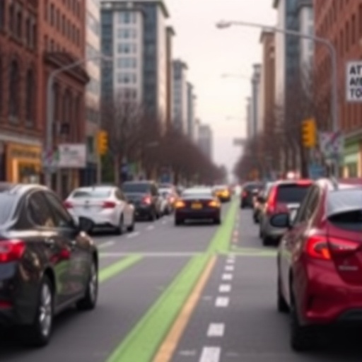
Urban emissions inventories typically suffer from either a lack of spatial resolution or impracticality when aiming for hyper-local datasets. MIT’s new approach elegantly addresses this gap by integrating multiple streams of urban data: leveraging the extensive network of traffic cameras alongside anonymized location data extracted from over 1.75 million mobile phones traversing Manhattan. Advanced computer vision algorithms categorize detected vehicles into one of twelve predefined classes with remarkable 93 percent accuracy, enabling the system to infer detailed vehicular flow patterns while maintaining stringent privacy safeguards by eschewing any collection of license plate information.
Analyzing the synchronization and timing of traffic signals provided key insights into dynamic stop-and-go traffic behaviors, a significant contributing factor to elevated emissions that are often overlooked in general urban pollution models. This nuanced understanding of how traffic control devices influence emission patterns is crucial, as intermittent acceleration and deceleration have exponentially higher environmental consequences compared to steady-speed driving, thus affecting urban air quality in ways previously unquantified across large city networks.
The researchers’ methodology melds vehicle type data with spatial-temporal traffic distribution derived from phone mobility records, culminating in robust emission estimates tailored down to individual city intersections and hourly intervals. This granularity facilitates unprecedented capacity for policymakers and urban planners to anticipate and evaluate the environmental impacts of transportation policies in near real-time, providing a powerful data-driven tool to shape sustainable urban mobility strategies.
Beyond mere static measurement, the MIT team employed their model to simulate various transportation scenarios to assess potential emission reductions. These simulations examined the shifting of travel demand from private cars to bus transit and the temporal redistribution of commuter peak hours to alleviate congestion density. The results underscore the sensitivity of emissions outcomes to subtle changes in traffic flow and vehicle composition, revealing that conventional coarse-grain emission models might underestimate or overestimate actual pollution by significant margins, potentially resulting in misguided policy decisions.
Crucially, the study examined the real-world effects of New York City’s congestion pricing initiative, introduced in January 2025 to reduce vehicular traffic south of 60th Street in Manhattan. Empirical analysis revealed that while traffic volume decreased by approximately 10 percent within the congestion zone, corresponding emissions dropped more substantially, in the range of 16 to 22 percent. This asymmetric decline reflects nonlinear relationships between traffic volume and emission outputs, further highlighting the effectiveness of pricing mechanisms as environmental interventions.
Interestingly, emission reductions were not evenly distributed across the city. The MIT team mapped emissions throughout the network and found pronounced decreases along major corridors inside the congestion zone, whereas peripheral areas exhibited more modest or mixed changes. This spatial heterogeneity emphasizes the importance of hyper-localized data in accurately capturing environmental benefits and trade-offs, essential for fine-tuning urban decarbonization policies.
One of the study’s technological triumphs lies in its commitment to privacy-preserving data utilization. By applying state-of-the-art computer vision that identifies vehicle categories without recording identifiable attributes such as license plates, the framework respects individual privacy norms while extracting critical environmental data. The ethical approach exemplifies how advanced urban sensing can evolve responsibly amidst increasing data governance scrutiny.
Moreover, the research hints at the extensibility of its framework beyond stationary traffic cameras. In a related exploratory study in Amsterdam, dashboard cams mounted on vehicles supplemented the emission estimation capabilities, capturing dynamic vehicle movement data across a broad urban milieu. This approach envisions a networked city where ubiquitous cameras—from city installations to thousands of mobile sources—collectively enhance pollution monitoring accuracy in real-time.
As urban areas worldwide strive to meet stringent climate goals and improve public health, this pioneering work from MIT offers a transformative tool to quantify, understand, and manage the environmental impacts of urban mobility. By converting existing urban digital infrastructure into a potent emissions sensor array, the study paves the way for smarter, data-driven interventions that can adapt dynamically to evolving traffic conditions and transportation policies.
The research is thoroughly documented in the paper titled “Ubiquitous Data-driven Framework for Traffic Emission Estimation and Policy Evaluation,” published in the prestigious journal Nature Sustainability. The international team of authors combines expertise from urban sensing, transportation engineering, and environmental science, contributing a multidisciplinary perspective vital for tackling the intricate challenges of urban pollution.
As policymakers grapple with designing equitable and effective urban environmental strategies, the MIT framework positions itself as an indispensable asset. The fusion of traffic camera imagery, mobile phone geolocation data, and emissions modeling offers an unprecedented clarity in visualizing how each vehicle’s movement and classification contributes to the overall emissions tapestry of the city, empowering targeted action at unprecedented spatial and temporal fidelity.
The implications extend beyond New York City. Given the global ubiquity of mobile phones and urban camera networks, this model is primed for adaptation to diverse metropolitan settings. Its scalable design and reliance on existing infrastructure suggest that other cities can feasibly replicate and customize this approach to suit local transportation dynamics and environmental priorities, potentially driving a new era of real-time emission-aware urban management worldwide.
Backing this innovative project, the MIT Senseable City Consortium assembled a wide-ranging coalition of partners, including academic institutions, municipal governments, and major industry players such as Toyota and Volkswagen Group America. Their support underscores the cross-sector recognition that advanced data-driven insights are essential to achieving sustainable urban futures, where technological integration and environmental stewardship converge.
The combination of technological ingenuity, data integration, and pragmatic focus on policy evaluation makes this MIT-led research a harbinger of how smart cities can harness their digital arteries to breathe cleaner air. In this era of urgent climate action, tools capable of delivering granular, real-time environmental intelligence will be pivotal in steering both collective behavior and public policy toward greener horizons.
Subject of Research: Urban Vehicle Emissions Measurement and Policy Impact Analysis using Data-Driven Techniques
Article Title: “Ubiquitous Data-driven Framework for Traffic Emission Estimation and Policy Evaluation”
Web References: Nature Sustainability Journal
Keywords: Pollution, Pollutants, Carbon emissions, Environmental sciences, Transportation, Vehicles, Automobiles, Urban studies, Cities, Urbanization, Sensors, Technology
Tags: block-level pollution mappingcomputer vision vehicle classificationgranular vehicular flow patternshigh-resolution emission dataMIT Senseable City Lab researchmobile phone data for pollution trackingNew York City pollution studyprivacy-preserving traffic monitoringreal-time urban traffic emissions monitoringscalable urban emissions frameworktraffic-related air pollution analysisurban sensor network integration


