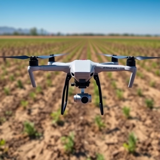
In the pursuit of sustainable agriculture and securing global food resources, the precise assessment of soil salinity has emerged as a paramount concern. Traditional methodologies centered around laborious field sampling and laboratory analyses have struggled to provide the spatially detailed insights demanded by modern agronomic practices. Addressing this critical gap, a pioneering study by researchers at the Institute of Agricultural Resources and Regional Planning, Chinese Academy of Agricultural Sciences, introduces an advanced ensemble learning framework that seamlessly integrates high-resolution multispectral data captured via unmanned aerial vehicles (UAVs) with essential soil auxiliary information. This innovative approach significantly refines the accuracy and stability of soil salinity estimation at the sub-meter scale, charting a transformative path for field-level soil monitoring.
Soil salinization constitutes a pervasive environmental challenge worldwide, undermining crop productivity and perturbing soil health, thereby imperiling long-term agricultural sustainability. Standard remote sensing techniques have broadened the spatial scope for salinity monitoring but often falter in balancing sufficient spatial resolution with the intricate soil-environment interactions that govern salinity dynamics. This complexity arises from multifaceted drivers encompassing spectral reflectance features, organic matter content, soil pH, and their interdependent nonlinear relationships. The new research confronts these challenges head-on by employing an integrative model that judiciously merges spectral and soil chemical indices derived from UAV imagery and laboratory data.
Central to the success of this study is a novel framework grounded in feature optimization and performance-weighted ensemble learning. Unlike conventional models that apply uniform weighting or simplistic aggregation, this methodology dynamically calibrates the contribution of multiple base learners according to their predictive reliability. By harnessing a hybrid embedded feature-selection algorithm, the model discriminates and prioritizes the most sensitive predictors—particularly UAV-derived salinity indices alongside soil organic matter and pH—thereby enhancing model interpretability and reducing redundancy. This nuanced approach achieves substantial improvements in accuracy, surpassing a coefficient of determination (R²) of 0.75 in validation tests while concurrently reducing prediction uncertainty.
Data acquisition employed multispectral UAV platforms equipped to capture green, red, red-edge, and near-infrared spectral bands across representative saline agricultural fields. These rich spectral datasets were complemented with meticulously collected soil samples, analyzed for salinity concentration, organic matter content, and pH levels under controlled laboratory conditions. Subsequent data preprocessing and spectral index computations enabled the extraction of relevant features sensitive to salinity variations. The model’s hybrid feature-selection process facilitated the identification of a targeted feature subset that robustly correlates with soil salinity, effectively addressing the high dimensionality challenges typical of remote sensing data.
The ensemble learning mechanism itself integrates a spectrum of machine learning algorithms, such as random forests, gradient boosting machines, and support vector machines. Each base model’s predictive performance is assessed through rigorous repeated cross-validation, with weights assigned proportionally to their predictive reliability. This performance-weighted aggregation mitigates the weaknesses inherent in any single method, producing a composite predictor characterized by enhanced robustness and generalizability. Detailed quantitative analyses reveal substantial reductions in root mean square error and mean absolute error relative to baseline models, underscoring the superior efficacy of the ensemble framework.
Spatial mapping outcomes generated by the proposed framework present highly resolved salinity distribution maps, delineating clear gradients and localized hotspots within the agricultural landscape. These fine-scale maps empower precision agriculture practitioners to deploy tailored interventions that optimize irrigation, soil amendments, and crop selection based on precise soil health indicators. The low prediction uncertainty accompanying these maps ensures confidence in decision-making workflows, potentially leading to increased crop yields and sustainable land management in regions plagued by salinization.
From a methodological standpoint, the integration of UAV technology with advanced analytical frameworks exemplifies the future trajectory of environmental monitoring. UAVs provide unprecedented spatial resolution and temporal flexibility, effectively bridging the scale gap between ground truth sampling and satellite remote sensing. The intelligent assimilation of auxiliary soil information further complements spectral data, addressing the complex biochemical and physical soil processes influencing salinity. The research underscores how such multi-source data fusion, coupled with machine learning innovations, is pivotal for capturing the nonlinear and heterogeneous nature of soil properties.
The implications of this study extend beyond soil salinity alone. The demonstrated framework is adaptable to the monitoring of other critical soil health parameters, including moisture content, nutrient availability, and contamination indices. Scaling this approach to larger geographic regions and diverse soil types holds promise for broad application in global agricultural systems. Moreover, it aligns with pressing climate adaptation strategies by enabling resilient farming practices that respond dynamically to land degradation and environmental stressors.
The research team highlights the operational advantages of their approach, emphasizing cost-effectiveness and scalability. By reducing dependency on extensive ground sampling campaigns and leveraging rapid UAV missions coupled with automated data processing pipelines, the system promises timely and actionable insights. This efficiency is crucial for resource-constrained agricultural settings confronting salinity-induced yield losses and soil degradation, facilitating proactive rather than reactive management frameworks.
This study also paves the way for future interdisciplinary collaborations. Integrating remote sensing expertise, soil science, agronomy, and data science, the framework serves as a blueprint for convergent innovations targeting complex ecological challenges. The transparent reporting of methodological details and open access publication further support the replicability and extension of this work by the broader scientific community.
In conclusion, this landmark research articulates a compelling vision for harnessing cutting-edge UAV technology and sophisticated ensemble learning to advance soil salinity monitoring. By fusing optimized feature selection with performance-based model aggregation, it achieves an unprecedented balance of accuracy, precision, and applicability at fine spatial scales. As global agriculture navigates the twin imperatives of productivity and sustainability, such intelligent soil monitoring frameworks are poised to become indispensable tools in the arsenal against land degradation and food insecurity.
Subject of Research: Soil science
Article Title: A Feature-Optimized and Performance-Weighted Ensemble Learning for Estimating Soil Salinity Using UAV Imagery and Soil Auxiliary Information
News Publication Date: 15-Jan-2026
References: DOI 10.34133/remotesensing.0805
Image Credits: Journal of Remote Sensing
Keywords: soil salinity, UAV imagery, ensemble learning, feature selection, precision agriculture, soil monitoring, machine learning, remote sensing
Tags: advanced UAV applications in agronomyagricultural resource management with UAVsensemble learning for soil monitoringhigh-resolution multispectral data in agricultureimproving spatial accuracy in soil salinityintegrating soil auxiliary data in salinity modelsnonlinear soil-environment interaction modelingremote sensing for soil health assessmentsoil salinization impact on crop productivitysub-meter scale soil salinity estimationsustainable agriculture technologyUAV precision soil salinity mapping


