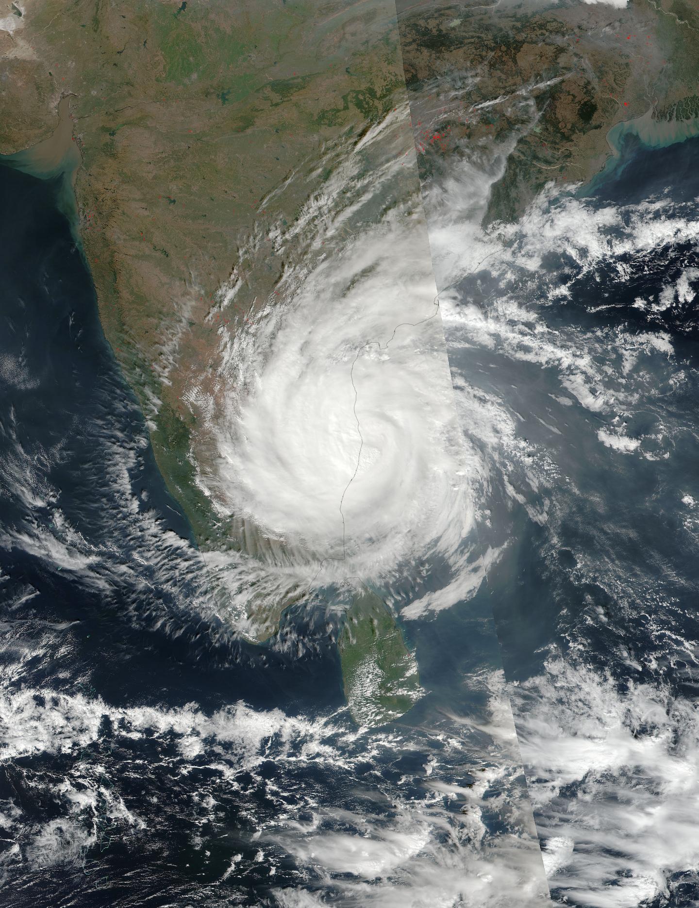
Credit: Credits: NASA MODIS Rapid Response/NOAA
Tropical Cyclone Vardah made landfall in eastern India as the NASA-NOAA Suomi NPP satellite passed over it from space. Vardah was hurricane-strength at the time of landfall and brought heavy rainfall and strong winds to areas of the India states of Tamil Nadu and Andhra Pradesh.
Vardah made landfall near Chennai, India. On Dec. 12 at 3:42 a.m. EST (0842 UTC) the Visible Infrared Imaging Radiometer Suite (VIIRS) instrument aboard NASA-NOAA's Suomi NPP satellite provided a visible-light image of the storm. The image showed bands of thunderstorms wrapped around the low-level center of circulation.
At 4 a.m. EDT (0900 UTC) Vardah's maximum sustained winds were 86.3 mph (75 knots/139 kph). Those hurricane-strength winds extended 25 nautical miles from the center of circulation.
Vardah's center was located near 13.2 degrees north latitude and 80.6 degrees east longitude. That put the cloud-filled eye of the storm about 718 nautical miles southwest of Kolkata, India. It was moving to the west at 10.3 mph (9 knots/16.6 kph).
The Joint Typhoon Warning Center expects Vardah to continue to move further inland and dissipate there.
###
Media Contact
Rob Gutro
[email protected]
@NASAGoddard
http://www.nasa.gov/goddard
############
Story Source: Materials provided by Scienmag


