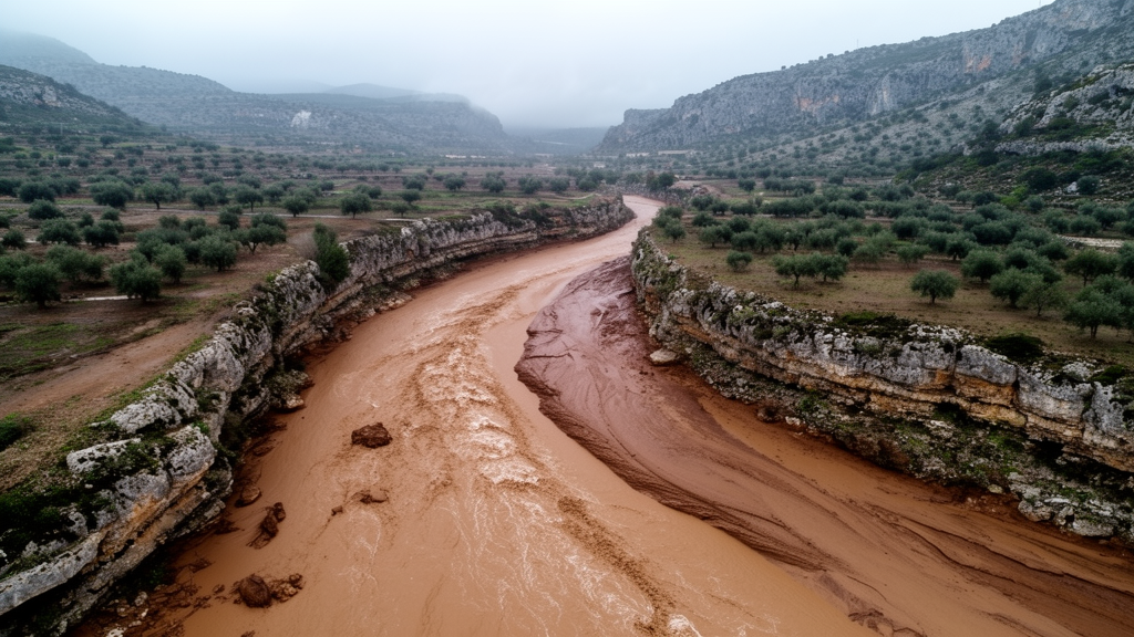
A computational reconstruction of the catastrophic flash flood that struck l’Horta Sud on 29 October 2024 has identified key hydrological and landscape factors that exacerbated the disaster, according to research conducted by the Universitat Politècnica de València. Published in the Journal of Hydrology: Regional Studies, the investigation by researchers at the university’s Institute of Water and Environmental Engineering (IIAMA-UPV) reveals that the severity of the event cannot be attributed to a single factor or watercourse alone. Instead, the catastrophe resulted from the combined effects of exceptional rainfall, near-simultaneous hydrologic surges across multiple ravines, substantial sediment transport, and dense urban development situated directly within flood-prone areas.
The research team, led by Carles Beneyto alongside co-authors Jaime Alberto Cachay-Melly, José Ángel Aranda, Miguel Á. Eguibar, Rafael García-Bartual, and Félix Francés, reconstructed the dynamics of the flood event using observed rainfall data and mathematical modeling tools. The researchers deployed the IIAMA-developed TETIS hydrological model alongside high-resolution hydraulic simulations to replicate how intense precipitation transformed into surface runoff, how moving water transported sediment, and how the resulting flood spread across the territory. The investigation received financial backing from the Spanish Ministry of Science and Innovation through the TETISPREDICT project.
A primary conclusion from the simulations is that the scale of the inundation cannot be explained solely by the flow rate of the Poyo ravine. Rather, the computational analysis showed that most of the ravines examined across the catchment reached their peak flows almost concurrently, within a narrow window between 18:30 and 19:50.
According to the study’s numerical simulations, the drainage system experienced a combined inflow of approximately 7,000 cubic metres per second prior to the occurrence of the main channel overflows. The authors emphasized that this estimated figure represents an integrated, system-wide total of concurrent tributary and ravine inflows rather than a discharge rate measured at any single monitoring point. Lead author Carles Beneyto explained that analysing the distinct response times of each ravine and the convergence of high water volumes and sediment within that compressed timeframe is essential to understanding the full magnitude of the inundation.
The sequence of precipitation throughout the day also proved decisive in preparing the landscape for extreme runoff. The researchers determined that persistent rainfall during the morning hours thoroughly saturated the catchment basins.
Solid material transport significantly altered flood behavior, as the researchers calculated that sediments represented roughly 7 percent of the cumulative flood volume and surged to approximately 19 percent at peak flow rates. As hydraulic engineering professor Félix Francés pointed out, these moving materials increased hydraulic resistance to flow while systematically reducing the drainage capacity of active watercourses.
Beyond hydrological and sediment dynamics, human land use substantially shaped the disaster’s footprint. The research highlighted that urban expansion in natural floodplains, transportation infrastructure, and artificial barriers altered the paths water took and escalated the depths it reached. The findings demonstrated that the ultimate impacts were governed not only by the sheer magnitude of the floodwaters, but also by how the surge interacted with the heavily built landscape.
While the TETIS hydrological model and hydraulic simulations successfully reproduced the general geographical extent of the observed flooding, the authors noted limitations in capturing temporary obstacles and localized urban details that altered water flow at fine scales. Concluding their study, the researchers emphasized that extreme episodes cannot be assessed solely through statistical flow rate estimates at isolated points. Instead, effective disaster risk assessment, spatial planning, and preventive measures against Mediterranean flash floods require fully integrating rainfall dynamics, multi-catchment responses, sediment transport, and land-use planning.
Published on 1 October 2026 under the title “Reconstruction of the October 2024 flood in l’Horta Sud (Valencia, Spain),” the peer-reviewed computational simulation study coincides with the second anniversary of the 29 October DANA. According to the Universitat Politècnica de València research team, reconstructing the event provides a clearer scientific understanding of what happened during the catastrophe, while offering critical lessons to strengthen prevention measures against extreme Mediterranean flash floods.
Subject of Research: Hydrological reconstruction of the October 2024 flash flood in l'Horta Sud
Article Title: A study by the UPV identifies the factors that exacerbated the 2024 flash flood in l'Horta Sud
Article References: A study by the UPV identifies the factors that exacerbated the 2024 flash flood in l'Horta Sud. Original publication (Bibliographic details unavailable.)
Image Credits: AI Generated
DOI: Not provided
Keywords: l'Horta Sud, Valencia flood 2024, Universitat Politècnica de València, IIAMA-UPV, TETIS hydrological model, flash flood reconstruction, sediment transport, Poyo ravine, catchment saturation, peak flow convergence, hydraulic simulations, floodplain development, Mediterranean flash floods, TETISPREDICT, DANA weather event, Journal of Hydrology Regional Studies
News Source: Violet Maxwell. (November 20, 2026). Study Identifies Converging Ravines and Sediment in 2024 Valencia Flash Flood. Scienmag.