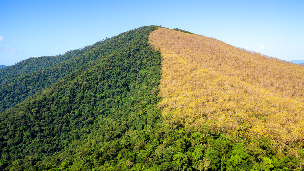
By analyzing a year-long dataset of bihourly measurements, the study reveals that shady slopes maintain higher moisture levels and delay daily drying minima by four to six hours compared to sunny slopes during autumn and winter. These findings, published in Fire Ecology, provide critical insights for operational fire-danger assessment in humid subtropical regions where terrain-driven microclimate variations are often overlooked in standard weather-based models.
The study focused on surface fine fuel moisture content, or SFFMC, a key variable that influences ignition potential and wildfire behavior. The research team established thirteen 20-meter by 20-meter plots in Masson pine stands in southern Jiangxi Province, China. These plots were categorized into shady and sunny slope classes based on their azimuth, with semi-shady and semi-sunny slopes combined into their respective binary groups. The monitoring period spanned from June 25, 2021, to June 23, 2022, capturing a full annual cycle of meteorological and hydrological conditions in a humid subtropical monsoon region.
Automated fuel-moisture monitoring systems were deployed in each plot to record air temperature, relative humidity, wind speed, illumination, and fuel weight every two hours. Vapor pressure deficit was calculated from temperature and humidity data to quantify atmospheric evaporative demand. Daily precipitation data were obtained from a nearby meteorological station and aligned with the bihourly records to assess antecedent wetting effects. This high-frequency monitoring approach allowed the researchers to resolve rapid diurnal fluctuations and short-term lag effects that lower-frequency sampling methods typically miss.
The results showed pronounced diurnal and seasonal variations in SFFMC. Time-of-day mean moisture was lowest between 10:00 and 16:00, averaging 35.27 percent, and highest between 04:00 and 06:00, averaging 49.08 percent. Seasonal means were highest in spring at 62.0 percent and lowest in autumn at 34.6 percent. Shady-slope plots consistently maintained higher SFFMC than sunny-slope plots, with mean values of 52.1 percent versus 41.6 percent across the entire monitoring period. This difference remained stable after temporal adjustment, with block-bootstrap analyses confirming a mean difference of approximately 8.59 percentage points.
Machine learning models, including Random Forest and XGBoost, were used to evaluate the predictive performance of meteorological and topographic variables. Under random external testing, both models achieved high R-squared values, indicating strong predictive capability within the monitored seasonal regimes. However, temporally blocked validation revealed that weekly transferability was stronger than monthly transferability, suggesting that models may struggle to predict fuel moisture in completely withheld time periods. This distinction highlights the importance of validation design when assessing the robustness of fuel-moisture prediction models.
SHAP analysis identified seasonal shifts in predictor importance. In spring and winter, precipitation-related features were the dominant drivers of SFFMC, reflecting the influence of recent rainfall on fuel wetting. In summer and autumn, temperature-related predictors and slope-aspect class became more influential, indicating a shift toward heat- and exposure-related drying. The precipitation feature indexed at the 20-hour lag position showed the strongest positive association with SFFMC in the SEM-based path analysis, while current temperature showed the strongest negative association. These findings underscore the role of antecedent meteorological conditions in shaping current fuel moisture status.
The SEM-based path analysis provided a structured framework for understanding the multivariable associations among meteorological factors, slope-aspect class, and SFFMC. The primary model explained 35.8 percent of SFFMC variation and showed acceptable fit indices. Sensitivity analyses, including a no-VPD model and temporal block bootstraps, retained the principal association structure, confirming that the core relationships were not driven solely by specific predictor choices. The weak wind-speed path was less temporally robust, suggesting that wind is a secondary predictor under the observed low-wind, humid understory conditions.
The observed moisture dynamics have direct implications for fire-risk assessment in subtropical forests. The recurrent SFFMC minimum between 10:00 and 16:00 identifies a daylight low-moisture window during which dead fine fuels are most receptive to ignition. Because sunny slopes reached their daily minima earlier than shady slopes in autumn and winter, hazardous fuel conditions may emerge earlier on exposed terrain. Operational warning systems should therefore integrate real-time SFFMC monitoring with slope-aspect class and short-term meteorological history to improve terrain-sensitive fire-danger assessments.
Limitations of the study include the use of a single annual monitoring cycle and one subtropical landscape, which limits the generalizability of the findings to broader regions. The co-variation of slope-aspect class with canopy density, elevation, and stand characteristics means that the observed SFFMC contrast represents an integrated site-exposure pattern rather than a single-variable effect. Future research should incorporate multi-site and multi-year datasets to test the transferability of the identified diurnal, seasonal, and slope-aspect patterns across diverse subtropical forest conditions.
By combining high-frequency monitoring with interpretable machine learning and path analysis, this study offers a comprehensive view of the complex interactions governing fuel moisture in subtropical forests. The results emphasize the need for terrain-sensitive and time-of-day specific approaches in fire management, moving beyond traditional weather-station based assessments.
The study area in southern Jiangxi Province features a humid subtropical monsoon climate with hilly terrain, elevations ranging from approximately 300 to 500 meters, and slopes between 0 and 20 degrees. Long-term regional records indicate a mean annual temperature of about 19.1 degrees Celsius and mean annual precipitation of 1,583.9 millimeters. During the 364-day monitoring period, conditions were comparatively warm and dry relative to these long-term averages. Cumulative precipitation was 1,365.5 millimeters, which was approximately 13.8 percent below the long-term mean annual precipitation. Mean understory air temperature was 20.54 degrees Celsius on shady slopes and 20.74 degrees Celsius on sunny slopes, roughly 1.4 to 1.6 degrees Celsius higher than the regional mean. The vegetation is dominated by subtropical evergreen coniferous and deciduous broadleaf forests, including Masson pine, China fir, slash pine, oil camellia, schima, and sweetgum.
Masson pine is one of China’s most widespread conifers, with monocultures constituting approximately 60 percent of its distribution area according to the Eighth National Forest Inventory. These stands often form fire-prone environments due to resinous, slowly decomposing needle litter and elevated surface fuel loads. Subtropical forests account for 44 percent of China’s forested area but are associated with 84 percent of its forest fires. Empirical evidence from Jiangxi Province indicates the importance of Masson pine-dominated forests in regional wildfire occurrence. The general mechanisms by which slope aspect modifies radiation, temperature, and atmospheric moisture are well established, but the magnitude and timing of surface fine fuel moisture differences between shady and sunny slope classes remained poorly quantified for Masson pine surface fuels at the within-stand plot scale prior to this research.
Fine fuel samples of 200 to 250 grams were collected from undisturbed locations in each plot to represent natural field fuel composition. These samples consisted mainly of dead Masson pine branches with a diameter less than 0.64 centimeters, classified as 1-hour time-lag fuels, along with fallen needles and small amounts of herbaceous litter. Samples were oven-dried at 105 degrees Celsius to remove free moisture and then at 85 degrees Celsius to constant weight. After drying, they were returned to the field in mesh bags, suspended 0.3 meters above the ground at each measurement point, and allowed to rehydrate naturally for 48 hours before monitoring began. Surface fine fuel moisture content was calculated every two hours from fresh fuel weight and oven-dry fuel weight. Decayed samples were replaced through the same drying and rehydration procedure to maintain consistency in the fuel bed composition throughout the study.
Statistical analyses accounted for the non-normal distribution of surface fine fuel moisture content and strong temporal persistence in the data. Conventional group comparisons were performed using Wilcoxon rank-sum tests for slope-aspect class and Kruskal–Wallis tests for seasons and fixed time periods. Formal time-adjusted inference used generalized least-squares models with a continuous-time autoregressive structure to handle temporal dependence. Temporal stability was further evaluated using synchronous 24-hour moving-block bootstraps with 2,000 replicates. The paired shady-sunny comparison was also tested using a 48-hour moving-block bootstrap with 1,000 replicates. Autocorrelation function diagnostics confirmed strong temporal persistence, with 2-hour residual autocorrelation of 0.967 for shady slopes and 0.944 for sunny slopes, supporting the use of these temporal adjustment methods in the statistical framework.
Environmental class comparisons revealed that surface fine fuel moisture content declined progressively across increasing temperature classes. Mean moisture was 56.98 percent under low temperatures below 15 degrees Celsius and dropped to 25.42 percent under high temperatures above 30 degrees Celsius. All pairwise contrasts across temperature classes remained significant after temporal adjustment. The high relative humidity class, defined as above 75 percent, maintained higher surface fine fuel moisture content at 50.26 percent compared to low and moderate humidity classes. Illumination and vapor pressure deficit showed non-monotonic grouped patterns, with the high-illumination class above 5,000 lux having the lowest mean moisture at 39.36 percent. The high vapor pressure deficit class above 0.09 kilopascals had the lowest mean moisture at 31.60 percent, while low and moderate vapor pressure deficit classes remained higher but were not significantly separated from one another after temporal adjustment.
Precipitation categories showed pronounced raw distributional differences, with mean surface fine fuel moisture content increasing from 35.82 percent under no precipitation to 86.41 percent under heavy precipitation. However, these pairwise precipitation contrasts were not retained after temporal adjustment, indicating that these binned observations occurred within temporally persistent rainfall and wetting episodes. This suggests that while precipitation is a strong descriptive gradient for moisture, its immediate statistical separation is confounded by the temporal persistence of wetting events. The study highlights that operational fire-danger assessment should consider both slope exposure and time of day, as the persistent moisture advantage of shady slopes and the earlier daytime drying of sunny slopes create distinct risk windows that standard weather-based models may overlook.
Subject of Research: Surface fine fuel moisture dynamics and slope-aspect effects in subtropical Masson pine forests
Article Title: Modeling aspect-associated microclimate variation and time-lag effects on surface fine fuel moisture dynamics in subtropical forests
Article References: Zhu, S., Wu, Z., Li, Z., & Li, S. (2026). Modeling aspect-associated microclimate variation and time-lag effects on surface fine fuel moisture dynamics in subtropical forests. Fire Ecology, 22(1), Article 123. https://doi.org/10.1186/s42408-026-00571-8
Image Credits: AI Generated
DOI: 10.1186/s42408-026-00571-8
Keywords: wildfire, fuel moisture, subtropical forests, slope aspect, machine learning, fire ecology, microclimate, Masson pine, Modeling, aspect-associated, variation, time-lag
News Source: Drew Townsend. (November 8, 2026). Slope Aspect Shifts Fuel Drying Timing in Subtropical Forests. Scienmag.