A groundbreaking study published in Nature Communications has unveiled a novel approach to measuring the United Nations Human Development Index (HDI) across the globe with unprecedented spatial resolution. Leveraging the convergence of satellite imagery and advanced machine learning techniques, researchers have developed a methodology that transforms the traditionally coarse national-level HDI data into high-definition, granular estimates capable of capturing human development variations at a local scale. This innovation not only represents a significant leap in social science analytics but also opens new avenues for policymaking, humanitarian interventions, and sustainable development monitoring.
The Human Development Index, an aggregate measure created by the United Nations Development Programme, combines income, education, and life expectancy indicators to assess and rank countries based on their level of human development. While the HDI serves as one of the most influential and widely used metrics globally, its resolution at the level of entire nations obscures critical disparities within countries, especially among urban and rural regions or marginalized communities. The new methodology addresses this limitation, enabling stakeholders to visualize and quantify socio-economic and health-related inequalities with a clarity never before achievable.
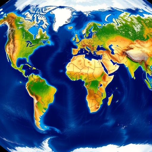
At the heart of this innovative work lies the use of earth-observation satellite imagery, which provides a rich repository of visual data on physical and anthropogenic features worldwide. High-resolution images capturing built-up infrastructure, vegetation, nighttime lights, and land use patterns form the raw material for analysis. These visual indicators act as proxies for various socio-economic parameters; for instance, bright nighttime illumination often correlates with electrification and economic activity, while road networks reflect accessibility and urban development.
To translate complex satellite data into meaningful human development metrics, the researchers employed sophisticated machine learning algorithms. By training models on known HDI values from countries where robust ground-truth data exists, the algorithms learned to associate specific visual features with development outcomes. These predictive models were then applied globally, generating spatially continuous estimates of the HDI at a much finer geographic scale – reaching granularities akin to neighborhood-level assessments in many regions.
The application of machine learning in this context is particularly notable for its capacity to handle the heterogeneity and high dimensionality of satellite data. Traditional statistical approaches falter when confronted with such vast and complex datasets. In contrast, the adaptive nature of machine learning models enables them to capture nonlinear relationships and interactions among multiple variables, enhancing predictive accuracy and robustness. This capability allowed the authors to overcome longstanding data scarcity and quality issues prevalent in many parts of the world.
One of the striking revelations enabled by this high-resolution HDI mapping is the discovery of stark intra-national disparities that remain invisible in national averages. For example, countries previously classified as having medium or high development can harbor regions of severe deprivation, hidden behind aggregate statistics. Conversely, pockets of advanced development can coexist within countries labeled as low HDI, highlighting the mosaic of development realities and underscoring the importance of tailored policy interventions.
Beyond merely reconstructing existing knowledge at greater detail, these new maps provide dynamic tools for tracking progress towards the UN Sustainable Development Goals (SDGs). Policymakers and international agencies can employ them to identify priority areas, optimize resource distribution, and monitor the impact of development programs in near real-time. The spatial precision afforded by satellite and machine learning fusion is especially valuable given ongoing global challenges such as urbanization, climate change, and socio-economic shocks.
Moreover, this study demonstrates the transformative potential of integrating geospatial technology with social science metrics in an era defined by data proliferation. It sets a benchmark for future research aiming to translate remote sensing data into actionable intelligence addressing human welfare and equity. The open-access nature of the data and methods further democratizes development monitoring, fostering transparency and collaboration across academic, governmental, and civil society domains.
While the current work focuses on the HDI, the underlying framework is adaptable to other composite indices and development indicators. Possibilities include poverty indices, health vulnerability assessments, and educational attainment measures, all of which could benefit from the enhanced resolution and timeliness offered by satellite data. This adaptability suggests a broader paradigm shift in how large-scale human development phenomena are measured, moving away from static and aggregate datasets to dynamic, high-resolution, and data-driven insights.
The researchers confronted several technical challenges, including harmonizing satellite data from different sensors, accounting for seasonal and regional variations, and mitigating biases introduced by cloud cover or urban anomalies. Their approach involved rigorous preprocessing pipelines, ensemble learning techniques, and cross-validation protocols to assure the reliability and validity of their estimates. Such meticulous engineering highlights the interplay between computational ingenuity and domain expertise required to achieve meaningful outcomes.
Importantly, this study also acknowledges ethical considerations related to data privacy and the responsible use of geospatial information. While aggregated satellite data avoids direct individual identification, ensuring that the resulting development maps are used to support vulnerable populations without stigmatization or discrimination remains paramount. The authors advocate for inclusive governance frameworks that empower local communities to interpret and act upon the insights derived from such technologies.
The implications extend beyond academic curiosity; real-world applications are imminent. Humanitarian organizations can harness these maps to deploy emergency aid more effectively after natural disasters or armed conflicts by identifying the most impacted and underserved segments of the population. Similarly, urban planners can augment community development strategies by recognizing pockets of infrastructural deficiency or educational need. The fusion of satellite and machine learning thus becomes a catalyst for equitable and efficient development interventions.
Looking forward, continued advancements in satellite technology, including higher temporal frequency and spectral diversity, promise to enhance the granularity and timeliness of human development assessments further. When combined with artificial intelligence breakthroughs such as federated learning and explainable AI models, the interpretability and accessibility of these estimates will improve, fostering trust among stakeholders. This synergy aligns well with global ambitions for data-driven policymaking in the digital age.
In summation, the pioneering research published by Sherman, Proctor, Druckenmiller, and colleagues marks a paradigm shift in the quantification of human development worldwide. By marrying high-resolution satellite imagery with cutting-edge machine learning, they have rendered an essential socio-economic metric visible at the local scale for the first time. This technological breakthrough not only exposes hidden disparities but also equips humanity with actionable knowledge to advance global development equity, marking a transformative stride towards more inclusive and informed governance.
The open-source release of their datasets and methodologies invites the global scientific community to build upon and refine this work, ensuring an evolving and collaborative effort to map the nuances of human development. As such, this initiative sets a visionary blueprint for integrating Earth observation and machine intelligence into sustainable development analytics, a timely achievement in a world increasingly defined by data and digital tools in the service of humanity.
Subject of Research: High-resolution spatial estimation of the United Nations Human Development Index using satellite imagery combined with machine learning.
Article Title: Global high-resolution estimates of the UN Human Development Index using satellite imagery and machine learning.
Article References:
Sherman, L., Proctor, J., Druckenmiller, H. et al. Global high-resolution estimates of the UN Human Development Index using satellite imagery and machine learning. Nat Commun 17, 1315 (2026). https://doi.org/10.1038/s41467-026-68805-6
Image Credits: AI Generated
DOI: https://doi.org/10.1038/s41467-026-68805-6
Tags: advanced spatial analytics for policy makingAI-driven sustainable development monitoringdetailed socio-economic inequality visualizationearth observation for social sciencegranular spatial HDI estimateshigh-resolution human development index mappinglocal scale human development measurementmachine learning in socio-economic analysismapping urban and rural development disparitiessatellite AI for humanitarian interventionssatellite imagery for human developmentUN Human Development Index innovation


