Credit: Credits: NASA MODIS Rapid Response/NOAA
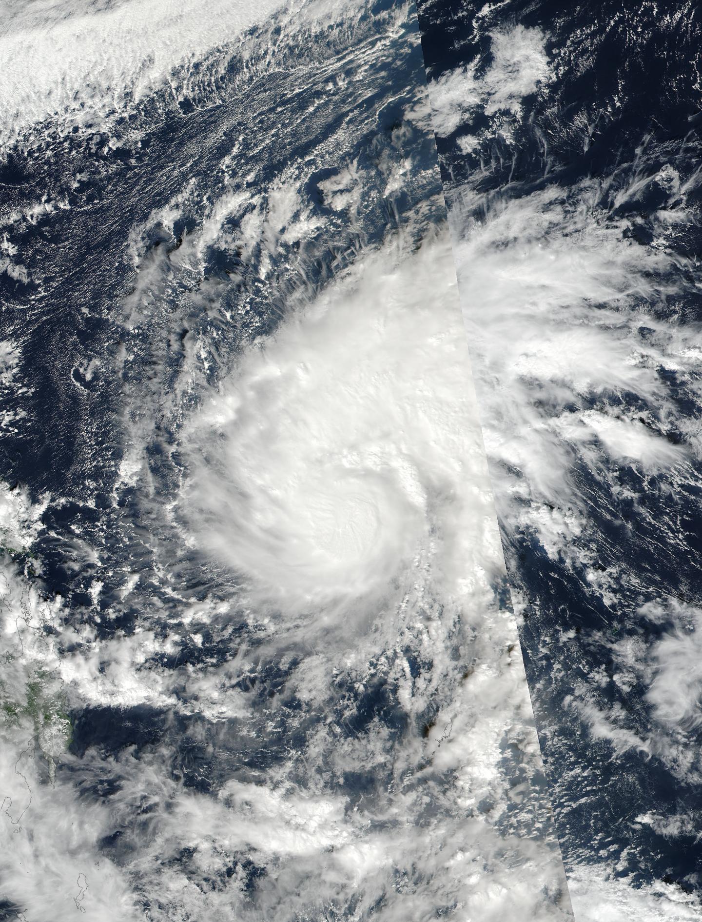
NASA-NOAA's Suomi NPP satellite captured a visible image of Tropical Storm Nock-ten as it continued to move west toward the Philippines where it is locally called "Nina."
On Dec. 23 at 12:13 a.m. EST (5:13 UTC) the Visible Infrared Imaging Radiometer Suite (VIIRS) instrument aboard NASA-NOAA's Suomi NPP satellite provided a visible-light image of the Tropical Storm Nock-ten moving through the Northwestern Pacific Ocean. The VIIRS image showed strong thunderstorms around the center of circulation and a large thick band of thunderstorms to the north of the center.
On Dec. 23, the Philippine Atmospheric, Geophysical and Astronomical Services Administration or PAGASA issued the following bulletin about Nock-ten (Nina): "Estimated rainfall amount is from moderate to heavy rains within its 400 km diameter of the severe tropical storm. "Nina" is expected to intensify further before making landfall.
It is expected to make landfall over Catanduanes by Sunday (Dec. 25) afternoon or evening (local time). Sea travel is risky over the Seaboards of Northern Luzon.
For updated warnings, visit the PAGASA website: http://www.pagasa.dost.gov.ph/.
At 4 a.m. EST (0900 UTC) Tropical Storm Nock-ten's maximum sustained winds had increased to 69 mph (60 knots /111 kph). Nock-ten is expected to continue intensifying and reach typhoon strength by Dec. 24. It was centered near 12.2 degrees north latitude and 132.2 degrees east longitude, about 669 miles east of Manila, Philippines. Nock-ten is moving to the west-northwest at 14 mph (12 knots/22 kph).
Nock-ten is forecast to intensify to 105 knots on approach to the Philippines. After passing through the central and northern Philippines during Christmas weekend, the storm will weaken over the South China Sea.
###
Media Contact
Rob Gutro
[email protected]
@NASAGoddard
http://www.nasa.gov/goddard
############
Story Source: Materials provided by Scienmag


