Credit: Credits: NASA MODIS Rapid Response/NOAA
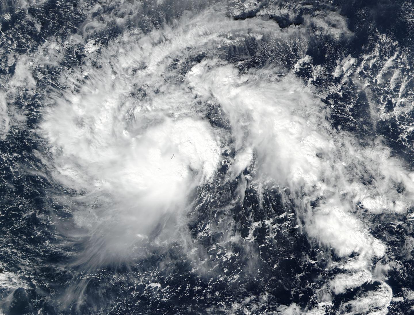
NASA's Aqua satellite flew over the Northwestern Pacific Ocean and captured a visible image of Tropical Storm Nock-ten after it strengthened from a tropical depression.
On Dec. 22 at 0348 UTC (Dec. 21 at 10:48 p.m. EST) the Visible Infrared Imaging Radiometer Suite (VIIRS) instrument aboard NASA-NOAA's Suomi NPP satellite provided a visible-light image of the storm. The image showed bands of thunderstorms wrapped around the low-level center of circulation and a fragmented band of thunderstorms east of the center.
The Joint Typhoon Warning Center (JTWC) issued a warning on Nock-ten on Dec. 22 at 10 a.m. EST (1500 UTC). At that time, Nock-ten's maximum sustained winds were near 52 mph (45 knots/83 kph). The storm was centered near 10.4 degrees north latitude and 135.9 degrees east longitude, about 96 nautical miles west-northwest of Yap. Tropical Storm Nock-ten is moving to the west-northwest at 17.2 mph (15 knots/27.7 kph).
JTWC's forecast track carries Tropical Storm Nock-ten in a west-northwesterly path and it is expected to intensify to typhoon strength on Dec. 24. The storm is then forecast to track through the north and central Philippines Dec. 25 and 26.
###
Media Contact
Rob Gutro
[email protected]
@NASAGoddard
http://www.nasa.gov/goddard
############
Story Source: Materials provided by Scienmag


