Credit: Credits: NASA Goddard MODIS Rapid Response Team
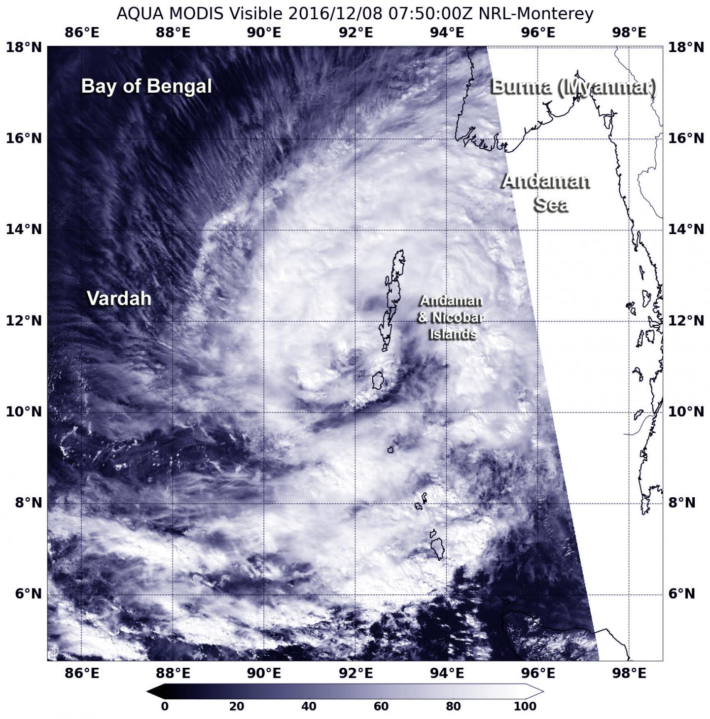
As NASA's Aqua satellite passed over the Bay of Bengal, Tropical Cyclone 05B was renamed Vardah and continued moving away from the Andaman and Nicobar Islands.
On Dec. 8 at 2:50 a.m. EST (0750 UTC) the Moderate Imaging Spectroradiometer (MODIS) instrument aboard NASA's Terra satellite captured a visible image of Tropical Storm Vardah. The MODIS image clearly showed that the center of the storm was just southwest of the Andaman and Nicobar Islands. Thick bands of thunderstorms in the north and east of center continued to blanket the islands and bring rainfall and gusty winds.
The Andaman Islands are an archipelago that consists of 550 islands, according to Andaman and Nicobar Tourism. There are 22 Nicobar Islands. All of the islands are known for white-sand beaches, mangroves and tropical rainforests.
At 10 a.m. EST (1500 UTC) on Dec. 8, Tropical Storm Vardah's maximum sustained winds were near 52 mph (45 knots/83 kph). It was centered near 11.7 degrees north latitude and 91.6 degrees east longitude, about 642 nautical miles south of Chittagong, Bangladesh. Vardah was moving to the northwest at 4.6 mph (4 knots/7.4 kph).
The Joint Typhoon Warning Center (JTWC) noted "Animated enhanced infrared satellite imagery shows a recent resurgence in central convection (developing thunderstorms) building over the consolidated low level circulation center. A microwave image continues to show fragmented [thunderstorm] banding wrapping around the northern periphery with dry air located to the south."
Vardah is forecast to move west-northwest and head across the Bay of Bengal toward eastern India. The storm is expected to intensify to hurricane-force before landfall in India.
###
Media Contact
Rob Gutro
[email protected]
@NASAGoddard
http://www.nasa.gov/goddard
############
Story Source: Materials provided by Scienmag


