• HOME
  • NEWS
  • EXPLORE
    • CAREER
      • Companies
      • Jobs
    • EVENTS
    • iGEM
      • News
      • Team
    • PHOTOS
    • VIDEO
    • WIKI
  • BLOG
  • COMMUNITY
    • FACEBOOK
    • INSTAGRAM
    • TWITTER
Thursday, October 2, 2025
BIOENGINEER.ORG
No Result
View All Result
  • Login
  • HOME
  • NEWS
  • EXPLORE
    • CAREER
      • Companies
      • Jobs
        • Lecturer
        • PhD Studentship
        • Postdoc
        • Research Assistant
    • EVENTS
    • iGEM
      • News
      • Team
    • PHOTOS
    • VIDEO
    • WIKI
  • BLOG
  • COMMUNITY
    • FACEBOOK
    • INSTAGRAM
    • TWITTER
No Result
View All Result
Bioengineer.org
No Result
View All Result
Home NEWS Science News

NASA and NOAA satellites watch Arlene, first Atlantic Tropical Storm of the season

Bioengineer by Bioengineer
April 21, 2017
in Science News
Reading Time: 2 mins read
0
Share on FacebookShare on TwitterShare on LinkedinShare on RedditShare on Telegram
IMAGE

Credit: Credits: NASA/NOAA GOES Project

The first tropical storm of the Atlantic Ocean hurricane season formed 40 days before the official kick off of the season. Tropical Storm Arlene formed in the North Central Atlantic Ocean and NOAA's GOES-East satellite provided forecasters with a look at the storm, swirling far from land areas.

Arlene formed on April 20 as Tropical Depression 1 and strengthened into a tropical storm at 5 p.m. EST that day. On April 20 at 15:12 UTC (11:12 a.m. EDT) NASA-NOAA's Suomi NPP satellite captured a visible image of Tropical Depression One as it was strengthening into a tropical storm. The image showed a large area of thunderstorms over the southwestern and northeastern quadrants of the storm.

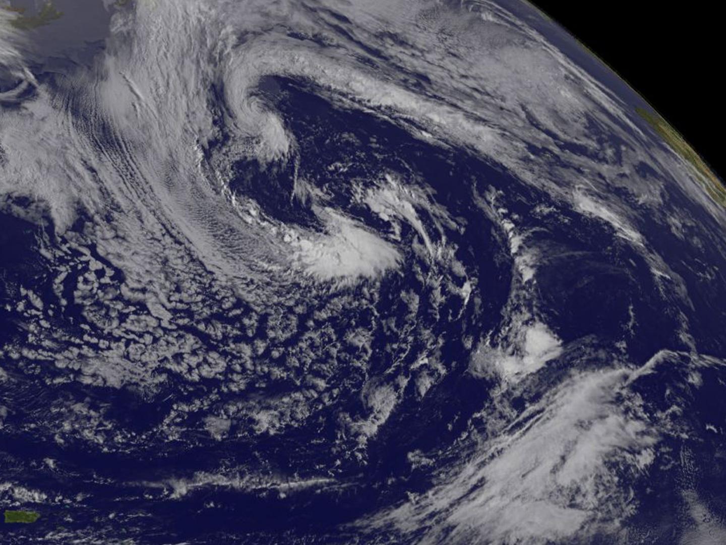
NOAA's GOES-East satellite captured a visible image of Tropical Storm Arlene on April 21 at 1145 UTC (7:45 a.m. EDT). Thunderstorms wrapped tightly around the center of circulation and a large band of storms circled west of center. Located to the west of Arlene were clouds associated with another frontal system.

The National Hurricane Center (NHC) said at 5 a.m. EST (0900 UTC), the center of Tropical Storm Arlene was located near 40.0 degrees north latitude and 48.0 degrees west longitude. That's about 1,135 miles (1,825 km) west-northwest of the Azores.

Arlene was moving toward the west near 31 mph (50 kph) and this general motion is expected to continue today. Maximum sustained winds were near 50 mph (85 kph) with higher gusts. The estimated minimum central pressure was 993 millibars (29.33 inches). Arlene was beginning to lose its tropical characteristics as the cyclone interacts with a frontal zone and also moves over cooler water. The new official intensity forecast continues the trend of the previous advisory, which shows Arlene degenerating to a post-tropical cyclone by 12 hours, and dissipating by 24 hours when the system is expected to be absorbed into the larger baroclinic low.

The National Hurricane Center noted "Tropical storms in April are rare and Arlene is only the second one observed in this month during the satellite era. It should be noted, however, that this type of storm was practically impossible to detect prior to the weather satellite era."

Little change in strength is expected, and Arlene is forecast to become absorbed by a large extra-tropical low pressure area and dissipate later today, April 21.

For updates on Arlene, visit NHC's website: http://www.nhc.noaa.gov

Rob Gutro NASA's Goddard Space Flight Center

###

Media Contact

Rob Gutro
[email protected]
@NASAGoddard

http://www.nasa.gov/goddard

############

Story Source: Materials provided by Scienmag

Share12Tweet8Share2ShareShareShare2

Related Posts

Tobacco Cessation: Ethnicity, Gender, and Acculturation Insights

October 2, 2025
blank

Brain Sparing and Blood-Brain Barrier: Bridging Gaps

October 2, 2025

Enhancing Drought-Tolerant PGPR for Rice Yield

October 2, 2025

Enhanced Deep Learning Model Estimates Battery SOC Accurately

October 2, 2025
Please login to join discussion

POPULAR NEWS

  • New Study Reveals the Science Behind Exercise and Weight Loss

    New Study Reveals the Science Behind Exercise and Weight Loss

    90 shares
    Share 36 Tweet 23
  • Physicists Develop Visible Time Crystal for the First Time

    74 shares
    Share 30 Tweet 19
  • New Study Indicates Children’s Risk of Long COVID Could Double Following a Second Infection – The Lancet Infectious Diseases

    72 shares
    Share 29 Tweet 18
  • How Donor Human Milk Storage Impacts Gut Health in Preemies

    64 shares
    Share 26 Tweet 16

About

We bring you the latest biotechnology news from best research centers and universities around the world. Check our website.

Follow us

Recent News

Tobacco Cessation: Ethnicity, Gender, and Acculturation Insights

Brain Sparing and Blood-Brain Barrier: Bridging Gaps

Enhancing Drought-Tolerant PGPR for Rice Yield

Subscribe to Blog via Email

Enter your email address to subscribe to this blog and receive notifications of new posts by email.

Join 60 other subscribers
  • Contact Us

Bioengineer.org © Copyright 2023 All Rights Reserved.

Welcome Back!

Login to your account below

Forgotten Password?

Retrieve your password

Please enter your username or email address to reset your password.

Log In
No Result
View All Result
  • Homepages
    • Home Page 1
    • Home Page 2
  • News
  • National
  • Business
  • Health
  • Lifestyle
  • Science

Bioengineer.org © Copyright 2023 All Rights Reserved.