In a groundbreaking advancement in hydrological science, researchers have unveiled a refined atmospheric river scale that incorporates soil saturation levels to dramatically enhance early flood hazard warnings. Atmospheric rivers (ARs), those vast, river-like corridors of moisture in the atmosphere, are renowned for transporting extreme volumes of water vapor from tropical regions to mid-latitude areas such as the Western United States and central Chile. While these meteorological phenomena are vital as seasonal water sources, their unpredictability in flood generation has posed significant challenges to accurate hazard forecasting.
Traditional models for ranking atmospheric river storms have primarily hinged on metrics such as storm size and duration, variables which, albeit important, fail to capture the nuanced interplay between atmospheric conditions and terrestrial landscape readiness. This has historically limited the precision with which forecasters could anticipate which AR events would escalate into devastating floods. Recognizing this critical gap, the new research, spearheaded by Mariana Webb and colleagues at the Desert Research Institute (DRI), advances an innovative approach that synergizes atmospheric data with land surface conditions, primarily via soil moisture proxies.
The team analyzed a vast dataset encompassing over 71,000 documented atmospheric river events across the Western U.S. and central Chile, regions notorious for their susceptibility to AR-driven hydrologic extremes. By incorporating antecedent moisture conditions—essentially how saturated the soil is before the onset of an AR storm—the researchers developed a modified AR scale that more accurately correlates storm rank with ensuing flood outcomes. This method effectively doubled the predictive correlation compared to existing scales, signaling a transformative improvement in flood hazard identification.
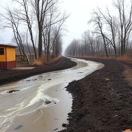
Underlying this refined scale is a simple yet robust proxy for soil saturation: the cumulative precipitation recorded over the preceding 90 days. This proxy stands out for its operational feasibility. Because precipitation data are widely accessible, even locations without direct soil moisture monitoring can implement this adjusted scale framework with minimal infrastructure upgrades. A wetter antecedent soil condition elevates the AR scale rank, reflecting greater flood hazard potential because saturated soils have reduced capacity to absorb additional moisture, increasing runoff and flood risk. Conversely, drier antecedent conditions moderate the scale, indicating a reduced likelihood of flooding.
Dr. Webb emphasizes that integrating land surface processes is indispensable for holistic hydrological forecasting. She articulates that the soil acts like a sponge: when unsaturated, it can absorb incoming moisture, but once saturated, it contributes to heightened streamflow and flood events. Incorporating this dynamic into the scale effectively bridges the gap between atmospheric drivers and terrestrial responses, enabling meteorologists and water managers alike to anticipate flooding hazards with unprecedented accuracy.
This enhanced forecasting capability carries profound practical implications. With flood damage on the U.S. West Coast alone estimated at roughly $1.1 billion annually, refining early warnings can substantially reduce economic losses and save lives. Furthermore, water resource managers can leverage improved forecasts to optimize reservoir operations, balancing the capture of critical water supplies while mitigating flood risks during storm events. In regions like California and Chile, where water scarcity alternates with deluge, such improvements in hydrologic prediction are crucial for sustainable water management.
The collaborative study also highlights important international scientific cooperation. Some of Webb’s closest collaborators are based in Chile, a country that experiences AR storms comparable in intensity and seasonal importance to those in California. Together, these scientists refined their model to be effective across both hemispheres, demonstrating the universality of soil moisture’s influence on AR flood hazards. Co-author Deniz Bozkurt underscores how the complex relationship between atmospheric rivers and antecedent moisture must be understood in both locations to safeguard communities dependent on these seasonal water influxes.
Beyond forecast improvements, the study’s approach is elegantly simple, facilitating broader integration into operational early warning systems. Dr. Christine Albano, a hydrologist and co-author, praises the framework’s ability to combine atmospheric and land-surface indicators in a manner that is both intuitive and powerful. It allows emergency managers, reservoir operators, and local governments to make more confident and timely decisions, ultimately enhancing public safety and infrastructure resilience.
Looking forward, Webb is now positioned at the Center for Western Weather and Water Extremes (CW3E) at the University of California, San Diego, where efforts are underway to operationalize this modified atmospheric river scale. The goal is to embed the scale within real-time prediction systems, providing actionable, localized flood hazard information at lead times critical for emergency preparedness. This work represents a vital step toward adaptive climate resilience in the face of increasingly frequent and intense weather extremes driven by climate change.
Experts such as Anna Wilson, Assistant Director for Atmospheric River Reconnaissance at CW3E, note that integrating soil moisture contextual data enriches the interpretation of incoming AR events. This multidimensional perspective empowers hazard outlooks that are not only more accurate but also more directly relevant to specific watersheds’ hydrologic responses. Such tailored information is especially important given the spatial variability of soil saturation and regional differences in terrain and land use.
Beyond atmospheric rivers alone, the principles demonstrated by this research offer a compelling framework for enhancing hazard classification in a range of hydrologic contexts. Understanding how pre-existing land surface conditions influence outcomes can improve forecasts of snowmelt-driven floods, post-wildfire erosion events, and flooding exacerbated by reservoir storage levels. This broader applicability ensures that the study’s conceptual leap will resonate widely in hydrometeorological risk management.
Ultimately, this study signifies a leap forward in the science of flood prediction, marrying meteorological dynamics with terrestrial hydrology in a simple yet sophisticated manner. By systematically including soil saturation in atmospheric river assessment, the research sets a new standard for early warning systems that save resources, reduce disaster impacts, and safeguard the lives and livelihoods of millions living in vulnerable flood-prone regions.
Subject of Research: Atmospheric river flood hazard forecasting enhanced by soil saturation levels
Article Title: Antecedent moisture enhances early warning of atmospheric river flood hazards
News Publication Date: February 12, 2026
Web References: https://www.nature.com/articles/s41467-026-69286-3
References: Webb et al., 2026, Nature Communications
Image Credits: Webb et al., 2026
Keywords: Flood control, Risk management, Atmospheric rivers, Soil moisture, Hydrology, Flood forecasting, Water resource management, Climate resilience
Tags: atmospheric river event analysisatmospheric river flood predictionatmospheric river storm rankingcentral Chile flood hazardsearly flood hazard warningshydrological modeling of floodsimproved atmospheric river scaleintegrating soil moisture datasoil moisture and flood risksoil saturation in flood forecastingterrestrial landscape impact on floodsWestern US flood prediction


