New method enhances predictions, even in areas where no data has been available
Credit: University of Delaware/ Kathy F. Atkinson
Soil moisture is easy to see when your favorite Little Leaguer slides into second base the day after a big summer storm. The mud splattered on that little hustler’s uniform tells the story.
Trying to gauge soil moisture across large areas — regions, nations, continents — is a whole ‘nother challenge, and a critical one. Knowledge of this dimension of our ecosystem is extremely important for farmers, planners, scientists, insurance companies and anyone concerned about preparing for global environmental change.
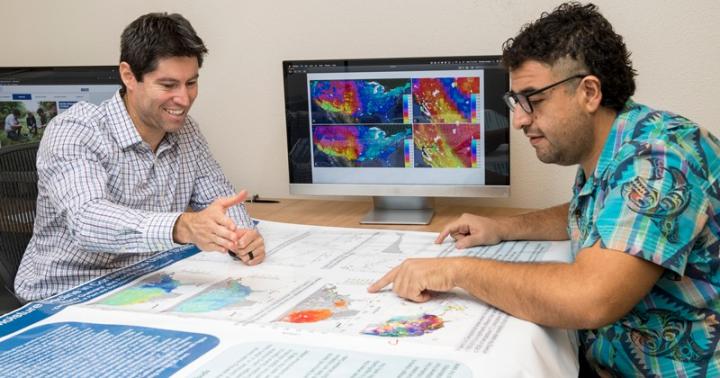
“Understanding these patterns is critical to national and international security,” said Rodrigo Vargas, associate professor of ecosystem ecology and environmental change in the Department of Plant and Soil Sciences at the University of Delaware. “We cannot measure everything everywhere all the time…. So we are using alternative approaches, such as machine learning that helps us get insight from complex sets of data.”
Now Vargas and doctoral student Mario Guevara have developed a new approach that sharpens our ability to predict soil moisture, even in large areas where no data have been available. Compared to standard estimates produced by satellite-based sensors, the new approach increases the accuracy of these estimates by more than 20 percent. It also makes it possible to predict soil moisture conditions in much smaller areas and in greater detail than standard models have been able to show. They described their work in a recent issue of PLOS ONE, a peer-reviewed journal published by the Public Library of Science.
The best data on soil moisture now is collected using satellite-based sensors that deliver predictions in grids of about 27 kilometers per pixel. That’s a space almost 17 miles square, about the distance from Main Street in Newark, Delaware, to historic New Castle on the Delaware River.
That’s helpful for analyzing regional or global patterns, but such a large scale can provide only limited information on local conditions.
The method Guevara and Vargas have developed provides much higher definition, improving resolution from 27 kilometers to 1 kilometer per pixel — or from about 17 miles to just over half a mile. That’s roughly the distance from UD’s Trabant Student Center on one end of East Main Street to the Newark Shopping Center on the other. Much tighter and much more useful for statewide applications.
The new approach combines data science and machine learning with the emerging science of geomorphometry — quantitative analysis of land surface using topographic information, image analysis and spatial statistics.
Because soil moisture varies by location and changes over time, reliable measurement and predictive methods are essential. Topography — defining the physical parameters of the Earth’s surface — is a critical factor for soil moisture estimates. Elevation, slope and other land-surface characteristics are strong predictors of how water — from rain, irrigation and other sources — will move, drain and affect an area.
“We need to understand water dynamics,” Guevara said. “We understand a lot of components of the water cycle, but there is a lot we don’t know. We want to protect water resources and know how they are distributed, their geography. Soil moisture is an important indicator of water resources.”
Using satellite-based sensors, soil moisture can be measured to a depth of about 5 centimeters (just under 2 inches).
“Satellites cannot easily see soil moisture at deeper soil layers,” Guevara said.
But that thin layer of soil holds crucial information.
“Superficial soil moisture is a key indicator of soil dryness. It influences soil productivity and ultimately soil health,” Guevara said, “as the water in the first few centimeters of soil is some of the water used by crops or by the soil biodiversity (cycling nutrients) controlling the capacity of soil to produce food, fiber and store water.”
In developing the new predictive model, Guevara used satellite data on soil moisture gathered for more than a decade (1991-2016) across the continental United States by the European Space Agency’s Climate Change Initiative.
He and Vargas worked in collaboration with UD Information Technologies, used the muscle of UD’s Farber high-performance computing cluster and drew upon the resources of the new Data Science Institute.
Guevara developed prediction factors using automated digital terrain analysis and defined 15 types of terrain parameters (such as slope and aspect, among others). He analyzed spatial structure and distribution of these parameters in relation to soil moisture and used an algorithm to select the best models.
The resulting predictions were validated by comparison to “ground truth,” field data on soil moisture from the North American Soil Moisture Dataset. This dataset, developed by UD alum Steven Quiring, who was a doctoral student of UD Professor and State Climatologist Dan Leathers, draws strictly curated data from more than 2,000 meteorological stations across the continental United States.
The next chapter of the research is extending the work to the global scale, Vargas said. More discussion on that is available in the journal Earth System Science Data.
###
The work is supported by a grant from the National Science Foundation and was done in collaboration with Michela Taufer, former professor of computer and information science at UD who now is at the University of Tennessee in Knoxville.
Media Contact
Peter Bothum
[email protected]
302-766-5103
Related Journal Article
http://dx.


