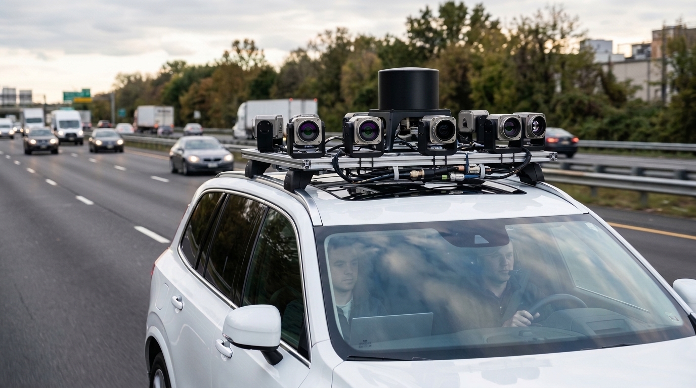
Autonomous driving perception systems depend fundamentally on extensive multimodal scene data for rigorous training and validation, yet gathering adequate coverage of critical real-world corner cases remains an enduring challenge for physical vehicle fleets. Rare events such as sudden vehicle cut-in maneuvers, occluded pedestrians, distant small obstacles, and sensor-degrading weather conditions appear infrequently in natural driving logs. Generative world models capable of synthesizing future sensor streams have consequently emerged as a vital complementary data source. Most prevailing generative frameworks, however, focus primarily on unimodal video synthesis or introduce cross-modal geometric alignment solely as implicit training objectives. Because these approaches lack explicit correction mechanisms during inference sampling, test-time discrepancies between camera perspective geometry and three-dimensional LiDAR point distributions frequently emerge. In a study published in Discover Computing, researcher Yuehan Kou introduced a Video–LiDAR joint generation framework designed to synthesize temporally extended driving scenes while enforcing explicit geometric correspondence and state stability across multi-step prediction rollouts.
The central technical challenge addressed by the research centers on the complementary yet distinct properties of visual cameras and laser scanners. Multi-view video captures fine contextual appearance, environmental texture, and dense visual semantics, whereas LiDAR supplies sparse but metric-accurate spatial coordinates and depth boundaries. In conventional generative architectures that connect camera and LiDAR representations through shared latent spaces or intermediate representations like Bird’s-Eye-View (BEV) and 3D occupancy grids, geometric constraints act only as training-loss supervision. When models execute multi-step temporal rollouts during testing, small intermediate prediction errors accumulate, causing visible object boundaries in generated camera frames to decouple from the corresponding LiDAR point clouds. Furthermore, approaches that attempt to pair unimodal video generation with geometric back-projection struggle to realistically synthesize LiDAR reflectance intensity and occlusion-induced ray visibility patterns. The investigated framework directly confronts these structural shortcomings by integrating explicit geometric corrections into sampling, introducing a recoverability-based state formulation, and implementing targeted counterfactual intervention mechanisms.
To enforce spatial alignment without requiring separate neural sampling networks, the methodology incorporates geometry-projected denoising directly into the diffusion inference schedule. Operating under an epsilon-prediction parameterization across a 50-step Denoising Diffusion Implicit Models (DDIM) schedule, the model computes clean estimates of video frames and point clouds at each diffusion step. Differentiable residuals derived from calibrated camera-LiDAR transformations, depth-range consistency between camera depth predictions and laser returns, and line-of-sight visibility are formulated as an explicit geometric energy function. Differentiating this energy with respect to video and LiDAR latent vectors produces bounded gradient updates that adjust the sampling trajectory at every retained denoising step. To maintain mathematical and numerical stability during inference, the guidance coefficient decreases linearly from 0.08 to 0.01 across the sampling sequence, while the gradient L2 norm is clipped at 1.0. Crucially, discrete foreground and visibility decisions from z-buffer masks are detached during backpropagation, ensuring continuous gradient flow through spatial coordinates while avoiding sampling instability.
Alongside spatial alignment, sustaining structural and identity continuity over multi-second simulation horizons requires controlling progressive state drift. The framework introduces a recoverable world-state constraint that operates entirely independently of raw pixel values and point-cloud arrays. An internal world state encapsulates BEV spatial occupancy, dynamic three-dimensional occupancy grids, ego-centric motion fields, instance tracking identities, and visibility masks. An autoregressive state-transition network predicts future state evolution conditioned solely on historical representations and exogenous ego-vehicle motion commands, without access to generated future sensor observations. Concurrently, a dedicated neural re-encoder maps the synchronously generated video frames and LiDAR point clouds back into the world-state latent space. A multi-component recoverability objective—incorporating binary cross-entropy for occupancy and visibility, an L1 motion distance, and a soft Hungarian matching loss for cross-frame object identities—forces generated observations to remain strictly consistent with the forward-predicted world states over rollout durations reaching up to 10 seconds.
To generate focused scenarios targeting known autonomous perception weaknesses rather than producing arbitrary visual variety, the framework incorporates a failure-feedback-driven counterfactual intervention mechanism. Instead of manipulating individual pixels or points, this module executes minimal, dynamically constrained state-space modifications tailored to four predefined long-tail conditions: object occlusion, distant small obstacles, aggressive cut-in trajectories, and localized LiDAR point sparsity. Guided by failure feedback signals extracted from a frozen, multi-task BEVFusion perception model—combining detection confidence, cross-frame tracking identity-switch frequency, and BEV segmentation boundary errors—an intervention network perturbs the world state while enforcing strict physical feasibility boundaries. These boundaries penalize trajectory jitter, maintain minimum inter-object clearance margins of 0.5 meters, cap motor-vehicle velocities at 35 meters per second, restrict linear acceleration to 4.0 meters per second squared, and cap jerk at 5.0 meters per second cubed, ensuring that synthetic corner cases remain realistic and geometrically valid.
The training protocol separates objectives through a structured two-stage optimization strategy on a cluster of four RTX A6000 GPUs running PyTorch and CUDA. In Stage I, which spans 35 epochs using the AdamW optimizer with a weight decay of 0.01 and batch size of 8, the modality-specific Variational Autoencoders, the 12-block shared temporal Transformer backbone, the four-layer MLP state-transition network, and the re-encoder are trained jointly under standard latent diffusion, geometric-consistency, and recoverability losses. In Stage II, all Stage I parameters, sensory encoders, and the diagnostic perception feedback model are frozen. For the remaining 15 epochs, optimization updates exclusively the six-layer MLP counterfactual intervention network via truncated backpropagation through time over the final 8 steps of the DDIM trajectory. Because sampling-stage gradient corrections operate solely as inference-time score modifications, they introduce no additional training parameters or separate generative heads.
Quantitative evaluations were conducted across five fixed random seeds using the Waymo Open Dataset Perception benchmark as the primary reference for geometric fidelity and temporal consistency, alongside the nuScenes benchmark for heterogeneous multi-sensor evaluations. On the Waymo validation benchmark, the full proposed model reduced Camera–LiDAR projection error by 16.6 percent compared to an adapted MagicDrive-V2 baseline, dropping from 0.247 to 0.206. Longitudinal rollout drift at the standard 6-second horizon fell by 15.5 percent, decreasing from 0.168 meters to 0.142 meters, while tracking identity retention measured by IDF1 improved by 1.6 points from 75.8 to 77.4. Both the projection error reduction and the rollout drift improvements remained statistically significant following Holm-Bonferroni correction, with an adjusted p-value of 0.030 for projection error. A matched shared-backbone control that eliminated all three core modules demonstrated consistent degradation, yielding an average projection error of 0.251, a drift of 0.205 meters, and an IDF1 of 73.5.
Analysis of performance across extended simulation rollouts verified that the architecture mitigates cumulative compounding errors as prediction horizons stretch from 2 seconds to 10 seconds. On the Waymo benchmark, projection error for the proposed model increased from 0.154 at 2 seconds to 0.291 at 10 seconds, while rollout drift rose from 0.071 meters to 0.238 meters and IDF1 decreased from 82.3 to 70.6. By contrast, the MagicDrive-V2 adapted baseline experienced steeper degradation, rising from 0.177 to 0.371 in projection error and from 0.086 to 0.312 meters in drift, with IDF1 dropping to 66.9. Linear fits across the five evaluation horizons yielded projection error growth slopes of approximately 0.017 per second for the proposed model, compared to 0.024 per second for MagicDrive-V2 and 0.027 per second for DriveX. These scaling trajectories demonstrate a flatter error accumulation profile, with the relative stability advantage expanding notably at simulation horizons exceeding 6 seconds.
Ablation experiments isolating each methodological component revealed clear functional specialization rather than uniform distributed effects across all simulation criteria. Eliminating geometry-projected denoising triggered an 18 percent increase in Waymo projection error and a 13 percent increase on nuScenes, confirming its primary role in governing spatial cross-modal correspondence. Conversely, removing the recoverability constraint produced the largest single reduction in Waymo identity tracking continuity, dropping IDF1 by 2.8 points while increasing projection error by only 4 percent. Removing counterfactual intervention exhibited negligible impact on geometric projection or identity continuity, but reduced long-tail mean average precision by 2.7 points on Waymo and 2.0 points on nuScenes. Simultaneously removing both geometric sampling projection and recoverability degraded Waymo projection error by 21 percent and IDF1 by 3.6 points, evidencing the complementary division between sampling-stage spatial correction and state-space temporal preservation.
Stress-testing under synthetic sensor corruption highlighted distinct robustness properties across modalities on the nuScenes dataset. When LiDAR point retention was artificially throttled from 100 percent down to 30 percent, long-tail mean average precision declined across all systems, yet the proposed model exhibited the lowest relative degradation, dropping 14.0 percent from 31.5 to 27.1. Under identical sparsification, MagicDrive-V2 dropped 18.1 percent, DriveX fell 18.6 percent, and vid2vid declined 29.5 percent. Under additive Gaussian noise applied to video inputs, the proposed model sustained lower projection error at moderate noise levels (0.31) compared to MagicDrive-V2 (0.39) and DriveX (0.43). Across generated counterfactual samples, evaluation of physical plausibility recorded collision, speed, acceleration, jerk, and invalid-projection violation rates of 1.7 percent, 2.6 percent, 3.4 percent, 2.1 percent, and 1.5 percent, respectively, showing that constrained state optimization largely maintained operational dynamics.
Downstream perception utility was assessed by augmenting perception training pipelines with synthetic data and testing them on a held-out set of real-world long-tail driving scenes. Compared to a baseline trained strictly on real recordings, adding standard ordinary synthetic data generated by the world model yielded modest gains, raising long-tail mean average precision from 34.1 to 34.6. Incorporating failure-aware counterfactual synthetic samples increased long-tail mean average precision further to 35.5, while producing smaller shifts in overall mAP (0.8 points) and nuScenes Detection Score (0.6 points). Standard perceptual metrics also illustrated that geometric consistency operates independently from local visual texture: while the proposed model achieved superior Fréchet Video Distance and lower LiDAR symmetric Chamfer Distance, MagicDrive-V2 retained a minor advantage in Learned Perceptual Image Patch Similarity, confirming that rigorous cross-modal spatial alignment does not automatically optimize single-frame perceptual texture similarity.
The study notes critical operational boundaries and dataset sensitivities that qualify the scope of these improvements. Performance gains were notably concentrated on the Waymo benchmark, where precise sensor calibration and dense LiDAR point clouds provide a stable geometric baseline; on nuScenes, where sensing configurations are more heterogeneous and radar is excluded from generation, improvements were smaller and several comparisons failed to reach Holm-corrected statistical significance, with IDF1 remaining 0.7 points lower than the baseline. In addition, counterfactual interventions currently encompass only four defined scenario categories rather than the full continuum of driving anomalies, and performance gains narrow when video cameras and LiDAR scanners suffer simultaneous severe degradation. While bounded score guidance substantially reduces drift, it does not provide an absolute mathematical guarantee of posterior preservation or complete physical validity. Nonetheless, the empirical findings confirm that coupling sampling-stage geometric gradient corrections with internal state recoverability substantially advances long-horizon consistency in multimodal autonomous driving simulation.
Subject of Research: Multimodal generative world modeling for autonomous driving simulation
Article Title: Generative Video-LiDAR world models for long-horizon multimodal scene simulation with temporal and geometric consistency
Article References: Kou, Y. (2026). Generative Video-LiDAR world models for long-horizon multimodal scene simulation with temporal and geometric consistency. Discover Computing, 29(1), Article 782. https://doi.org/10.1007/s10791-026-10684-y
Image Credits: AI Generated
DOI: 10.1007/s10791-026-10684-y
Keywords: autonomous driving, world models, video generation, LiDAR simulation, diffusion models, multimodal perception, geometric consistency, temporal consistency, state recoverability, counterfactual intervention, Waymo Open Dataset, nuScenes dataset, depth-range consistency, sensor simulation, robotics, computer vision, synthetic data, trajectory rollout
News Source: Denise Maddox. (November 13, 2026). Generative Video-LiDAR World Model Improves Autonomous Driving Simulation Consistency and Stability. Scienmag.