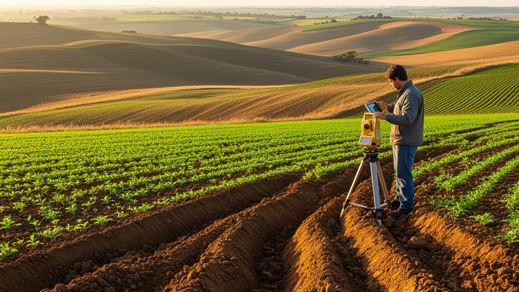
Agricultural researchers have released EroMapper, an open-source QField plugin designed to standardize the digital field mapping of water-induced soil erosion across agricultural landscapes. Water erosion remains one of the primary global threats to agricultural productivity and environmental sustainability, progressively degrading arable land through the transport of fertile topsoil downslope during intense rainfall and overland runoff. This physical displacement reduces soil fertility while depositing sediment into adjacent fields, waterways, and transport infrastructure. Capturing reliable empirical field data immediately following erosion events is essential for describing feature types, spatial distributions, and soil loss rates. However, long-term monitoring has historically been constrained by inconsistent digital workflows and the obsolescence of earlier proprietary mapping software. EroMapper addresses these limitations by establishing a modular, tool-based field recording framework that standardizes data collection, stores spatial observations within structured GeoPackage layers, and facilitates reproducible post-processing for long-term monitoring programmes, predictive erosion modeling, and soil conservation.
Field surveys investigating soil erosion by water have traditionally operated across diverse spatial scales, ranging from controlled experimental plots to broad assessments derived from satellite remote sensing. Although each methodological approach contributes valuable insights, continuous field monitoring across multiple active agricultural parcels remains uniquely vital for understanding long-term erosion dynamics. Repeated multi-year observations enable researchers to track temporal changes under shifting meteorological conditions, diverse crop rotations, and variable management decisions, allowing the identification of recurring erosion patterns while minimizing the statistical uncertainties inherent in short-term studies. Despite the scientific necessity of multi-year assessments, long-term monitoring programmes spanning decades remain exceedingly rare in agricultural research. Documented examples include a ten-year monitoring campaign conducted across arable fields in the Swiss Midlands, as well as an extensive monitoring programme in Lower Saxony, Germany, where seven agricultural areas covering approximately 425 hectares of cropland have been continuously surveyed since 2000, creating an empirical record spanning up to 26 years.
The ongoing monitoring initiative in Lower Saxony, funded by the Lower Saxony Authority of Mining, Energy and Geology, centers on agricultural landscapes in northern Germany exposed to moderate to extremely high erosion risks. These pronounced risks stem from extensive loess and sandy loess deposits containing Luvisols and Cambisols, whose elevated silt content creates topsoils that are particularly erodible. Over time, monitoring encompassed up to 464 hectares across seven observation areas, with approximately 425 hectares across six areas currently under active observation. From its inception, the programme utilized a standardized field recording protocol based on DVWK guidance, which subsequently helped shape the current erosion mapping guidelines published by the German Association for Water, Wastewater and Waste. To replace earlier paper-based mapping, researchers developed EroPad, an application running on the mobile GIS platform Esri ArcPad. Following the discontinuation of official technical support for ArcPad, developers created EroMapper as an open-source QField plugin to maintain continuous, standardized digital erosion surveys.
Field mapping campaigns under this framework adhere to rigorous operational schedules governed by environmental conditions and formal precipitation thresholds. Surveys are routinely conducted each spring following snowmelt, throughout the vegetative growing season, and within one week following erosive storm events, as well as after farmer-reported incidents. Under established German standards, erosive precipitation is defined as total rainfall reaching at least ten millimeters or rainfall intensity exceeding ten millimeters per hour within a thirty-minute window, with updated standards adopting a revised intensity threshold exceeding 12.7 millimeters per hour. To record these events, EroMapper operates as a plugin for QField, an open-source mobile GIS built upon QGIS. Implemented using QML and JavaScript within the Qt Quick framework, EroMapper interacts directly with QField and QGIS application programming interfaces. Distributed under the GNU General Public License version 2.0 or later, the software supports multiple operating systems, including Android, iOS, Linux, macOS, and Windows.
The overall EroMapper architecture follows a structured three-stage workflow encompassing desktop preparation, mobile field mapping, and automated post-processing. During initial desktop preparation within QGIS, users configure a standardized GeoPackage container using a predefined template that establishes empty spatial layers corresponding to distinct erosion features. Users can optionally define custom parcel polygons with unique identifiers to facilitate subsequent spatial linking. Data projects are then transferred to mobile devices using cable connections or cloud synchronization through QFieldCloud. In the field, EroMapper presents a modular interface featuring a dedicated right-hand toolbar and an integrated terminology glossary. Selecting a specific mapping tool displays contextual control panels that guide surveyors through sequential multi-step input dialogs. Recorded attributes and spatial geometries are automatically committed through the QField form drawer into corresponding GeoPackage layers upon form submission, ensuring systematic data acquisition while allowing field personnel to focus on physical field observations rather than complex software navigation.
Within this interface, dedicated tools capture agricultural management and sheet erosion processes. The management tool logs crop type, vegetative growth stage, management practices, and soil cover at point locations positioned using a map crosshair, supporting photo documentation and reference images stored in project resource directories. During post-processing, management attributes are linked to parcel polygons via point-in-polygon operations. For diffuse water erosion, the sheet erosion tool allows users to map affected areas by placing sequential vertices to construct polygon boundaries, accompanied by real-time visual previews. Attribute forms record sheet erosion types, affected wheel tracks, thalweg occurrence, sedimentation, and flow directions. In post-processing, polygon areas are calculated in hectares. Eroded mass is determined by multiplying affected area by an empirical erosion rate, set by default to 0.75 metric tons per hectare for general sheet erosion and wheel tracks, or 1.70 metric tons per hectare for rill-bearing sheet erosion. Dividing eroded mass by an average soil bulk density of 1.45 metric tons per cubic meter yields the corresponding eroded volume.
For incised channel formations, the linear erosion tool enables surveyors to record rills and gullies by capturing consecutive measurement points initiated via GPS or map coordinates. Every point along an incision retains a shared line identifier while documenting local depth, top width, bottom width, sidewall shape, and wheel-track characteristics. Post-processing scripts assemble these measurement points into polyline geometries, calculating segment lengths between adjacent nodes alongside corresponding cross-sectional areas derived from recorded widths and depths. Multiplying average cross-sectional area by segment length yields individual segment volumes, which are summed across the entire feature, adjusted for wheel tracks, and multiplied by soil bulk density to determine total eroded mass. In addition, the post-processing script buffers the mapped polyline by a default distance of eight meters on each side. This sixteen-meter buffer reflects conventional agricultural tillage widths and associated soil redistribution, allowing researchers to quantify affected area and estimate an average erosion depth per unit area.
Field mapping efficiency is further enhanced by specialized tools designed for recurring linear features and complex, interconnected erosion forms. The copy tool enables field surveyors to duplicate the cross-sectional measurements and attributes of an already mapped linear feature, transferring them to a new incision by defining new start and end coordinates via GPS or screen input. Post-processing scripts establish a new polyline geometry whose length is derived from the new endpoints while retaining original depth and width values, recalculating eroded volume, affected area, and erosion depth under the assumption of morphological similarity. Meanwhile, the sheet-to-linear tool captures areas exhibiting extensive, closely spaced linear features interconnected with sheet wash. Surveyors delineate an outer polygon defining the combined affected area and sequentially map nested linear features within it. Post-processing scripts evaluate these inputs jointly, deriving total eroded volume and mass from the linear channel measurements while using the bounding polygon geometry to represent total affected surface area.
Complementary mapping tools record sediment deposition, overland flow, and field observations. The deposition tool distinguishes between small deposits under twenty square meters, recorded solely as points without volumetric calculations, and large deposits of twenty square meters or more, which are digitized as polygons containing five representative depth measurements. Post-processing scripts calculate deposition volume by multiplying polygon area by average measured depth. Hydraulic pathways are documented using the runoff tool to mark discrete exit points where surface runoff leaves arable parcels into roads, neighboring fields, ditches, or streams, while the overland water flow tool logs point features representing concentrated inflows, inlet shafts, or drainage outlets. Neither hydrological tool undergoes mathematical post-processing. Surveyors can also utilize a notes tool to record free-text observations within point or polygon geometries, which is particularly valuable for documenting intra-parcel management differences, while an integrated photo tool triggers mobile device cameras to capture georeferenced photographic records.
The accompanying Python-based post-processing script automates data evaluation, generating standardized GeoPackage output layers suitable for long-term storage and analytical modeling. To prevent redundant entries during iterative processing runs, the script applies rigorous matching criteria based on spatial centroids and observation dates. When user-defined parcel boundaries are present, the script automatically links mapped features to underlying parcel geometries, assigning unique parcel identifiers to maintain parcel-level documentation. Output datasets can be integrated into regional databases and erosion event registries, such as those maintained in Lower Saxony. Because critical calculation parameters, such as soil bulk density and empirical sheet erosion rates, remain fully adjustable within the post-processing script, EroMapper is readily adaptable to diverse geographic environments and local soil conditions beyond northern Germany. By coupling standardized mobile GIS acquisition with automated analytical processing, the open-source plugin establishes a robust framework for monitoring long-term soil loss, identifying primary erosion drivers, and supporting predictive soil erosion modeling across agricultural catchments.
Subject of Research: Open-source mobile GIS plugin for standardized soil erosion field mapping
Article Title: EroMapper – a QField plugin for soil erosion mapping
Article References: Barthel, N., Ott, S., Burkhard, B., & Steinhoff-Knopp, B. (2026). EroMapper – a QField plugin for soil erosion mapping. One Ecosystem, 11, Article e209853. https://doi.org/10.3897/oneeco.11.e209853
Image Credits: AI Generated
DOI: 10.3897/oneeco.11.e209853
Keywords: EroMapper, QField, soil erosion, water erosion, digital field mapping, GeoPackage, linear erosion, sheet erosion, sediment deposition, QGIS, Lower Saxony, erosion monitoring, soil bulk density, overland flow, rills and gullies, agricultural runoff, spatial post-processing
News Source: Violet Maxwell. (November 16, 2026). EroMapper Plugin Enables Standardized Digital Mapping of Agricultural Soil Erosion. Scienmag.