In an editorial published in Landscape Ecology, landscape ecologist Geoffrey M. Henebry addresses persistent conceptual confusion surrounding spatial scale by advocating for a structured four-part reporting framework in ecological investigations. Writing on the recurring debate over how scale is defined and applied across ecological disciplines, Henebry suggests that adopting clear spatial reporting metrics could resolve longstanding ambiguities that arise when researchers conflate the physical scale of observation with the broader concept of landscape.
The essay opens with a reflection on human perception drawn from author Evelyn Waugh’s 1960 travel book A Tourist in Africa. Waugh observed that aeroplanes have added nothing to the human enjoyment of height, noting that the human eye receives its most intense images when the observer remains planted on the ground or on a building, while aerial perspectives tend to belittle the scene below.
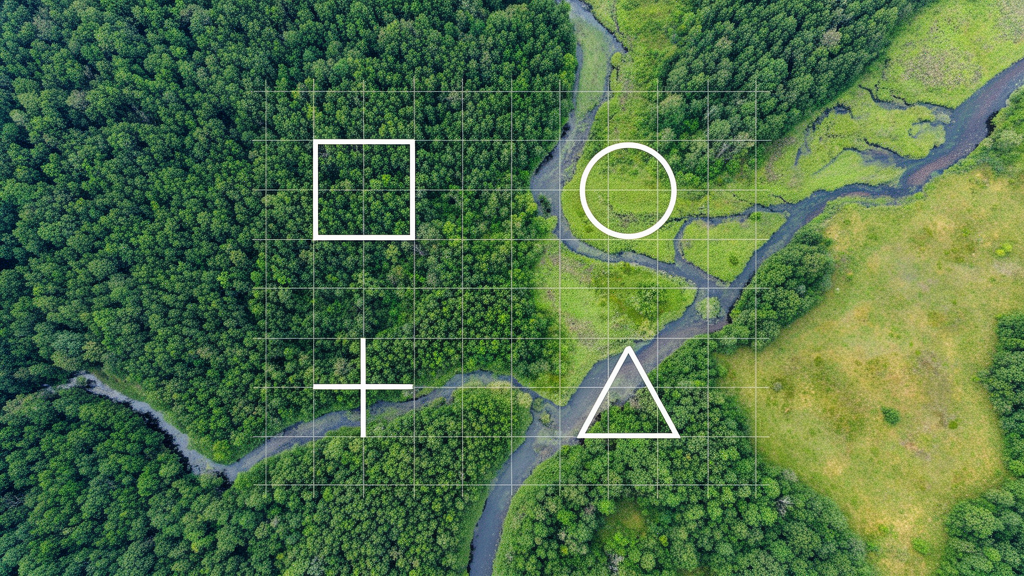
Drawing on decades of experience working with remote sensing data since the 1990s, Henebry explains how Waugh’s reflection mirrors the cognitive detachment that occurs when viewing landscapes from above. While ground-level oblique perspectives inspire a sense of grandeur, overhead satellite and aerial imagery flattens ecological features such as patches, corridors, matrices, and mosaics into abstract spatial heterogeneity, making it difficult for observers to orient themselves without anthropogenic objects for reference.
This perceptual challenge becomes even more pronounced when sensors record scenes outside the visible spectrum of electromagnetic radiation. Henebry points to 21-centimeter wavelength microwave observations, which produce soil moisture maps with coarse 36-kilometer pixel resolutions from upwelling radiation that penetrates cloud cover day and night, provided the ground remains unfrozen and tree canopies are not excessively dense.
The editorial highlights that human perceptions of expansive landscapes stem directly from the peculiarities of visual cognition. Much like a camera failing to capture the psychovisual impression of a low harvest moon or an afternoon mountain vista, scientific instruments capture phenomena through specific observational constraints, demonstrating that scaling fundamentally reflects how measurement instruments encounter the phenomena under study.
Examining the theoretical foundations of spatial terminology, Henebry cites ecologist T.F.H. Allen’s 1998 essay on the landscape level, which argued that while landscapes and spatially based ecology remain vital, terms like landscape level and landscape scale cause confusion. Allen asserted that level refers to types of things, which are formed prior to observation, whereas scale refers strictly to measurements tied directly to the operational act of observing.
Because the definition of a landscape is inherently relative to the specific entities and ecological processes under scrutiny, the phrase landscape scale can mislead researchers. Depictions in fine art, such as landscape paintings by Constable, Turner, Cezanne, or O’Keeffe, capture particular impressions of specific geographic locations but do not establish the characteristic spatial extents required for landscape ecological research.
To demonstrate the relative nature of landscapes, Henebry recalls a student poster presented at the 1990 US Landscape Ecology Symposium at Miami University in Oxford, Ohio. The student used detailed pencil drawings to map the landscape across the dorsal carapace of a horseshoe crab, documenting how various small organisms coexisted on its surface as a self-contained ecological system.
In evaluating conceptual solutions, Henebry discusses Allen’s proposed term landscape criterion, which conceptualizes landscape as an observational criterion or model based on relative planar spatial relationships. However, Henebry considers the landscape criterion concept somewhat too abstract and dense to provide immediate practical guidance for working field researchers.
Instead, the editorial highlights a practical four-part framework proposed in 2000 by quantitative geographer Ferko Csillag alongside Marie-Josée Fortin and Jennifer Dungan in the Bulletin of the Ecological Society of America. To prevent incompatible observations and contradictory conclusions, the authors recommended reporting four distinct spatial characteristics in methods sections: the size and shape of the observation, the size and shape of the study area, the characteristics of the agents of interest, and the process area across which those agents interact.
In detailing the four-part reporting framework, Henebry emphasizes how Csillag, Fortin, and Dungan divided spatial properties into two distinct functional categories: the observational framework and the ecological system under investigation. The first two characteristics—the size and shape of the observation alongside the size and shape of the broader study area—explicitly define the parameters of the observational data. In contrast, the third and fourth characteristics—the specific agents of interest and the process area across which those agents act—describe the underlying biological and physical processes.
Beyond merely listing these four metrics, the framework urges researchers to include an explicit discussion of the relationships between observation dimensions and process domains within the methods section of every published paper. According to Csillag and colleagues, failing to evaluate these interactions leads directly to incompatible observations and contradictory ecological conclusions. Henebry notes that adopting this reporting habit across ecological literature would ground study findings within their proper context, clarifying how systems were measured and enabling the broader scientific community to evaluate and build upon published results fruitfully.
This operational clarity directly addresses the theoretical critique articulated by Allen in his 1998 critique of ecological terminology. Allen argued that the persistent confusion between landscape level and landscape scale stems from a failure to separate the fundamental concept of types from the concept of measurements. In Allen’s framework, a level refers to a type, which exists in a rich and fully formed state prior to any empirical observation. Conversely, scale refers strictly to measurement, achieving meaning only when it is operationalized through an act of observation. Because scale is inseparable from the measurement instrument, Allen concluded that ecological writing should abandon ambiguous terms like landscape scale in favor of scale-specific and scale-independent terminology.
Allen had proposed the term landscape criterion as a potential substitute for landscape level, defining it as an observational criterion possessing the general properties of an ecological model. Under this model, relative spatial relationships across a plane—or a loose equivalent of a plane—serve as the foundational organizing principle for determining the proximity of system components. While acknowledging Allen’s conceptual contribution, Henebry observes that the landscape criterion packs too much theoretical complexity into a single phrase to provide immediate, actionable guidance for empirical practitioners, making Csillag’s four-part reporting standard a far more accessible solution.
The operational nature of scale is equally visible in the technical constraints of satellite remote sensing, where physical sensor mechanisms encounter natural phenomena far outside direct human sensory capability. For instance, sensors measuring 21-centimeter wavelength microwaves capture upwelling microwave radiation that passes through atmospheric cloud cover during both day and night cycles. However, this sensing capability remains contingent on specific physical conditions: it operates effectively only when the ground is not frozen and where overlying tree canopies are not excessively dense. Because the resulting soil moisture maps are resolved into coarse 36-kilometer pixels, the instrument encounters the landscape at a grain fundamentally detached from ordinary human comprehension.
Henebry explains that this divergence between human visual cognition and sensor measurement underscores why scaling is fundamentally about how instruments encounter phenomena of interest. Human psychovisual cognition interprets expansive landscapes through unique perceptual tendencies that standard optical equipment cannot easily reproduce, as seen when a camera fails to capture the visual impression of a late-afternoon mountain vista or a harvest moon low on the horizon. Because instruments capture reality strictly through their own measurement parameters, scientific interpretations must remain explicitly tethered to how those measurements were collected.
This dependency reinforces why artistic portrayals of landscapes cannot define the operational boundaries of ecological science. While landscape paintings by artists such as John Constable, J.M.W. Turner, Paul Cézanne, and Georgia O’Keeffe capture evocative human impressions of specific geographic places, they do not establish characteristic spatial extents for ecological inquiry. As demonstrated by the student illustration of a horseshoe crab’s carapace at the 1990 symposium, a fully functional landscape mosaic complete with coexisting organisms can occur across the surface of a single animal’s shell, proving that landscape remains an inherently relative concept defined entirely by the agents and processes being observed.
Subject of Research: Spatial scale terminology and measurement frameworks in landscape ecology
Article Title: Grounding our perspectives: musings on ‘landscape scale’
Article References: Henebry, G. M. (2026). Grounding our perspectives: musings on ‘landscape scale’. Landscape Ecology, 41(8), Article 149. https://doi.org/10.1007/s10980-026-02438-4
Image Credits: AI Generated
DOI: 10.1007/s10980-026-02438-4
Keywords: landscape scale, landscape ecology, spatial scale, spatial heterogeneity, remote sensing, landscape level, landscape criterion, spatial resolution, microwave observations, soil moisture mapping, visual cognition, observation size, study area extent, process area, agents of interest, measurement scale, Geoffrey M Henebry
News Source: Drew Townsend. (November 20, 2026). Editorial Proposes Four Spatial Metrics to Clarify Ecological Landscape Scale. Scienmag.