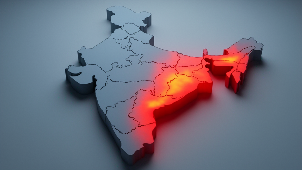
A nationwide district-level assessment of cardiovascular disease vulnerability in India has identified pronounced geographic clustering across the country, with eastern and northeastern districts exhibiting the highest vulnerability while western and rugged hilly areas demonstrate substantially lower vulnerability. Published in the International Journal of Health Geographics, the investigation establishes a spatially disaggregated index to map structural disparities that shape prospective cardiovascular health risks across Indian districts.
The research framework was developed to address persistent public health challenges generated by deep socioeconomic, infrastructural, and environmental inequalities across India. Rather than treating national cardiovascular risks as geographically uniform, the authors established a localized analytical index designed to identify how uneven structural conditions contribute to distinct regional vulnerability profiles at the district administrative level.
To construct the vulnerability index, the investigators compiled twenty-six individual indicators structured across seven distinct domains: socioeconomic conditions, physiological characteristics, behavioural habits, healthcare access, dietary practices, and environmental conditions divided into indoor and outdoor exposure. The primary data were gathered from the National Family Health Survey-5, the Rural Health Statistics 2021-22 report, and complementary satellite-derived observation datasets.
Methodologically, the researchers curated, preprocessed, and harmonized the diverse datasets onto a uniform scale to allow rigorous cross-domain comparison. The team then implemented a one-common-factor model to derive objective weights for each indicator, which were utilized to compute intermediate scores for each domain. These seven domain scores were subsequently synthesized into an overall district vulnerability score by assigning equal weight to each domain.
To investigate geographic patterns and dependency across administrative boundaries, the study applied Global Moran’s I and Anselin’s Local Moran’s I spatial statistics. The global analysis yielded a Moran’s I value of 0.636, with a Z-score of 27.17 and a pseudo p-value of 0.001. This outcome demonstrated strong and statistically significant spatial autocorrelation, confirming that cardiovascular disease vulnerability in India is organized into distinct geographic clusters rather than being randomly distributed.
The localized spatial evaluation uncovered prominent high-vulnerability clusters concentrated in eastern and northeastern regions. Districts identified with heightened vulnerability included Kolkata, Haora, and Paschim Barddhaman, alongside Kamrup Metropolitan. According to the research findings, elevated vulnerability across these urbanized and regional centers is driven predominantly by degraded ambient air quality, inadequate access to healthcare infrastructure, and suboptimal dietary practices among resident populations.
In contrast, districts situated in western territories and topographically rugged mountainous regions demonstrated notably lower cardiovascular vulnerability, forming significant low-low clusters under Anselin’s Local Moran’s I analysis. Specific districts exhibiting low vulnerability included Bageshwar, Rudraprayag, and Chamba in hilly terrain, as well as Barmer, Pali, and Agar Malwa. The authors noted that these lower vulnerability profiles are supported by favourable air quality indices, more nutritious diets, and physically active daily lifestyles influenced by rugged local terrain.
The study highlights a crucial conceptual distinction regarding the scope of the framework: the index measures potential future vulnerability based on prevailing behavioural, environmental, and structural risk conditions, rather than recording actual current disease burden or clinical morbidity rates. The resulting spatially disaggregated model provides public health planners, researchers, and policymakers with an empirical tool to pinpoint localized cardiovascular risks and formulate tailored health interventions addressing specific district needs.
Subject of Research: Spatial assessment of district-level cardiovascular disease vulnerability in India
Article Title: Assessing cardiovascular disease vulnerability in India: a spatially disaggregated index-based framework
Article References: Gayathri, B., Raj, A., Sujata, S., & Thakur, R. (2026). Assessing cardiovascular disease vulnerability in India: a spatially disaggregated index-based framework. International Journal of Health Geographics. https://doi.org/10.1186/s12942-026-00491-5
Image Credits: AI Generated
DOI: 10.1186/s12942-026-00491-5
Keywords: cardiovascular disease, vulnerability index, India public health, district-level analysis, spatial epidemiology, Global Moran's I, Anselin's Local Moran's I, National Family Health Survey, Rural Health Statistics, environmental health, air quality, healthcare access, dietary patterns, spatial autocorrelation, Kolkata, Kamrup Metropolitan, spatial disaggregation, preventive healthcare
News Source: Ophelia Keating. (November 18, 2026). Eastern Districts Face Higher Cardiovascular Vulnerability in India-Wide Spatial Index Study. Scienmag.