In the rapidly evolving landscape of disaster response, harnessing real-time data to assess the severity of earthquake-impacted areas has become an indispensable objective. A breakthrough study recently published in the International Journal of Disaster Risk Science introduces a pioneering methodology that leverages mobile signaling data combined with an advanced machine learning technique known as Random Forest to expedite the assessment process of areas ravaged by earthquakes. This approach promises to transform emergency management by providing rapid, accurate, and scalable insights in the chaotic aftermath of seismic disasters.
Earthquakes, by their very nature, strike with little warning, often wreaking havoc on infrastructure, communities, and livelihoods. Traditional damage assessment methods, largely dependent on ground surveys and satellite imagery, face significant limitations when timeliness and resource constraints become critical. They typically require days or even weeks to compile detailed and reliable damage reports, delaying targeted relief operations. The study under discussion reimagines this paradigm by tapping into an omnipresent source: mobile signaling data emanating from the ubiquitous smartphones carried by millions.
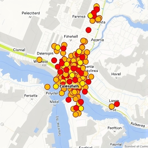
Mobile signaling data — the digital footprints generated by mobile devices as they communicate with cellular towers — captures nuanced patterns of human movement and behavior. When an earthquake occurs, disruptions in these patterns often arise due to infrastructure damage, population displacement, or communication breakdowns. By analyzing large volumes of this data, researchers can infer where the most severely affected zones lie, often much faster than physical reconnaissance teams can reach those regions.
The research team employed a Random Forest algorithm, a sophisticated machine learning model well-regarded for its robustness and accuracy in classification and regression tasks. This ensemble method constructs multiple decision trees during training and outputs the mode of the classes (classification) or mean prediction (regression) of the individual trees. Its ability to handle large datasets with high dimensionality while mitigating overfitting makes it ideal for interpreting the complex and noisy data streams derived from mobile networks during disaster events.
In their methodology, the researchers first collected vast datasets of mobile signaling metrics in the wake of an earthquake occurrence. These metrics included variations in signal strength, frequency of connections, movement trajectories, and temporal usage patterns. By correlating these features with known damage reports from initial field surveys, the Random Forest model was trained to recognize patterns indicative of severe infrastructural impact and human distress.
One salient advantage of this method lies in its capacity for near real-time deployment. As mobile network operators continuously log signaling data, updated inputs can be fed into the model immediately after seismic events, allowing for rapid damage zonation maps to be generated within hours rather than days. This capability is crucial for emergency responders, enabling prioritized resource allocation to the most critical zones, potentially saving lives and optimizing logistics in high-stakes scenarios.
Validation results demonstrated remarkable accuracy, with the model effectively distinguishing highly damaged areas from less affected ones across diverse geographic and demographic contexts. This performance underscores the model’s generalizability, suggesting it could be adapted for different earthquake-prone regions worldwide, pending local calibration.
Beyond damage assessment, the insights gleaned from mobile data analytics also illuminate post-disaster human mobility trends—information pivotal to understanding displacement patterns, shelter needs, and the progression of recovery efforts. The fusion of data science and disaster risk management heralds a new era where decision-makers are equipped with actionable intelligence derived from the digital pulse of affected populations.
The study further discusses the privacy and ethical considerations inherent in utilizing mobile phone data. Although anonymized and aggregated datasets were used, the authors stress the importance of strict data governance frameworks to protect individual privacy while maximizing societal benefits, highlighting an ongoing dialogue in the integration of big data and humanitarian aid.
Future directions proposed by the researchers involve combining seismic sensor data, satellite imagery, and social media signals with mobile network inputs to create a multi-modal assessment platform. Integrating diverse data streams through advanced AI models could further enhance prediction accuracy and reduce uncertainties in damage appraisal.
Importantly, the research underscores the role of public-private partnerships in disaster response innovation. Cooperation between telecom operators, government agencies, and academic institutions was essential for data access and methodological development, exemplifying a collaborative model for future crises.
The application of Random Forest algorithms in this context exemplifies the broader trend of employing machine learning to interpret complex environmental and social phenomena. As computational capabilities continue to advance, such tools can unlock unprecedented insights from seemingly mundane data, revolutionizing how societies prepare for and respond to natural disasters.
In conclusion, the pioneering use of mobile signaling data, coupled with Random Forest analysis, represents a significant leap forward in earthquake disaster management. By enabling rapid, accurate assessments of severely affected areas, this technology stands to significantly improve emergency response effectiveness, ultimately safeguarding communities and accelerating recovery in the face of seismic catastrophes.
Subject of Research:
Rapid damage assessment of earthquake-affected areas using mobile signaling data and machine learning algorithms.
Article Title:
Rapid Assessment of Severely Affected Earthquake Areas Using Mobile Signaling Data and a Random Forest Approach.
Article References:
Guo, X., Wei, B. & Su, G. Rapid Assessment of Severely Affected Earthquake Areas Using Mobile Signaling Data and a Random Forest Approach. Int J Disaster Risk Sci (2025). https://doi.org/10.1007/s13753-025-00684-9
Image Credits: AI Generated
Tags: AI in emergency managementcommunity resilience after earthquakesearthquake impact assessmentinfrastructure damage evaluationmachine learning for disaster recoverymobile data disaster responsemobile signaling data utilizationRandom Forest algorithm applicationsrapid damage assessment techniquesreal-time earthquake data analysisseismic disaster response innovationstimely relief operations strategies


