Grasslands represent one of the planet’s most vital ecosystems, providing a spectrum of essential ecological services—from supporting global livestock production to sequestering carbon and harboring remarkable biodiversity. Despite their critical importance, these landscapes face escalating threats from human activities, particularly livestock grazing. Early signs of grassland degradation, however, are often cryptic and elude traditional monitoring techniques, which may rely heavily on labor-intensive field surveys focusing on vegetation cover alone. A groundbreaking approach emerging from recent research harnesses the power of autonomous drones equipped with hyperspectral imaging technology, offering a transformative lens not only into biomass levels but also into the intricate functional traits of plant communities and their dynamic responses to grazing pressures.
Livestock grazing, the dominant anthropogenic force shaping grassland ecosystems worldwide, inflicts complex effects that vary markedly with grazing intensity. While moderate grazing has been shown to sometimes bolster biodiversity by maintaining habitat heterogeneity, intense grazing regimes often precipitate declines in ecosystem productivity and cause pronounced shifts in species composition. The challenge for ecologists lies in accurately detecting these nuanced shifts—not merely in the quantity of vegetation but within the qualitative changes in plant physiological traits and the broader community architecture. These changes underpin ecosystem resilience and function, making their detection critical for sustainable grassland management and conservation strategies.
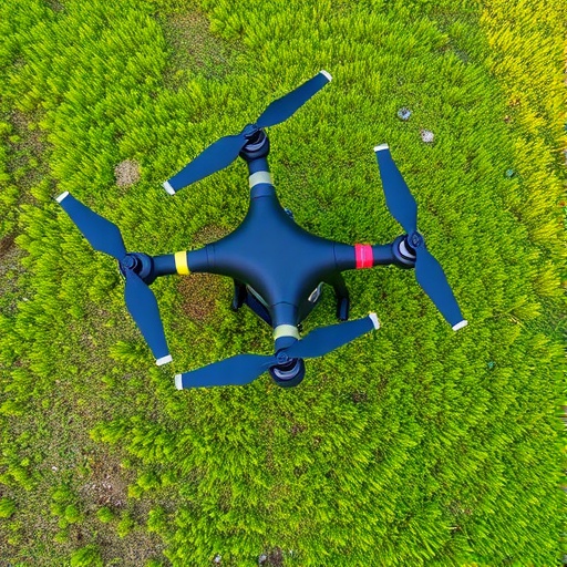
In a pioneering study slated for publication in the February 2026 issue of the Journal of Remote Sensing, a multidisciplinary team from prestigious institutions including Peking University, Beijing Forestry University, Inner Mongolia University, the University of Twente, and Sun Yat-sen University, embarked on an ambitious project within the Xilin Gol Grassland Nature Reserve of Inner Mongolia, China. Harnessing drone-borne hyperspectral sensors, the researchers sought to establish whether advanced remote sensing methodologies could yield precise, actionable data regarding aboveground biomass and key plant functional traits, offering timely insights into ecosystem responses along a gradient of grazing intensity.
The research methodology centered on deploying unmanned aerial vehicles equipped with cutting-edge hyperspectral imagers capable of capturing reflectance data across hundreds of narrow spectral bands. This high spectral resolution enabled the differentiation of subtle variations in plant biochemical and structural properties that traditional multispectral sensors often miss. Concurrently, ground-truthing with extensive field measurements allowed validation of drone-derived data, anchoring remote observations firmly in ecological reality and ensuring robustness in trait estimation models.
Key findings of the study unveiled that aboveground biomass exhibited a consistent negative correlation with grazing intensity—most markedly under heavy grazing treatments. This decline aligns with ecological theory predicting biomass attrition under elevated herbivory pressure. More intriguingly, several nutrient-related plant traits such as leaf nitrogen and phosphorus content showed decreasing trends as grazing intensified, signaling potential nutrient stress and adaptive shifts in resource allocation. Conversely, traits associated with stress tolerance, including increased leaf thickness and elevated leaf carbon content, manifested an uptrend, pointing to a community-level strategy shift toward more resilient species assemblages under duress.
Beyond individual trait alterations, the study highlighted evolving interactions between plant functional traits and biomass across the grazing spectrum. Under heavier grazing pressure, trait-biomass relationships strengthened, implying that specific trait configurations become progressively more predictive of ecosystem productivity in stressed environments. Functional diversity metrics also revealed that greater trait variability correlated positively with biomass in heavily grazed zones, suggesting that diverse functional portfolios might buffer against biomass losses and underpin ecosystem resilience through niche complementarity or facilitative interactions.
Delving deeper into community network dynamics, the researchers employed trait network analysis to elucidate how inter-trait connectivity patterns shifted with grazing intensity. They discovered that under stronger grazing pressure, networks exhibited reduced connectivity, corresponding with decreased biomass levels. This disintegration of trait networks might reflect simplified community structures prone to functional redundancy loss, thereby reducing ecosystem multifunctionality and resistance to disturbance.
These multifaceted insights underscore the superiority of integrating plant functional trait information alongside conventional biomass assessments in remote sensing-based ecological monitoring. Drones equipped with hyperspectral technology offer unparalleled spatial and spectral resolution, enabling ecologists to detect subtle physiological and organizational transformations that presage ecosystem degradation. This paradigm shift toward trait-informed monitoring holds promise for more timely and nuanced assessments, essential for adaptive grassland management.
Dr. Yiwei Zhang, the study’s lead author from Peking University, emphasized the significance of transcending traditional vegetation quantification: “Monitoring grasslands using remote sensing typically focuses on vegetation amount, but this study demonstrates the powerful insights gained when we also examine how plant traits and community structures shift in response to grazing pressures. This comprehensive perspective is critical for effective ecosystem stewardship.”
Importantly, the research leveraged data from a long-term grazing experiment initiated in 2013, comprising treatments spanning from grazing exclusion to heavy livestock presence. This experimental design provided a controlled context to disentangle grazing impacts from other environmental variables, bolstered by rigorous field measurements interlinked with drone data. Such longitudinal and multifactorial datasets are invaluable for refining remote sensing algorithms and enhancing the ecological relevance of hyperspectral indices.
The broader ramifications of this investigation extend beyond the Xilin Gol Grassland, offering a scalable and efficient framework adaptable to grassland monitoring globally. As large-scale field surveys remain constrained by logistical and financial hurdles, drone-based hyperspectral imaging presents a transformational pathway to facilitate high-resolution, repeatable, and comprehensive ecosystem assessments. Ultimately, these technological advances promise to support more sustainable livestock management, biodiversity conservation, and climate mitigation efforts across the world’s extensive grassland biomes.
In conclusion, this study heralds a new frontier in ecological monitoring by intertwining innovative remote sensing technology with plant functional ecology. It elucidates how grazing intensity orchestrates complex shifts in plant trait syndromes and community organization, which effectively govern ecosystem functions such as productivity and resilience. This integrated ecological insight, captured from the skies, empowers researchers and land managers with a more holistic and timely understanding of grassland health, poised to inform enhanced conservation strategies in an era of mounting environmental challenges.
Subject of Research: Not applicable
Article Title: Unraveling Ecosystem Function Responses to Grazing Intensity through UAV-Based Hyperspectral Analysis
News Publication Date: 3-Feb-2026
References: 10.34133/remotesensing.0732
Keywords
Remote sensing, grasslands, grazing intensity, hyperspectral imaging, plant functional traits, biomass estimation, ecosystem monitoring, UAV technology, ecological resilience, biodiversity, plant community structure, Inner Mongolia
Tags: autonomous drones in environmental studiesbiodiversity effects of grazing intensitybiomass assessment in grasslandsdrone hyperspectral imaging for grasslandsecological monitoring with drone technologygrassland degradation detection methodsgrassland ecosystem resilience monitoringimpacts of livestock grazing on ecosystemsplant functional traits and grazingremote sensing in ecological researchsustainable grassland management techniquesvegetation community shifts from grazing


