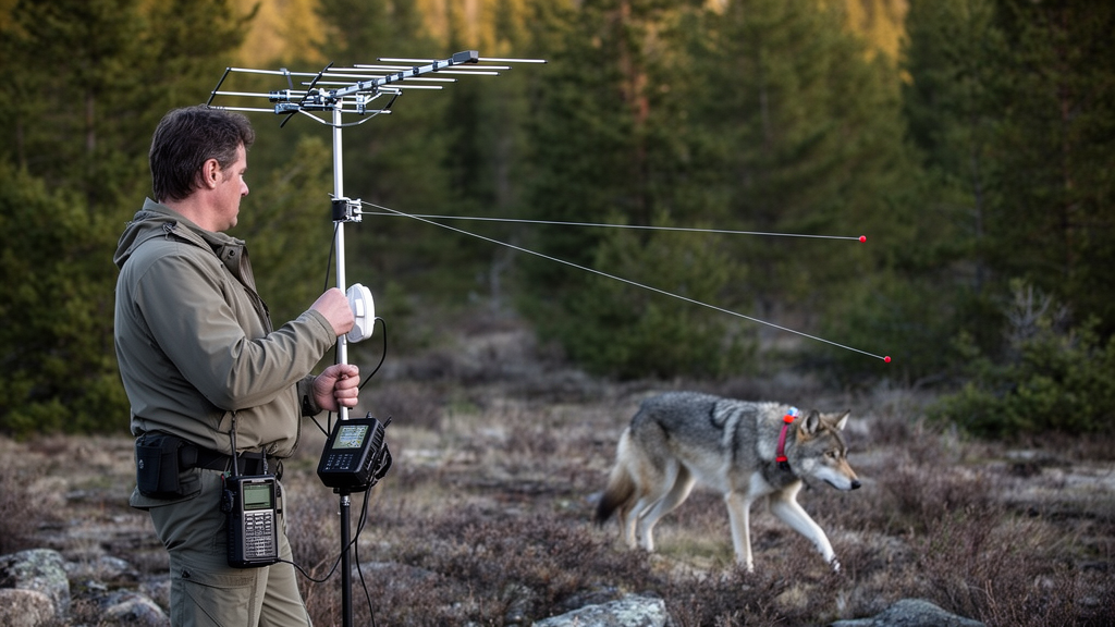
An antenna beam-based position finding method for automated radiotelemetry systems delivers position estimates for up to 99 percent of recorded signal intervals while matching the spatial accuracy of traditional angulation. Researchers evaluating very-high-frequency radiotelemetry in agricultural landscapes in Germany demonstrated that calculating positions along directional antenna reception lobes substantially reduced data loss compared with bearing-intersection methods. Concurrently, the team introduced a generalized linear mixed model that successfully predicts per-position spatial errors down to a mean absolute deviation of 21 meters using incoming signal metrics, providing an empirical basis for assessing position trustworthiness without requiring continuous ground-truth tracking.
Ecological research and conservation management increasingly depend on precise wildlife movement trajectories to evaluate animal responses to landscape alterations and understand population dynamics. Automated radiotelemetry systems utilizing very-high-frequency transmitters have emerged as a primary alternative to satellite-based Global Positioning System units, which carry hardware payloads that generally weigh at least 1.5 to 6 grams. Because animal tracking guidelines advise against transmitter loads exceeding five percent of an animal’s body weight to prevent behavioral interference, time-based satellite tags cannot be deployed on approximately 60 percent of vertebrate species. Automated radiotelemetry ground stations overcome this physical constraint by tracking lightweight transmitters weighing less than 0.1 grams, allowing investigators to monitor small vertebrates such as songbirds, bats, and insects continuously across varying spatial extents.
Despite their utility for lightweight subjects, automated radiotelemetry systems face substantial analytical hurdles when resolving fine-scale movements. Satellite receivers determine locations using highly synchronized internal clocks measuring signal arrival times, but ground-based radiotelemetry networks typically derive spatial positions from received signal strength indications. Received signal strength fluctuates based on transmitter-receiver distance, transmission attenuation caused by dense vegetative cover or atmospheric moisture, transmitter antenna orientation relative to ground receivers, and surrounding electronic noise. Prior analytical frameworks routinely collapsed these variable influences into a single study-wide mean error estimate, obscuring substantial location-specific spatial uncertainties that can range from several meters to hundreds of meters across complex study sites.
To overcome yield restrictions and spatial imprecision, researchers Mirjam R. Rieger, Jan Schmitt, Paula Machin, Johann Musculus, Ralf Dittrich, Thomas K. Gottschalk, Jannis Gottwald, Patrick Lampe, and Jonas Höchst developed and evaluated alternative positioning workflows across two agricultural environments in Brandenburg, Germany. Situated 70 kilometers east of Berlin within the Märkisch Oderland district, the field trial examined two contrasting experimental sites during the late summer and autumn of 2023. Site maisC, located in the Oderbruch region across 20 hectares, featured minor topographic relief and hosted ten directional stations and ten omnidirectional stations. Site maisD, positioned in Lubusz land across 16 hectares, contained moderate topographic variation with elevation differences reaching up to 15 meters and operated eight directional stations.
The experimental infrastructure utilized the trackIT automated radiotelemetry architecture running open-source trackIT operating system software version 2023.05.3. Directional stations were configured with four 90-degree directional antennas detecting very-high-frequency transmissions across 150.000 to 150.300 megahertz with signal durations between 8 and 40 milliseconds. To generate validation baselines, field researchers traversed four test tracks per site carrying active 600-microwatt transmitters attached at heights of 0.5 to 2.0 meters with antennas oriented at 45-degree angles to emulate perched birds. These calibration walks generated roughly 13,500 simultaneous Global Positioning System fixes per site, logged every second via mobile positioning devices and matched to two-second radiotelemetry detection intervals.
Raw signal archives underwent strict preprocessing to eliminate extraneous radio interference before positional computation commenced. Algorithmic filtering bounded signals within a 4-kilohertz band surrounding transmitter center frequencies and isolated burst durations spanning 8 to 24 milliseconds. The researchers also implemented a Lastmatch-Nextmatch timing filter evaluating expected one-second transmission intervals between consecutive detections. By setting an interval change threshold below 0.1 seconds, the routine eliminated anomalous pulses lacking matching predecessor or successor signals, filtering out false positive noise while remaining resilient to slight interval drifts caused by ambient temperature swings, humidity fluctuations, or declining transmitter battery voltages.
The investigation tested three primary positioning methodologies on the filtered two-second signal aggregates: antenna beams, directional angulation, and omnidirectional multilateration. Directional angulation relied on gain differences between the strongest receiving antenna and its adjacent neighbor to derive absolute signal bearings, projecting intersection lines scaled to twice the estimated distance. Multilateration computed omnidirectional positions by fitting exponentially decaying distance curves to signal strengths and optimizing initial inverse-distance coordinates through error minimization. The antenna beam technique generated directional estimates along antenna reception lobes at half the anticipated detection range, averaging multi-antenna receptions via normalized signal-strength weighting, while omnidirectional beam variants averaged station locations directly.
Comparative analyses revealed that directional antenna beams provided an effective operational alternative to conventional angulation, achieving comparable accuracy while recovering far more tracking points. In site maisC, directional antenna beams yielded an average position error of 41 meters, aligning closely with the 44-meter mean error observed for directional angulation. However, directional angulation successfully resolved only 30 to 50 percent of ground-truth test track locations because it required intersecting bearings from at least two separate stations that each detected transmissions across two neighboring antennas. In contrast, directional antenna beams produced valid estimates for more than 90 percent of recorded track intervals, reaching up to 99 percent yield and maintaining dense temporal tracking sequences.
Topographic contours exerted a noticeable influence on the optimal parameterization of antenna beam geometry across the two test landscapes. In the flat terrain of maisC, evaluating directional antenna beam detection ranges established an optimal radius of 800 meters, which yielded a mean predicted position error of 63.8 meters. In the undulating terrain of maisD, where 15-meter elevation differences altered line-of-sight propagation, the lowest mean predicted position error occurred at an assumed detection range of 900 meters, generating a mean predicted error of 95.1 meters. Because standard antenna beam formulae presume isotropic signal decay, downhill-facing antennas achieved greater real-world coverage than uphill-facing units, causing positional errors to vary more widely across sloping environments.
To quantify spatial reliability without ongoing ground-truth calibration walks, the investigators constructed generalized linear mixed models with lognormal error distributions to predict per-position error values. Modeling error as a function of participating station counts, receiving antenna counts, maximum signal strength, normalized summed signal weights, and spatial station coverage yielded robust predictive capacity on reserved validation tracks Ctest and Dtest. Directional antenna beam models achieved mean absolute deviations between predicted and true errors of 21 meters in maisC and 33 meters in maisD, whereas directional angulation showed absolute deviations of 22 and 44 meters, omnidirectional antenna beams reached 38 meters, and omnidirectional multilateration produced deviations of 53 to 69 meters.
Covariate evaluations highlighted that positional precision improved substantially when signals were detected across higher numbers of antennas distributed among receiving stations. In maisC, single-antenna detections per station produced the highest predicted errors of 150 to 180 meters, whereas estimates incorporating higher antenna counts approached errors of 25 meters or less. Post-hoc filtering that excluded position estimates derived from single-antenna and single-station detections removed only 2 to 6 percent of directional antenna beam fixes while improving overall positional accuracy. The authors noted that large antenna counts produced a slight centralizing bias toward study cores, yet the per-position error framework accurately reflected underlying spatial uncertainty, offering a verifiable basis for wildlife habitat and home-range modeling.
Beyond directional configurations, the research evaluated the practical trade-offs between directional stations and simpler, lower-cost omnidirectional receiver arrays. In the flat terrain of maisC, omnidirectional antenna beams resolved roughly 90 percent of recorded track positions, whereas omnidirectional multilateration yielded nearly 80 percent. However, omnidirectional systems incurred substantially higher spatial errors, generating mean predicted position errors between 50 and 150 meters for multilateration and around 100 meters for omnidirectional antenna beams, even under favorable reception conditions where at least three stations logged the signal. Because omnidirectional antenna beam calculations average station coordinates directly, estimated fixes were structurally constrained within the polygon bounded by the receiving stations, inherently restricting all resolved locations to the central study area. Across both station designs, the observed errors fell within the midfield of previous automated telemetry evaluations, where reported position errors have spanned from under 10 meters in tight station grids to several hundred meters in widely dispersed arrays.
Because optimal detection parameters and error model predictive behaviors differed between the flat and undulating experimental landscapes, the authors cautioned that the statistical error models cannot be transferred directly to new field sites without dedicated empirical tuning. To account for site-specific signal attenuation, terrain contours, and antenna configurations, the investigators recommended that future tracking projects conduct on-site ground-truth calibration before deploying automated radiotelemetry systems on wildlife. At minimum, this baseline protocol involves one extensive calibration walk to train the predictive model and a shorter validation walk to evaluate performance, ensuring transects traverse both the core array and peripheral zones out to half the expected detection range. Adjusting walk spacing to local habitat complexity, deploying multiple test tags simultaneously, and mapping predicted errors across the landscape enable researchers to verify whether spatial precision meets their biological research questions and whether additional stations are required to eliminate peripheral coverage blind spots.
Subject of Research: High-resolution wildlife radiotelemetry positioning and per-position error modeling
Article Title: Enabling high-resolution wildlife tracking: antenna beam-based approach including novel per-position error estimations for automated radiotelemetry systems
Article References: Rieger, M. R., Schmitt, J., Machin, P., Musculus, J., Dittrich, R., Gottschalk, T. K., Gottwald, J., Lampe, P., & Höchst, J. (2026). Enabling high-resolution wildlife tracking: antenna beam-based approach including novel per-position error estimations for automated radiotelemetry systems. Movement Ecology, 14(1), Article 55. https://doi.org/10.1186/s40462-026-00687-1
Image Credits: AI Generated
DOI: 10.1186/s40462-026-00687-1
Keywords: automated radiotelemetry systems, antenna beams, wildlife tracking, position error, VHF telemetry, angulation, multilateration, movement ecology, trackIT, spatial accuracy, signal strength, ground-truth validation, habitat use, radio tracking, biotelemetry, generalized linear mixed models
News Source: Margaret Porter. (November 20, 2026). Antenna Beam Telemetry Yields More Wildlife Tracking Locations Than Angulation. Scienmag.