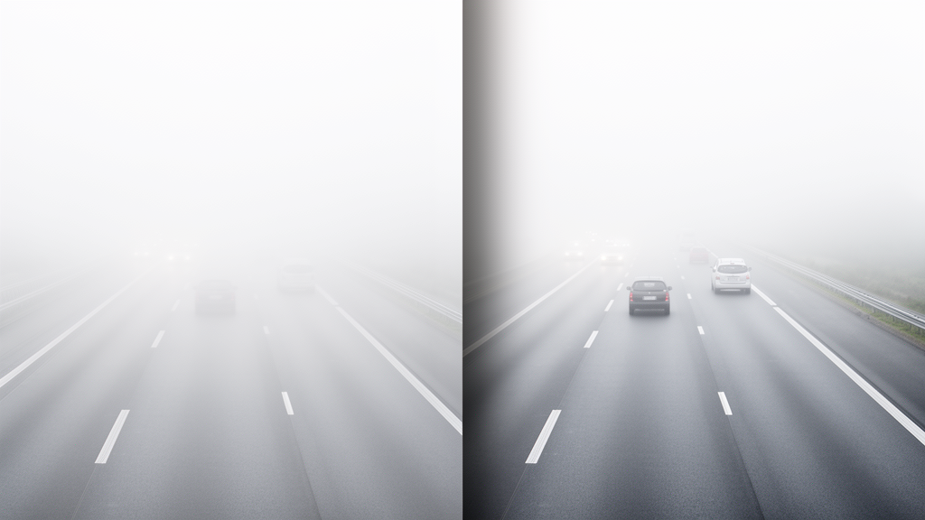
Researchers Yue Qin, Chao Liu, and Jingsong Zhang have developed an edge-preserving image dehazing algorithm designed to restore fine visual structures in autonomous driving scenes degraded by fog. Traditional single-image dehazing techniques that depend on manual priors often smooth across structural boundaries or generate unnatural halo artifacts around object borders, while modern deep learning approaches frequently fail to resolve depth discontinuities accurately. To resolve these persistent degradation issues, the research team designed an integrated framework that unites deep representation learning with multiscale geometric modeling. By coupling a U-shaped Transformer depth estimation subnetwork with a dedicated multiscale convolutional feature fusion module and an edge-preserving post-processing pipeline, the system systematically suppresses fog interference while maintaining acute boundary gradients. Quantitative evaluations demonstrate that this coordinated architecture improves scene clarity, sharpens vehicle and road contours, and stabilizes vision preprocessing across diverse atmospheric scattering conditions, providing an effective solution for automated perception systems operating in challenging visibility.
Foggy atmospheric conditions substantially impair the perceptual capabilities of vehicle-mounted optical sensors by reducing image contrast, distorting colors, and obscuring fine environmental textures. At object intersections, boundary blurring and halo effects complicate downstream perception tasks such as target detection, semantic segmentation, and path planning. From an optical standpoint, image degradation is governed by the atmospheric scattering model, wherein observed pixel brightness results from the linear combination of direct scene radiance attenuated by medium transmittance and global atmospheric light scattered into the line of sight. Because transmittance decreases exponentially as scene depth increases across a scattering medium, accurate depth estimation is mathematically indispensable for calculating transmittance maps. When dehazing pipelines lack precise scene geometry, inaccurate transmittance values cause severe boundary distortions, proving that preserving the spatial integrity of structural edges while extracting atmospheric haze depends primarily on resolving local and global depth transitions across diverse driving ranges.
Earlier restoration methodologies attempted to invert atmospheric scattering by relying on heuristic assumptions, most notably the Dark Channel Prior, which estimates medium transmittance from minimal channel intensities. Although effective in basic scenes, dark-channel techniques struggle in expansive sky regions where atmospheric radiance causes pronounced color distortion, and their reliance on soft matting or guided filtering fails to maintain sharp depth transitions at object perimeters. Subsequent frameworks sought improvements through specialized hardware architectures and domain transforms, such as wavelet-domain filtering, yet they struggled to decouple noise suppression from edge retention. Generative adversarial networks and knowledge distillation frameworks similarly attempted end-to-end dehazing, but often suffered from edge blurring, localized haze retention, or structural instability. Furthermore, heuristic white-balance corrections combined with dark channel priors lacked adaptive multidimensional feature fusion, resulting in incomplete fog removal and localized chromatic aberrations when operating across heterogeneous fog distributions in complex roadside environments.
To overcome these structural limitations, the authors constructed a U-shaped Transformer depth estimation subnetwork that infers scene depth directly from raw three-channel foggy images. Rather than relying on standard convolutional downsampling that discards high-frequency spatial contours, the network encoder converts input images into positional patch embeddings of dimension four by four by three before projecting them through linear embedding layers. Alternating patch merging layers and Swin Transformer Blocks facilitate hierarchical downsampling and semantic abstraction, using sliding-window multi-head self-attention mechanisms to establish cross-window feature interactions. In the symmetric decoder, patch expansion layers and Transformer blocks progressively restore spatial resolution, while lateral skip connections transfer multi-level encoder features to mitigate the loss of spatial context. This hierarchical arrangement enables the subnetwork to model long-range spatial dependencies in distant fog distributions while maintaining localized attention to structural boundaries, ultimately producing a full-resolution pixel-level scene depth map that reflects geometric distributions across diverse driving distances.
Supervised training of the depth estimation subnetwork is conducted from random weight initializations using a custom joint loss function rather than relying on frozen pre-trained weights. The total optimization objective weights depth regression loss at seventy percent and edge preservation loss at thirty percent. The regression component constrains overall pixel-by-pixel deviations between predicted and ground-truth depth values across the entire field of view, penalizing relative depth offsets. Simultaneously, the edge preservation component calculates the gradient differences between predicted and ground-truth depth maps specifically along boundary pixels identified by the Canny edge detection operator. By enforcing gradient steepness along target silhouettes, this composite loss prevents the network from over-smoothing abrupt geometric transitions between foreground objects and distant backgrounds. Backpropagation updates all parameters across the depth estimation network and the subsequent multiscale fusion module in an end-to-end joint training regime, ensuring structural coherence throughout the predictive pipeline.
Because initial depth predictions reflect coarse distance distributions that may retain residual edge blurring, the authors introduced a dedicated multiscale depth feature fusion module to sharpen boundary transitions. The single-channel depth map is replicated into a three-channel tensor and preprocessed through a three-by-three convolutional layer to extract foundational shape and edge features. The representation then enters a four-branch parallel convolution layer engineered to process multiple receptive fields simultaneously: a one-by-one convolution branch yielding sixteen feature maps for global low-frequency distribution, two separate branches of three-by-three and five-by-five convolutions each yielding twenty-four feature maps for mid-to-high frequency structural features, and a three-by-three pooling branch generating twenty-four feature maps. Concatenating these distinct parallel outputs yields eighty-eight diverse feature maps, compensating for the spatial information loss inherent to fixed-receptive-field convolutions and reinforcing the network’s capacity to represent multi-scale edge details across complex driving environments.
Inter-layer feature propagation within the fusion module is governed by three sequential residual dense connection modules that facilitate comprehensive feature reuse and prevent gradient vanishing. Each module integrates a two-layer residual convolutional block utilizing parameterized rectified linear unit activations, a convolutional layer, and an efficient characteristic attention mechanism that sequentially weights channel and spatial dimensions. The channel attention operation combines global average pooling to measure overall statistical channel representation with global max pooling to identify peak activations occurring at abrupt depth boundaries. Subsequently, spatial attention pools across the channel dimension and applies a seven-by-seven convolution activated by a sigmoid function to construct two-dimensional spatial weight masks. This cascaded dual-attention strategy isolates channels that contribute most to depth contours while pinpointing exact spatial mutation coordinates, before a final deep aggregation layer compresses the enriched representation into an edge-enhanced depth map that provides reliable geometric structure for subsequent processing.
Using the refined depth map, the system calculates pixel-wise scene transmittance through the exponential attenuation equation under an initial homogeneous scattering assumption. To prevent numerical instability, division by zero, and severe noise amplification in far-field regions where transmittance approaches zero, the authors enforced a strict lower bound threshold of 0.05, restricting maximum noise amplification factors to twenty. Although the atmospheric scattering coefficient is held constant at 1.0, the learned depth map implicitly absorbs spatial variations in fog density because the neural network maps dense fog regions to greater perceived depth values and thinner haze to shallower values. Incorporating global atmospheric light values estimated from the brightest pixels in the original dark channel, the system inverts the atmospheric scattering model to generate a preliminary dehazed image that recovers broad scene structures while exhibiting minor residual boundary blurring that requires targeted edge-preserving post-processing refinement.
Final restoration is achieved through an edge-preserving post-processing framework that combines local linear guided filtering with à-trous wavelet multiscale decomposition without adding trainable parameters to network backpropagation. The preliminary restored image undergoes guided filtering using the original foggy input as a reference guide, which smooths flat regions while preserving primary edge directions based on local linear constraints. To counteract subtle energy leakage that occurs when rapid transmittance shifts violate local linearity assumptions, the filtered output is processed through a three-level à-trous wavelet transform. This decomposition isolates low-frequency approximation components from high-frequency detail coefficients across multiple spatial scales, capturing both coarse structural boundaries and delicate road markings. A weighted summation then combines the guided filtering result at a fixed weight of 0.7 with the high-frequency wavelet compensation terms at 0.3, eliminating residual haze while avoiding boundary halo artifacts and maintaining global brightness consistency across the restored image.
Experimental evaluations validated the framework on autonomous driving datasets using visual acquisition parameters of thirty frames per second, one-thousandth of a second exposure, ISO 200, and 5500 Kelvin white balance. Training integrated 1,449 NYU Depth V2 indoor pairs with 8,500 Outdoor Haze synthetic pairs derived from KITTI LiDAR scans, while cross-domain testing utilized real RTTS and ACDC benchmarks. On clear-weather KITTI depth completion benchmarks, the model attained an absolute relative error below 0.12 in the far-field eighty-to-one-hundred-meter range, outperforming the Dark Channel Prior at 0.20 and single-scale networks at 0.24. On paired synthetic fog sets, the algorithm demonstrated an edge gradient amplitude of 0.78, perceptual similarity of 0.11, and transmittance edge variance of 0.63 on real RTTS images. Submodule ablation confirmed that omitting multiscale convolutions reduced edge gradient amplitude to 0.59, while excluding wavelet compensation worsened perceptual similarity to 0.19. Deploying the 12.4-million-parameter model achieved 56 milliseconds per frame on an RTX 4090 and 78 milliseconds on a Jetson AGX Xavier, though performance bottlenecks in Swin attention at 52 percent runtime and severe degradation in visibility below fifty meters indicate essential targets for future temporal and quantization research.
Subject of Research: Edge-preserving image dehazing for autonomous driving vision
Article Title: An edge-preserving dehazing algorithm based on multiscale fusion and depth estimation
Article References: Qin, Y., Liu, C., & Zhang, J. (2026). An edge-preserving dehazing algorithm based on multiscale fusion and depth estimation. Discover Computing, 29(1), Article 911. https://doi.org/10.1007/s10791-026-10831-5
Image Credits: AI Generated
DOI: 10.1007/s10791-026-10831-5
Keywords: image dehazing, depth estimation, multiscale feature fusion, U-shaped Transformer, Swin Transformer block, guided filtering, à-trous wavelet transform, atmospheric scattering model, autonomous driving vision, edge preservation, transmittance estimation, KITTI benchmark, RTTS dataset, dual attention mechanism, residual dense connections, Jetson AGX Xavier, halo artifact suppression
News Source: Denise Maddox. (November 19, 2026). Multiscale Fusion Dehazing Algorithm Preserves Sharp Edges in Foggy Driving Vision. Scienmag.