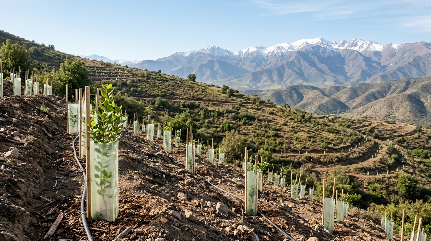
Researchers at Chile’s Institute of Ecology and Biodiversity (IEB) alongside colleagues from the University of Talca, the Forest Science and Technology Centre of Catalonia, and the University of Seville have developed a novel multi-objective computational optimization framework designed to identify and prioritize continental territories for large-scale ecological restoration. Published in the Journal of Environmental Management, the peer-reviewed investigation addresses the accelerating loss and degradation of native ecosystems across Chile, processes that continually jeopardize indigenous biological diversity while undermining essential ecosystem services such as climate regulation and freshwater availability and quality. The research team, led by industrial civil engineer Matías Moreno-Faguett, recognized that while ecological restoration represents a vital instrument for recovering degraded landscapes and their functional capacities, conservation programs routinely face severe constraints in financial budgets, technical personnel, and available operational time. Consequently, the team formulated an algorithmic decision-support tool capable of evaluating multiple ecological criteria simultaneously to guide national planning.
The comprehensive research project brought together an extensive interdisciplinary cohort of scientists, including postdoctoral researcher Jessica Castillo-Mandujano, Eduardo Álvarez Miranda, María José Martínez Harms, Bárbara Larraín, Olga Barbosa, Cecilia Smith, Aníbal Pauchard, Eduardo Fuentes Lillo, Micaela Poutay, and Patricio Pliscoff. Historically, ecological restoration initiatives throughout Chile have remained largely fragmented, characterized by isolated, local interventions that lacked an overarching national perspective. To overcome this institutional and geographic fragmentation, the researchers designed their framework to evaluate continental Chile as an integrated whole, explicitly accounting for the extensive climatic diversity and contrasting biomes spanning the country. As explained by co-author and University of Talca professor Eduardo Álvarez, recognizing that distinct geographic areas have fundamentally different ecological protection requirements was paramount, because restoring fragile arid habitats within the hyper-arid northern Atacama Desert demands an entirely different operational paradigm than rehabilitating temperate rainforests, peatlands, or coastal fjords situated across southern Patagonia.
To establish a rigorous computational basis for national prioritization, the investigators compiled extensive spatial datasets covering continental Chile and systematically partitioned the entire landmass into 812,910 individual planning units. Each standardized planning unit was delineated to encompass exactly one square kilometre, providing a uniform resolution for nationwide spatial analysis. Utilizing advanced mathematical optimization techniques, the team integrated spatial data across four explicit ecological criteria: reducing the risk of species extinction, prioritizing existing and potential carbon stocks, promoting the restoration of critical riparian zones, and assessing the overall ecological feasibility of restoration interventions. By applying mathematical programming to this high-resolution spatial grid, the computational simulation evaluated trade-offs and synergies among competing environmental objectives. Moreno-Faguett, who developed the model as part of his doctoral studies in mathematics at the University of Seville, emphasized that the underlying algorithm allows planners to dynamically simulate how spatial priorities shift when specific targets are weighted, added, or removed.
The multi-objective model strategically balances four distinct ecological criteria that frequently point toward conflicting geographic locations across the national territory. Postdoctoral researcher Jessica Castillo-Mandujano emphasized that while the primary biological objective of ecological restoration is recovering native biodiversity and underlying ecosystem functioning, conservation planning must simultaneously preserve the tangible contributions that nature provides to sustain human well-being. However, spatial analyses demonstrate that an area recognized as essential for the biological recovery of threatened taxa is not necessarily the same territorial unit that should be prioritized to satisfy pressing socioeconomic or cultural needs. Because spatial planning must reconcile ecological conservation with broader human dimensions, the authors constructed the computational model to assess these divergent priorities in unison, avoiding the pitfalls of single-objective planning that historically overlooked multifunctional regional benefits.
According to the study authors, one of the central methodological innovations of their optimization framework is the explicit incorporation of ecological feasibility into spatial prioritization. As Castillo-Mandujano observed, a specific geographic unit may harbor exceptionally high conservation value for endangered species yet remain simultaneously exposed to persistent external pressures that severely undermine the probability of lasting biological recovery. To quantitatively assess this operational feasibility, the researchers incorporated three concrete landscape-level risk factors across the 812,910 planning units: recurring historical exposure to destructive wildfires, persistent human pressure associated with transportation networks and built infrastructure, and the potential presence or establishment of harmful invasive alien species that outcompete native vegetation.
To rigorously test the impact of integrating operational persistence into conservation planning, the researchers evaluated an illustrative simulation scenario covering an aggregate area equivalent to 30% of Chile’s continental territory. When ecological feasibility was formally incorporated into the mathematical optimization model alongside traditional ecological goals, the spatial distribution of priority units shifted substantially. Specifically, the model replaced 16.52% of the planning units that had been selected under a baseline formulation that omitted feasibility criteria. This spatial reconfiguration demonstrated significant performance trade-offs across the four planning objectives. Incorporating feasibility metrics noticeably improved the model’s overall performance regarding long-term ecological viability and species extinction risk reduction. Conversely, this necessary substitution led to a measurable reduction in the optimization performance achieved for standing carbon stock accumulation and riparian habitat restoration, illustrating that distinct conservation goals do not naturally converge upon identical spatial locations and requiring decision-makers to evaluate competing environmental trade-offs explicitly.
A critical empirical finding generated by the optimization algorithm was the identification of multifunctional landscapes capable of achieving multiple environmental benefits simultaneously. Across the selected prioritization network, 80.4% of the designated planning units were classified as multifunctional, meaning that individual square-kilometre units contributed directly to more than one of the four prioritized ecological objectives. By pinpointing territories where conservation priorities overlap, the model provides spatial guidance on where limited capital and labor investments can yield the highest cumulative ecological returns. Lead author Matías Moreno-Faguett noted that the algorithmic selection process systematically steered recommended restoration locations away from active threat zones, including areas with high historical wildfire recurrence, heavy anthropogenic disturbance, and invasive species infestations.
The computational results demonstrated pronounced geographic divergence in restoration priorities across Chile’s major ecological regions, reflecting the country’s diverse biomes. In the arid northern zone, which encompasses the hyper-arid Atacama Desert, a large proportion of designated priority sites contributed heavily to the ecological feasibility objective, largely because these remote desert environments experience a much lower prevalence of wildfires and invasive species compared to populated regions. In central Chile, where dense human populations exert intense anthropogenic pressure through urban expansion, road infrastructure, frequent wildfire ignitions, and widespread invasive alien species, the model prioritized units that contribute to reducing species extinction risk for endemic wildlife and flora. Further south, the optimization shifted heavily toward conserving and recovering massive carbon stocks.
The authors carefully emphasized that while their mathematical optimization framework generates high-resolution spatial recommendations, the resulting maps should not be misconstrued as rigid, turnkey intervention plans ready for direct field execution. Rather, the computational model serves as a strategic decision-support platform designed to inform policy deliberation, collaborative spatial analysis, and iterative multi-stakeholder dialogue. Successful on-the-ground implementation invariably demands fine-scale local ecological assessments, detailed financial cost analyses, rigorous verification of legal land tenure arrangements, and active community participation. Furthermore, the mathematical formulation possesses intrinsic structural flexibility, permitting conservation planners to incorporate updated remote sensing data, refine environmental parameters, or integrate novel territorial constraints as socio-ecological conditions evolve across Chile’s diverse administrative regions.
Ultimately, the study authors positioned their decision-support framework as a timely tool to inform environmental governance and modern public policy in Chile. Because the tool establishes transparent, quantifiable relationships between ecological benefits, landscape threats, and operational feasibility, it allows public agencies to allocate scarce financial and human resources with greater strategic precision. By balancing competing ecological objectives within an adaptable mathematical framework, the researchers have delivered an actionable computational foundation to guide enduring ecosystem recovery across continental Chile’s vulnerable and diverse landscapes.
Subject of Research: Multi-objective computational modeling for large-scale ecological restoration planning across continental Chile
Article Title: New model identifies priority areas for large-scale ecological restoration in Chile
Article References: New model identifies priority areas for large-scale ecological restoration in Chile. Original publication (Bibliographic details unavailable.)
Image Credits: AI Generated
DOI: Not provided
Keywords: ecological restoration, Chile, mathematical optimization, Institute of Ecology and Biodiversity, ecological feasibility, carbon stocks, riparian restoration, species extinction risk, computational simulation, Journal of Environmental Management, University of Talca, wildfire exposure, invasive species, Biodiversity and Protected Areas Service, multifunctional planning units, Atacama Desert, spatial conservation planning
News Source: Margaret Porter. (November 17, 2026). New Optimization Model Maps Priority Ecological Restoration Zones Across Continental Chile. Scienmag.