Published in Discover Mechanical Engineering, the study presents a proof-of-concept system that combines multi-gas electrochemical sensors with a laser-based particulate matter detector, all managed by an onboard Raspberry Pi 4 processor. The platform was deployed across three distinct micro-environments on the Symbiosis campus in Lavale, Maharashtra, India, to evaluate its capability to capture spatial and temporal variations in pollutant concentrations that static ground-based monitoring stations often miss.
The primary objective of the study was to address the limitations of conventional air quality surveillance, which relies heavily on immobile ground-based stations that offer limited spatial coverage. While these fixed networks are essential for regional assessments, they cannot easily access difficult-to-reach areas or resolve high-resolution micro-environmental pollution patterns. The UAV platform offers a flexible alternative, capable of measuring pollutants such as nitrogen dioxide (NO2), ozone (O3), particulate matter 2.5 (PM2.5), carbon monoxide (CO), and sulfur dioxide (SO2) at higher spatial resolutions, including vertical profiles up to 50 meters above ground level.
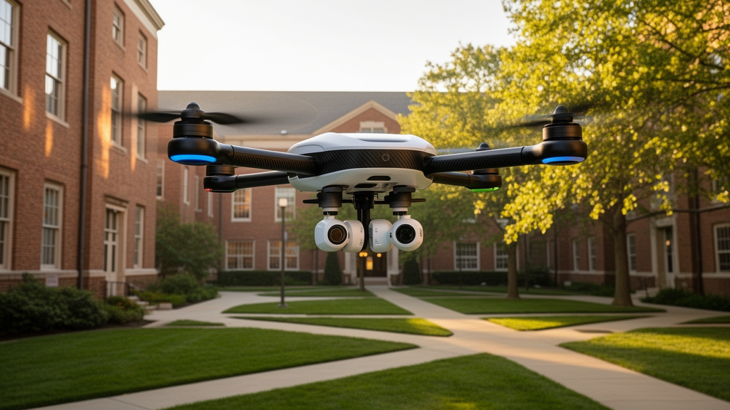
The hardware architecture centers on a custom-engineered quadcopter frame constructed from lightweight carbon-fibre composites. The central payload, weighing approximately 450 grams, houses the sensor array and processing unit within a modular enclosure designed to minimize in-flight vibrations. The sensing array includes electrochemical modules for CO, NO2, SO2, and O3, alongside a PMS5003 laser-based sensor for PM2.5. To ensure measurement accuracy, the intake ports were positioned outside the central rotor wash envelope, and the PM2.5 sensor utilized an active micro-sampling fan to maintain consistent particle concentration measurements despite propeller downwash turbulence.
Data acquisition and processing occur at the edge, with the Raspberry Pi 4 sampling telemetry at a rate of 1 Hz. The onboard system employs a signal conditioning pipeline that includes outlier rejection using a sliding three-sigma window to remove voltage spikes caused by electromagnetic interference from the drone’s electronic speed controllers. Additionally, a five-sample Exponential Moving Average filter suppresses transient noise, while environmental compensation algorithms adjust raw sensor baselines for temperature and relative humidity in real-time. This preprocessing ensures that the data transmitted to the cloud is clean and reliable, mitigating common issues such as sensor drift and packet loss.
Calibration was a critical component of the study, performed through a co-location protocol adjacent to a certified Continuous Ambient Air Quality Monitoring Station (CAAQMS) in Pune. Over 120 consecutive hours, the UAV sensors were compared against reference instruments, including a Beta Attenuation Monitor for PM2.5 and chemiluminescence analyzers for NO2. A Multivariate Linear Regression model was applied to compensate for environmental artifacts, resulting in an overall channel correlation coefficient (R-squared) of 0.89. This calibration reduced the Mean Absolute Error in Air Quality Index (AQI) estimation from 18.4 to 16.5 points, a 10.3% improvement in accuracy, demonstrating the viability of low-cost sensors when properly calibrated against certified standards.
Field deployment involved a cumulative flight time of 75 minutes across three locations on the campus, with data packets transmitted to the ThingSpeak cloud platform every 15 seconds via a 4G cellular gateway. The system achieved a packet delivery rate of 98.6%, with a local circular buffer ensuring that data lost during brief signal fades was synchronized once the connection was re-established. The flights were conducted during daylight hours under Visual Line-of-Sight conditions, adhering to Directorate General of Civil Aviation regulations, with automated return-to-launch fail-safes configured for low voltage and telemetry loss.
The results indicated that the overall calculated AQI across all monitoring locations ranged from 21.7 to 42.1, falling within the “Good” category according to US EPA and CPCB criteria. This suggests that the immediate campus environment does not present significant health risks from short-duration exposure. However, the platform successfully captured subtle spatial micro-gradients that static networks might overlook. For instance, ozone concentrations showed significant temporal variation, with micro-peaks reaching 0.1571 ppm at 50 meters above ground level, coinciding with high solar irradiance and thermal stability. These observations highlight the photochemical nature of ozone formation in the local atmosphere.
Nitrogen dioxide levels also exhibited transient localized shifts, ranging from 0.0125 ppm to 0.0182 ppm, which the researchers attributed to localized sources such as campus access roads. On the first day of monitoring, NO2 was the primary pollutant driving the AQI, whereas on the second day, SO2 became the dominant factor in two of the three locations. This shift in the primary pollutant underscores the dynamic nature of urban air quality and the necessity for high-frequency, mobile monitoring to identify changing emission sources.
Particulate matter levels remained generally low throughout the sampling period, with most baseline measurements ranging from 0 to 4 micrograms per cubic meter on Day 1 and 0 to 9 micrograms per cubic meter on Day 2. The PMS5003 sensor demonstrated an acquisition variance of less than 1.2 micrograms per cubic meter, confirming the effectiveness of the central intake placement in reducing downwash turbulence. Carbon monoxide concentrations were consistently below the detection limit of the electrochemical cells, reinforcing the observation that the campus area is free from major point-source industrial or heavy vehicle emissions during the sampling windows.
The study acknowledges several limitations, including a flight endurance of 22 to 25 minutes due to battery and payload weight constraints. Additionally, the electrochemical sensors are susceptible to cross-sensitivities at high ambient relative humidity levels above 80%. Future iterations of the platform aim to incorporate machine learning algorithms for dynamic cross-sensitivity compensation and explore hybrid fixed-wing/vertical take-off and landing airframes to extend the operational flight envelope. The researchers also plan to expand co-location calibration protocols to account for multi-seasonal environmental conditions, moving toward regulatory-grade decision-making capabilities.
This work provides a scalable foundation for mobile micro-climate air quality monitoring across diverse urban and industrial topographies. By integrating edge computing with cloud-based analytics, the platform offers a flexible and cost-effective solution for assessing air quality in real-time. The open-source nature of the hardware and software design allows for broader adoption by the scientific community, facilitating further research into the spatiotemporal dynamics of air pollution. The findings suggest that UAV-based IoT platforms can complement existing ground-based networks by providing high-resolution data that captures the complex, localized variations in pollutant concentrations.
The study was conducted as a proof-of-concept field validation, focusing on the integration of hardware and software for airborne environmental sensing rather than establishing long-term health outcomes or regulatory compliance. By situating the work within the broader context of Internet of Things frameworks for smart city environmental telemetry, the authors highlight a shift from static, fixed-point monitoring toward dynamic, high-resolution spatial mapping. This approach allows for the assessment of localized dispersion patterns that are often smoothed out or missed by traditional ground-based networks, which rely on a large number of fixed sensors to achieve adequate spatial coverage.
A significant portion of the methodology involves rigorous data preprocessing to ensure the integrity of the raw telemetry before it reaches the cloud. The authors note that wireless sensor networks and mobile platforms are frequently affected by noise, missing data due to packet loss, and occasional outliers. In airborne deployments, these vulnerabilities are exacerbated by physical stressors, including electromagnetic interference from high-current Electronic Speed Controllers and severe propeller downwash turbulence that can affect particulate matter optical counter intakes. To mitigate these issues, the system employs a multi-stage edge processing pipeline. This includes outlier rejection using a sliding three-sigma window to remove voltage spikes, noise suppression via a five-sample Exponential Moving Average filter, and real-time environmental compensation for temperature and relative humidity. These steps are critical for maintaining the quality of the data stream, which is essential for any downstream analytical or predictive models that may be applied to the collected information.
The calibration protocol was designed to minimize bias resulting from ambient relative humidity sensitivity, thermal cross-sensitivities, and zero-point drift inherent to low-cost electrochemical and optical sensors. The co-location study was conducted adjacent to a Continuous Ambient Air Quality Monitoring Station in Pune, with the UAV payload positioned within 1.5 meters of the reference instruments. The environmental conditions during the 120-hour calibration period included temperatures ranging from 21.2 to 36.8 degrees Celsius and relative humidity levels between 38% and 86%. The reference instrumentation included a Beta Attenuation Monitor for PM2.5, a Chemiluminescence Analyzer for NO2, a Pulsed UV Fluorescence Analyzer for SO2, a Non-Dispersive Infrared Gas Analyzer for CO, and a UV Photometric Analyzer for O3. The data synchronisation process involved aggregating the 1 Hz sensor telemetry into rolling 15-minute averages to match the reporting intervals of the certified reference station, ensuring a valid statistical comparison between the low-cost UAV sensors and the high-precision ground-based equipment.
The power management system was engineered to provide stable voltage levels while maintaining flight endurance, a critical constraint for airborne monitoring. The sensing and control subsystem is powered by a 22.2 V Lithium Polymer battery, which is electrically isolated from the UAV propulsion system to prevent interference and allow for independent recharging. A DC-DC buck converter reduces the battery voltage to a regulated 5 V rail for the Raspberry Pi 4 and digital devices, while a low-dropout regulator provides a stable 3.3 V output for the electrochemical gas sensors. The total power consumption remains below 5 W during operation, with the Raspberry Pi 4 accounting for the highest load at 600 to 1000 mA. Protective measures include reverse polarity protection, startup delay circuits to stabilize voltage before powering sensitive sensors, and an isolated analog supply for gas sensors to minimize signal noise from digital circuits. This design ensures reliability in measurements and increases the service life of components across successive missions, supporting the platform’s potential for repeated field deployments.
Subject of Research: Development and field validation of a UAV-integrated IoT sensing platform for real-time air quality monitoring and AQI estimation.
Article Title: UAV integrated IoT sensing platform for sustainable air quality monitoring and real time AQI estimation
Article References: Bongale, A., Kumar, S., Kumar, C. H., Birwadkar, P., & M, H. K. (2026). UAV integrated IoT sensing platform for sustainable air quality monitoring and real time AQI estimation. Discover Mechanical Engineering, 5(1), Article 184. https://doi.org/10.1007/s44245-026-00370-0
Image Credits: AI Generated
DOI: 10.1007/s44245-026-00370-0
Keywords: UAV, IoT, Air Quality, AQI, Sensors, Environmental Monitoring, Edge Computing, Cloud Telemetry, Pollution, Raspberry Pi, integrated, sensing
News Source: Russell Cooper. (November 12, 2026). Drone-Based IoT Platform Maps Micro-Gradients in Campus Air Quality. Scienmag.