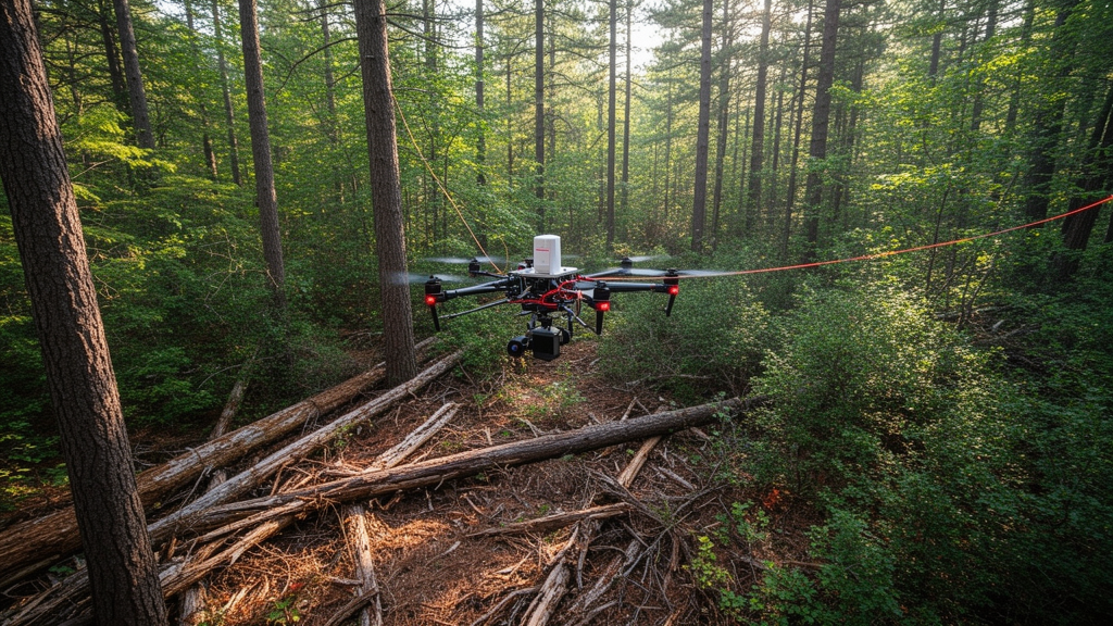
An ecological modeling framework that couples airborne and terrestrial laser scanning data with forest process models can accurately predict broad-scale loads of downed woody debris across fire-maintained longleaf pine forests, even while struggling to track localized debris patterns on the forest floor. In an investigation published in Fire Ecology, researchers evaluated whether detailed three-dimensional canopy maps could predict the ground accumulation of dead branches and fallen wood across southeastern pine woodlands managed with regular prescribed fire. The study established that linking laser-derived tree crowns to branch deposition, wood decay rates, and historical fire return intervals yielded virtually unbiased fuel load estimates when evaluated across broader spatial areas. However, the model predictions showed an almost negligible correlation with fine-scale, destructive microplot field measurements taken across individual stands. This divergence highlights a persistent challenge in wildland fire science: broad canopy metrics effectively capture stand-level fuel averages, but fine ground-level fuel distributions remain subject to complex local processes.
Downed woody debris represents an essential structural component of surface fuel beds in fire-adapted pine savannas, directly shaping fire spread, energy release, smoke emissions, and biological effects during wildland burns. Forest managers routinely partition this fallen deadwood into fine woody debris, consisting of one-hour fuels under zero point six centimeters in diameter, ten-hour fuels between zero point six and two point five centimeters, and one-hundred-hour fuels spanning two point five to seven point six centimeters, alongside coarse woody debris representing one-thousand-hour fuels larger than seven point six centimeters. Traditional fuel monitoring methods rely heavily on labor-intensive destructive clip plots or planar intersect line transects, both of which suffer from severe spatial sampling error, poor repeatability, and substantial uncertainty across heterogeneous landscapes. Because the vast majority of surface woody debris originates directly from overstory tree canopies through natural branch shedding, self-pruning, and senescence, researchers sought to determine whether three-dimensional remote sensing could capture fuel generation at operational spatial extents.
To construct and validate the predictive framework, the research team focused on frequent-fire pine ecosystems across the southeastern United States, predominantly characterized by longleaf pine alongside slash, shortleaf, and loblolly pines. The primary experimental units were situated at Fort Stewart in Georgia and Eglin Air Force Base in Florida, both of which have been actively managed for decades with prescribed fires recurring every two to three years. Additional study sites, including Pebble Hill Plantation, Tall Timbers Research Station, and Osceola National Forest, provided comparative field data representing time-since-fire intervals ranging from one to six years. Airborne laser scanning surveys mapped the structural dimensions of dominant overstory trees across these sites, providing high-resolution point clouds that captured canopy heights and horizontal distributions. Field teams paired these remote sensing datasets with destructive biomass harvests from hundreds of pre-fire and post-fire clip plots measuring between zero point twenty-five and one square meter, alongside planar transects documenting coarse downed logs.
The modeling architecture operated through two distinct stages, first determining annual woody deposition from standing tree canopies and subsequently simulating fuel accumulation on the ground over time. Airborne laser scanning data were processed using specialized forestry software algorithms to normalize point heights above ground level, generate one-meter canopy height models, and segment individual overstory tree crowns based on local maxima detection. Predictor metrics summarizing crown height, geometry, and density were supplied to random forest models calibrated against regional tree inventory datasets to estimate total branch and bole wood biomass for each delineated crown. Because airborne sensors predominantly detect outer foliage and upper canopy boundaries, the investigators integrated highly detailed terrestrial laser scanning measurements to partition predicted tree woody biomass into standard time-lag fuel categories. Terrestrial point clouds collected from forty-two longleaf pine specimens at Austin Cary Forest and Osceola National Forest were segmented using deep learning to separate woody material from needles.
Using quantitative structure models fitted to the isolated woody point clouds, the researchers developed allometric crown proportion equations relating total aboveground wood biomass to branch size distributions. Branch segments reconstructed from the terrestrial scans were sorted into volumetric proportions matching one-hour, ten-hour, one-hundred-hour, and one-thousand-hour diameter thresholds, applying a constant wood density of five hundred and fifty kilograms per cubic meter. Analysis revealed that smaller trees possessing under seventy kilograms of total wood biomass exhibited high proportions of coarse material due to main stem dominance, whereas larger trees developed substantially greater relative proportions of intermediate branches. For delineated crowns, the authors assigned empirical branch proportion curves across wood biomass gradients, while fixing fine one-hour twig components at one percent for small trees and zero point five percent for larger trees. The resulting component biomass was combined with component-specific annual branchfall rates and crown areas to calculate annual woody deposition rates for each individual tree crown.
To translate discrete crown-level branchfall into realistic continuous ground inputs, the researchers rasterized the deposition estimates at a five-meter spatial resolution, which roughly matched the horizontal extent of mature pine crowns. Recognizing that falling branches disperse beyond the vertical perimeter of the originating tree, the team applied an isotropic two-dimensional convolution filter using a three-by-three kernel matrix. Under this spatial smoothing procedure, the central focal pixel received two-thirds of the modeled branchfall biomass, while the remaining one-third was distributed uniformly among the eight surrounding neighboring cells in equal shares of one twenty-fourth. In contrast to fine woody debris, coarse one-thousand-hour fuels were modeled uniformly at the stand level rather than mapped to individual tree positions, reflecting the random nature of large bole failure and main stem fall. The resulting spatial grids represented the baseline annual deposition flux of each woody fuel class across the analyzed forest management units.
Once annual deposition rates were established, the team simulated ground-level fuel accumulation using a spatially explicit formulation of the Olson negative exponential accumulation model. The mathematical function incorporated annual woody deposition, size-specific wood decomposition rates derived from regional published literature, and site-specific accumulation intervals defined by historical fire return intervals or documented time since fire. To realistically represent recurrently burned landscapes, the formulation included a non-zero initial boundary condition representing residual, unburned fuel surviving previous prescribed fires, assuming the stand had attained a dynamic steady-state accumulation. Component-specific fire consumption rates were parameterized through an empirical analysis of pre-fire and post-fire field datasets, which revealed that prescribed surface fires consumed higher proportions of fine twigs while leaving substantial fractions of coarser fuels unburned. Predicted annual fine woody debris deposition at Fort Stewart reached roughly double the rates estimated at Eglin Air Force Base, reflecting pronounced underlying differences in site productivity.
Model validation demonstrated that the remote sensing framework produced remarkably accurate fuel load estimates when aggregated across spatial areas, achieving relative bias values under twenty-one percent across all fine woody debris categories. The highest relative bias was observed in the ten-hour fuel component at negative twenty point nine percent, reflecting a modest tendency toward underestimation, while ninety-five percent confidence intervals confirmed the absence of systematic bias across evaluated fuel classes. At Fort Stewart, predicted average fine fuel loading ranged between zero point twenty-two and zero point thirty kilograms per square meter, while coarse debris loads averaged zero point thirteen to zero point fifteen kilograms per square meter. However, when researchers evaluated model predictions against unaggregated field observations, Pearson correlation coefficients dropped to near-zero levels, showing negligible association for total fine debris, ten-hour fuels, and one-hundred-hour branches, with only one-hour twigs showing a modest correlation of zero point thirty-one.
The researchers concluded that the extreme discrepancy between stand-scale accuracy and plot-scale correlation stems from severe spatial mismatches and fundamental ecological dynamics governing surface fuel beds. Individual field clip plots covered only zero point twenty-five to one square meter, creating a hundred-fold area disparity compared to the twenty-five-square-meter resolution of the model grid cells. Destructive microplot harvests frequently undersample sparsely distributed large branches, occasionally generating implausible negative consumption values in field records where post-fire fuel counts exceed pre-fire measurements due to spatial sampling artifacts. Furthermore, the findings demonstrate that the localized distribution of fallen deadwood on the forest floor is not governed strictly by the overhead distribution of living tree crowns. Real-world fuel beds are shaped by unmodeled standing dead snags, localized branch shed during wind events, and highly variable fuel consumption patterns during prescribed burns that diverge markedly from uniform consumption assumptions.
Despite these fine-scale limitations, the investigation provides a critical conceptual bridge connecting three-dimensional laser scanning technology with mechanistic ecosystem process models for wildland fuel characterization. The methodology demonstrates that overstory lidar metrics can parameterize landscape-scale fuel accumulation models without relying purely on empirical regression fits, establishing a transferable framework for heterogeneous fuel mapping in fire-prone forests. Future refinements must incorporate explicit snag detection to account for standing deadwood mortality pools, integrate multitemporal airborne lidar to monitor log decay over time, and incorporate dynamic meteorological parameters governing decomposition rates. By establishing that crown-derived inputs successfully predict broader surface fuel loads, the study offers fire managers improved operational tools for fire behavior simulations, carbon accounting, and prescribed burning plans, while highlighting the critical need for improved field sampling protocols capable of capturing high-resolution wildland fuel heterogeneity.
Subject of Research: Modeling downed woody debris accumulation in fire-maintained southeastern pine forests using laser scanning
Article Title: Modeling tree crown-mediated accumulation of downed woody debris in fire-maintained longleaf pine forests of the southeastern US from laser scanning data
Article References: Sánchez-López, N., Hudak, A. T., Xia, J., Robertson, K., Bright, B. C., Prichard, S., Nemens, D. G., Hawley, C., Loudermilk, E. L., Keane, R., Woodall, C. W., Mauro, F., Boschetti, L., Silva, C. A., & Cabo, C. (2026). Modeling tree crown-mediated accumulation of downed woody debris in fire-maintained longleaf pine forests of the southeastern US from laser scanning data. Fire Ecology, 22(1), Article 136. https://doi.org/10.1186/s42408-026-00548-7
Image Credits: AI Generated
DOI: 10.1186/s42408-026-00548-7
Keywords: downed woody debris, airborne laser scanning, terrestrial laser scanning, longleaf pine, fine woody debris, coarse woody debris, Olson accumulation model, prescribed fire, quantitative structure models, fire return interval, fuel loading, Fort Stewart, Eglin Air Force Base, crown proportion equations, forest fuels, branchfall deposition, fuel consumption
News Source: Drew Townsend. (November 11, 2026). Lidar Models Broad Woody Fuel Loads While Missing Fine Ground Scale Patterns. Scienmag.