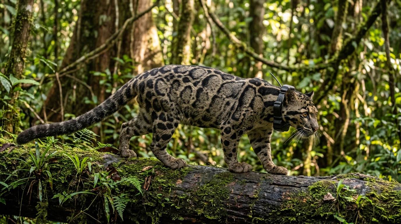
High-resolution GPS telemetry combined with long-term camera-trap surveys in the fragmented Lower Kinabatangan floodplain of eastern Sabah, Malaysian Borneo, has revealed the first detailed individual-level movement pathways and spatial dynamics of the elusive Sunda clouded leopard (Neofelis diardi). Conducted across a roughly 2,000-square-kilometer multiple-use landscape, the investigation provides an empirical look into how this forest-dependent felid navigates an environment heavily shaped by human activity. The study area, which encompasses parts of the Lower Kinabatangan Wildlife Sanctuary as well as the Gomantong and Pin Supu Forest Reserves, contains approximately 520 square kilometers of forest embedded within extensive industrial oil palm plantations and infrastructure. By fitting adult leopards with GPS-GSM collars programmed to record spatial coordinates at twenty-minute intervals and pairing these tracking paths with years of systematic photographic captures, researchers uncovered clear behavioral contrasts between forested refuges and agricultural matrices, while tracking the spatial segregation and communication routines governing individual animals.
The Sunda clouded leopard is an ecologically vital apex carnivore endemic to Borneo and Sumatra, yet it historically ranks among the least-understood large tropical felids due to its secretive habits, low natural densities, and partially arboreal lifestyle. Prior to this research, empirical movement datasets for the species were limited to a single female monitored through very high frequency (VHF) radio tracking in central Sabah and an earlier GPS study focused on broad-scale connectivity modeling rather than fine-scale path architecture. The Kinabatangan floodplain presents a uniquely challenging mosaic where remaining forests have undergone repeated logging over the past century and now form a largely linear network of protected riparian blocks, limestone outcrops, and degraded corridors. To evaluate how these landscape modifications influence solitary carnivores, researchers established capture and tracking protocols designed to document individual home ranges, habitat-specific travel velocities, temporal activity patterns, and instances of shared site visitation without making unwarranted population-level extrapolations.
Live-trapping efforts executed between May 2013 and September 2014 involved deploying unbaited, custom-built steel mesh box traps across six locations in Lots 5 and 6 of the wildlife sanctuary and the adjacent Pin Supu reserve. Traps were positioned along known travel routes and monitored continuously with passive infrared trail cameras alongside daily or twice-daily visual inspections under veterinary supervision. The team captured three adult males and two adult females, successfully fitting collars on four individuals while releasing one elderly female in suboptimal condition without a collar. The deployed tracking collars featured automated drop-off mechanisms set for thirty-two weeks, although premature device failures resulted in functional operational lifespans ranging from six to 103 days across tracked individuals. Before deploying the units, the team validated tracking accuracy over a twenty-four-hour period, determining a mean Euclidean error of 9.5 meters, which was subsequently established as the minimum spatial threshold for identifying true animal movements versus stationary bouts.
To complement the high-frequency telemetry data, the researchers ran phased camera-trapping operations across the central floodplain between 2010 and 2014, logging photographic captures across distinct survey regimes. The initial intensive phase in 2010 deployed seventy camera stations covering approximately 89 square kilometers, yielding thirty-one independent clouded leopard captures from 4,340 trap nights. An expanded second intensive survey phase from 2013 to 2014 deployed ninety stations across 101 square kilometers, recording 119 detections over 6,046 trap nights, while an intervening deployment of twenty-two stations along the Kinabatangan River gathered an additional 114 photographic events. Across all camera efforts, 264 independent photographic records were collected, representing nine distinct individuals identifiable by unique coat patterns and morphological characteristics. All four GPS-collared cats were recorded on camera traps alongside five uncollared leopards, though four photographic captures remained unassigned due to insufficient visual clarity.
Home-range analyses performed on the three individuals with sufficient tracking durations revealed profound differences depending on the analytical estimator applied to the spatial data. When using the fixed-k Local Convex Hull (k-LoCoH) boundary-based method, both monitored adult males occupied comparable ranges of approximately 41 square kilometers, strictly constrained within forest tracts. In stark contrast, unconstrained methods such as ninety-five percent kernel density estimation (KDE) and ninety-five percent minimum convex polygons (MCP) yielded range sizes spanning 162.8 to 175.1 square kilometers and 118.7 to 199.7 square kilometers, respectively. The authors noted that KDE and MCP smooth across space or connect peripheral points, artificially encompassing extensive non-forested agricultural land where leopards did not linger. The tracked female occupied a far more compact k-LoCoH home range of roughly 7.0 square kilometers, which expanded to 67.8 square kilometers when evaluated through ninety-five percent KDE and MCP metrics.
Spatial overlap calculations based on k-LoCoH boundaries demonstrated marked territorial partitioning between the two monitored males, whose ranges overlapped by only eight percent. Their mutual exclusion was organized geographically, with one male maintaining a predominantly linear territory stretching westward along the river toward the Pin Supu Forest Reserve, while the other held ground extending north and east toward the Gomantong limestone formations. The minimal overlap between these males occurred almost exclusively around a distinct topological feature known as Batangan ridge. Conversely, the tracked female exhibited extensive spatial overlap with the eastern male, sharing 68.5 percent of her home range across both the ridge and Gomantong forest, while sharing 20.9 percent of her range with the western male exclusively at Batangan. This spatial arrangement mirrors patterns documented in other solitary felids, where reproductive males maintain mutually exclusive territories that encompass or intersect the smaller home ranges of females.
Beyond general spatial overlap, the camera-trap network identified Batangan ridge as a disproportionately vital communication hub within the broader floodplain ecosystem. While solitary detections accounted for over eighty-five percent of thirty- and sixty-day monitoring windows at ordinary camera stations, the single station situated along the 200-meter-long, 50-meter-high limestone ridge produced 141 of the 260 identifiable detections, representing 54.2 percent of all photographic events. Batangan recorded frequent multi-individual co-occurrences within thirty-day windows, including mixed-sex pairings in 35.5 percent of windows, male pairs in 6.5 percent, and trios of one male and two females in 6.5 percent. Furthermore, six of the eight photographic records capturing scent-marking behavior across the entire study took place on Batangan ridge and involved three separate males. The authors suggest that prominent topographic ridgelines serve not only as convenient travel pathways through low-lying, flood-prone terrain but also function as persistent chemical messaging centers facilitating indirect conspecific communication.
Analysis of 20-minute movement steps highlighted a movement strategy characterized by cathemeral activity, short directed travel bouts, and prolonged stationary intervals anchored within forest boundaries. Across all recorded travel sequences, the three collared males covered mean daily distances ranging from 3.18 to 4.12 kilometers, occasionally reaching single-day movement maximums of 13.03 kilometers, whereas the tracked female exhibited a lower daily average of 2.08 kilometers and a maximum of 6.14 kilometers. Travel bouts were generally brief and right-skewed, averaging 2.1 hours for one male and 1.3 hours for the second. Across 516 recorded stationary periods, the first male spent 98.9 percent of resting intervals in forest and 1.1 percent in closed-canopy oil palm, while the second male spent 100 percent of his stationary periods inside forest. These extended resting periods averaged 6.1 hours and 2.3 hours, respectively, underscoring the absolute dependence of the species on forest structure for shelter, stalking, and security.
When leopards ventured beyond forest boundaries into agricultural land or infrastructure corridors, their locomotion changed noticeably. Male leopards moved significantly faster when traversing oil palm plantations and roads than when navigating forest interiors. One male maintained an average travel speed of 0.53 kilometers per hour in forest, increasing to 0.91 kilometers per hour in oil palm and 1.49 kilometers per hour along roads; the second male registered speeds of 0.37 kilometers per hour in forest, 1.05 kilometers per hour in plantations, and 0.68 kilometers per hour on roads. The collared female engaged in no recorded movements outside forest cover. The accelerated travel observed among males in modified areas suggests directed transit through environments perceived as risky, where sparse understory offers minimal protection. Although documented vehicle collisions with Sunda clouded leopards on Bornean roads remain rare, expanding highway infrastructure across Sabah presents an escalating threat of habitat fragmentation and direct mortality.
Activity density modeling derived from camera-trap records and GPS collar data demonstrated that Sunda clouded leopards maintain cathemeral rhythms with notable crepuscular peaks. Both sexes displayed heightened activity around dawn, followed by a midday lull, while females showed a secondary peak near dusk and males sustained relatively steady activity across nocturnal hours. Overall temporal overlap between sexes was moderate, characterized by an overlap coefficient of 0.74. While camera traps reflected sharper crepuscular spikes than collars, both monitoring streams confirmed that the felids remain capable of moving throughout all twenty-four hours of the diel cycle. Temporal dynamics at shared locations also reflected changing social constraints; for instance, an uncollared female accompanied by a dependent juvenile avoided the Batangan communication site entirely during the 2010 survey phase, only visiting the ridge repeatedly during later phases after her offspring had departed.
The study authors emphasize several critical methodological and ecological limitations inherent to tracking cryptic, low-density carnivores in tropical environments. Small sample sizes, premature battery and transmitter failures, and variable monitoring windows restricted comprehensive home-range calculations to three individuals, meaning the resulting data provide an individual-level descriptive baseline rather than broad population-level estimates. Furthermore, because camera stations deliberately targeted trails and ridgelines to maximize captures, detection rates represent indices of site use and spatiotemporal association rather than unbiased measures of total animal abundance or habitat preference. Nonetheless, the findings establish that while Sunda clouded leopards may traverse agricultural mosaics and roads, their fundamental life-history requirements—including hunting cover, secure denning, prolonged resting, and localized scent communication—remain tightly bound to contiguous and fragmented forest patches, highlighting the irreplaceable conservation value of retaining existing riparian reserves and forest corridors.
Subject of Research: Sunda clouded leopard spatial ecology and movement behavior in Sabah
Article Title: Individual-level movement and space use of Sunda clouded leopards revealed by GPS telemetry and camera traps in a human-modified Bornean landscape
Article References: Hearn, A. J., Nájera, F., Bolongon, G., Evans, M. N., Lai, S., Teoh, S. W., Guerrero-Sánchez, S., Abram, N. K., Bakar, M. S. A., Macdonald, D. W., & Goossens, B. (2026). Individual-level movement and space use of Sunda clouded leopards revealed by GPS telemetry and camera traps in a human-modified Bornean landscape. Animal Biotelemetry, 14(1), Article 36. https://doi.org/10.1186/s40317-026-00474-0
Image Credits: AI Generated
DOI: 10.1186/s40317-026-00474-0
Keywords: Sunda clouded leopard, Neofelis diardi, GPS telemetry, camera traps, wildlife tracking, Borneo, movement ecology, habitat fragmentation, Individual-level, movement, space, Sunda
News Source: Drew Townsend. (November 9, 2026). GPS Tracking Reveals Sunda Clouded Leopard Movement Across Fragmented Bornean Forests. Scienmag.