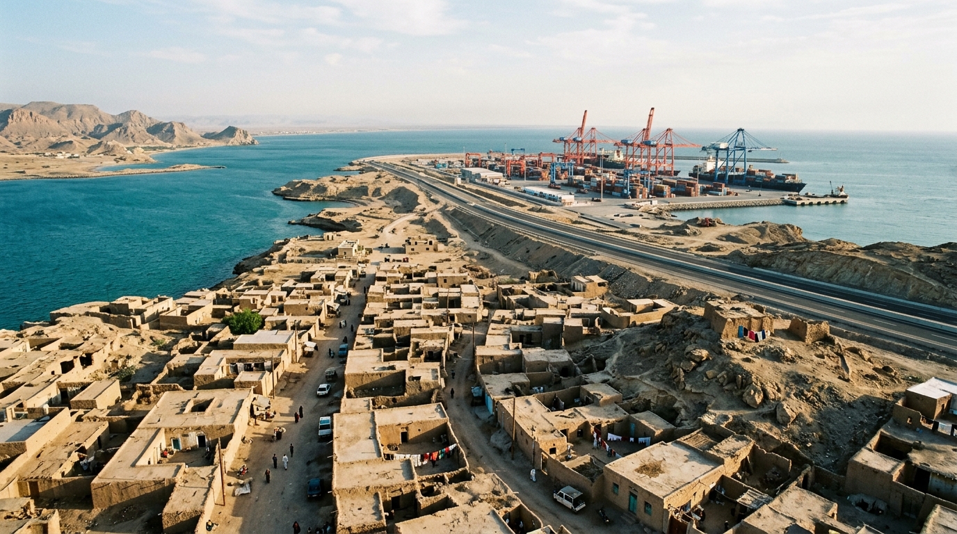
Researchers from Iran have proposed a multi-scalar, phased development framework designed to integrate informal settlements into sustainable land use planning in Chabahar, a port city in the Sistan and Baluchestan Province. Published in the journal City and Built Environment, the study addresses the spatial inequalities resulting from rapid regional development and rural-to-urban migration. The framework aims to transform marginalized areas into formal, sustainable urban components through a structured process that combines expert consensus, hierarchical analysis, and spatial simulation.
Chabahar, situated on the Gulf of Oman, serves as Iran’s only oceanic port and a strategic transit gateway to eastern Iran. The city has experienced significant growth driven by the establishment of a free trade zone and international infrastructure projects. However, this development has led to the spread of informal settlements in the city’s outskirts, creating social, economic, and spatial disparities. These settlements often lack basic services and infrastructure, contributing to persistent poverty and housing insecurity for marginalized residents.
The study adopts a mixed-methods approach to address the complexities of planning in areas with incomplete data and diverse stakeholder priorities. The methodology integrates the Delphi method for expert consensus building, the Analytic Hierarchy Process (AHP) for prioritizing planning criteria, and the SLEUTH urban growth model for spatial simulation. This combination allows for a transparent and evidence-based strategy that bridges participatory decision-making with technical spatial analysis.
The Delphi method involved a panel of 18 experts, including academic researchers, local government officials, engineering professionals, and urban planners. Over a three-month period, the panel engaged in iterative rounds of feedback to reach consensus on development criteria. This process ensured that the planning framework reflected a broad range of professional and local perspectives, enhancing the reliability and contextual relevance of the proposed interventions.
Using the Analytic Hierarchy Process, the researchers weighted the criteria identified through the Delphi process. The AHP analysis, supported by Expert Choice software, revealed that Urban Management and Justice emerged as the most influential domain, with a weight of 0.295. This highlights the critical importance of coordinated governance and equitable law enforcement in achieving sustainable development. The Economic category followed closely with a weight of 0.283, emphasizing the role of employment generation and financial support mechanisms in fostering resilience among marginalized populations.
The framework is structured across three scales: macro, meso, and micro. At the macro scale, the focus is on regional connectivity, ecological resilience, and strategic infrastructure, aligning local development with national policies. The meso scale targets urban-rural integration and service accessibility, while the micro scale prioritizes neighborhood livability, housing quality, and local participation. This hierarchical approach ensures that interventions at the local level are consistent with broader regional and national development goals.
The implementation strategy is divided into two main phases. The first phase, known as the Micro-Scale Intervention, focuses on targeted, grassroots actions to address immediate housing shortages and formalize informal settlements. This phase involves the strategic use of underutilized areas and land reserves to create detailed local plans for residential plot allocation. The “First Popular Wave” engages the community in this process, ensuring that the plans reflect the specific needs and characteristics of each neighborhood.
The second phase, Macro-Scale Integration, aims for a citywide transformation from 2023 to 2030. This phase seeks to provide adequate housing and essential services to meet the current population’s needs while achieving long-term development objectives. By integrating the study area into Chabahar’s urban framework, the plan intends to eliminate informal settlements through planned redevelopment. The goal is to create a unified urban environment that supports Chabahar’s strategic role as a competitive international port and economic hub.
The SLEUTH model was used to simulate land-use changes under different policy scenarios, incorporating the AHP-derived priorities as spatial constraints. This simulation provided insights into the future spatial dynamics of the area, guiding decision-making and resource allocation. The model helped identify zones suitable for development while considering environmental factors such as slope, land use, and proximity to transportation networks. This technical analysis ensured that the proposed interventions were spatially feasible and environmentally compatible.
The study acknowledges several methodological limitations, including the subjectivity inherent in expert judgment for criteria weighting. The hierarchical model assumes independence among different scales, whereas in reality, these scales are interdependent. Additionally, the lack of large-scale empirical testing limits the generalizability of the results. Future research is recommended to conduct sensitivity analyses and longitudinal studies to better capture the complex interdependencies between different spatial scales.
The findings suggest that integrated land use planning, combined with community-validated phased implementation, can create replicable models for similar marginalized regions. By repositioning informal settlements as integral components of the urban landscape rather than anomalies to be eliminated, the framework offers a pathway to inclusive growth. This approach emphasizes the importance of balancing legal, economic, environmental, and infrastructural dimensions to achieve spatial justice and sustainable urbanization in Chabahar and beyond.
The study area encompasses approximately 9,739 square kilometers in the southeast of Sistan and Baluchestan province, with a population of 291,910 people. Chabahar is defined by its 135 kilometers of land border and 115 kilometers of sea border, including 145 kilometers of coastline adjacent to the Sea of Oman. This geographic positioning makes it the sole oceanic port of Iran, with deep waters and natural cuts providing ideal conditions for deep docks and anchorage for large ocean-going ships. The city’s strategic importance is further underscored by its role as a transit gateway to eastern Iran and its designation as a strategic area for transit and industrial development. In 1991, the lands east of Chabahar Bay, spanning 14,000 hectares, were designated as the Chabahar Free Zone and officially opened in 1992. This zone has operated for over two decades, contributing to the national economy and serving as a support system for the underprivileged region of Balochistan, although its development has fallen short of expectations in terms of population growth and job creation due to external political-economic conditions such as international sanctions and infrastructure weaknesses.
The environmental and climatic context of the Chabahar region presents specific challenges and opportunities for planning. The area features a hot and humid desert climate with an average annual precipitation of 114.2 millimeters and an average temperature ranging from 8.4 to 8.9 degrees Celsius. The region is home to diverse ecological assets, including the Gandu Protected Area, Pink Lagoon Wetland, and the International Wetland of Gwatar Gulf. These areas are ecologically unique and popular tourist destinations but are particularly susceptible to recent developments due to their delicate ecosystems. The presence of these natural landscapes necessitates that spatial planning accounts for environmental compatibility and protection. The SLEUTH model integration in the study specifically considers factors such as slope, land use, exclusion layers, and hillshade data to ensure that proposed development scenarios respect these environmental constraints. This approach aims to prevent the environmental degradation and increased exposure to hazards often associated with rapid urban sprawl and informal settlement growth in similar coastal and arid regions.
At the meso-scale, the proposed spatial layout includes distinct functional zones designed to support regional development and urban-rural integration. One key component is the proposed offshore islands, which are strategically conceived to support tourism, recreation, and high-value residential development. The spatial program for these islands incorporates beachfront villas, coastal promenades, hotels, and maritime transport hubs, aligning with development-oriented planning objectives and regional economic diversification strategies. The metropolitan area is planned to include retail and commercial zones, business gateways, hospitality areas, and high-density residential towers, along with transit-oriented development and light rail transit services. The urban area focuses on promoting local development through mixed land use, urban greening, and increased activity density around transport hubs. A backup metropolitan area is proposed to provide complementary spaces for administrative, industrial, and wholesale activities, while a suburban residential reserve area is designated to prevent spatial imbalance and social inequality. These zoning decisions are informed by the Delphi group’s assessment of key factors, including developed physical and social infrastructures, the diversity of existing facilities, and the availability of specialized knowledge and technical resources.
The micro-scale phase emphasizes targeted action plans that address tangible and intangible dimensions of development, including the natural environment, social dynamics, and economic structures. The SLEUTH model is employed to simulate urban growth patterns over time, examining factors such as population growth, land use changes, and infrastructure development to guide decision-making. The study identifies specific long-term interventions for economic revitalization and social inclusion, such as establishing local charitable loan funds for low-income households, conducting local social censuses, and mapping settlement areas for informed spatial planning. Housing construction models adapted to local conditions and the negotiation of alternative programs to avoid forced displacement are also central to this phase. The integration of the Transit-Oriented Development model with light rail transit routes forms a movement hierarchy in the urban fabric, aiming to improve accessibility and functional mix. This detailed approach ensures that the development of micro-urban construction meets the local community’s needs in neighborhoods, utilizing a hierarchy to address the settlement population’s requirements while preserving local identity and social structures.
The theoretical underpinnings of the study draw from multiple perspectives on spatial inequality, including Marxist geography and dependency theory. Marxist geographers argue that capitalist systems generate spatial disparities through mechanisms of overproduction and uneven accumulation, linking overconsumption in some regions to underdevelopment in others. Dependency theorists view informal settlements as non-traditional urban dwellings established by rural migrants struggling to assimilate into urban life, often resulting from factors such as unemployment and poverty. The study acknowledges that informal urbanization, driven by population mobility, presents both challenges and opportunities, potentially leading to overcrowded living conditions but also providing economic opportunities for migrants. By addressing these theoretical frameworks, the proposed framework aims to move beyond traditional top-down planning models that often neglect informal settlements. Instead, it advocates for a comprehensive approach that considers the intersectionality of class, gender, and spatial patterns to create more inclusive and equitable urban spaces, ensuring that interventions do not merely displace existing inequalities but actively work to redress them through participatory governance and equitable resource allocation.
Subject of Research: Integrating informal settlements into sustainable land use planning: a phased development framework for addressing spatial inequalities in Chabahar, Iran
Article Title: Integrating informal settlements into sustainable land use planning: a phased development framework for addressing spatial inequalities in Chabahar, Iran
Article References: Aflaki Samani, E., Fanni, Z., & Jafarpour Ghalehteimouri, K. (2025). Integrating informal settlements into sustainable land use planning: a phased development framework for addressing spatial inequalities in Chabahar, Iran. City and Built Environment, 3(1), Article 26. https://doi.org/10.1007/s44213-025-00061-8
Image Credits: AI Generated
DOI: 10.1007/s44213-025-00061-8
Keywords: Integrating, informal, settlements, sustainable, land, planning, phased, development, framework, addressing, spatial, inequalities
News Source: Denise Maddox. (November 8, 2026). Phased Planning Framework Targets Spatial Inequality in Chabahar. Scienmag.