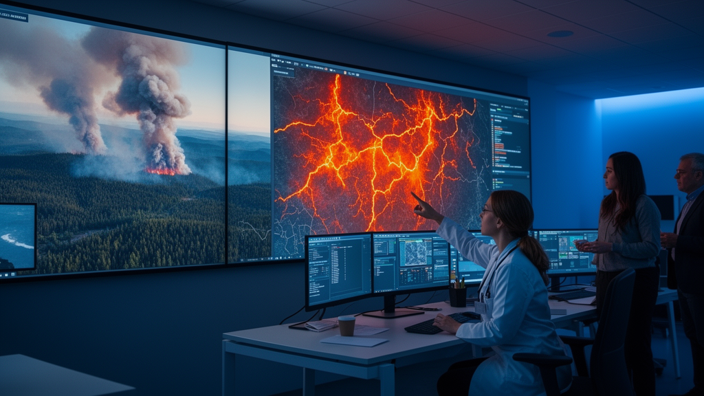
Wildfires are increasing in frequency, extent, and intensity in many regions, with consequences for climate, human health, and ecosystem integrity. Forest fire emissions have risen by roughly 60 percent over the past two decades, and annual premature deaths from smoke exposure could exceed 1.4 million people by the end of the century, according to estimates cited in a new meeting report published in the journal Fire Ecology. Yet the satellites that currently watch the planet for fire cannot see many of the blazes that matter most: small, cool, short-lived, and understory fires slip through the gaps of coarse-resolution, infrequently revisiting sensors. A new report lays out a coordinated science strategy for FireSat, an upcoming non-governmental satellite constellation designed to close that gap with unprecedented spatial and temporal resolution.
The report synthesizes outcomes from three international science workshops held in 2025, which brought together approximately 100 participants from academia, government, non-governmental organizations, and the private sector. Attendees came from Australia, Brazil, South Africa, various European nations, Canada, and the United States, and worked to identify scientific priorities in climate impact, community health and safety, and ecosystem integrity for the period from 2026 to 2030. The teams co-created a communal document of key data needs and priorities, which was distilled into a consensus set of priorities and timelines. All participants were invited to review the consolidation and the resulting manuscript, which was published as a Brief Report on 26 October 2026.
FireSat is a program of the non-governmental Earth Fire Alliance, a public-private-philanthropic partnership that grew out of a co-design effort involving the Environmental Defense Fund, philanthropic funders, Google Research, and Muon Space, the technical partner that builds and operates the satellites. Funding to date has been primarily philanthropic, with long-term sustainment expected to rely on government funding, agency-level data agreements, and commercial licenses. Individual satellites have an expected lifetime of three to five years, and the alliance’s operations plan provides for replenishment to maintain continuity beyond full deployment.
The technical specifications are ambitious. The first FireSat satellite, called protoflight, was launched in March 2025 for testing and demonstration. The first three operational satellites, termed Initial Operation Capability, launched in 2026 and are expected to begin providing data in northern hemisphere fall or winter 2026. The constellation should reach an average hourly temporal resolution across the globe around 2029 with approximately twenty satellites, and ultimately achieve a revisit time of 20 to 30 minutes, depending on latitude, in the early 2030s with roughly fifty satellites at Full Operational Capability. The sensor is a multi-band imager collecting data in six spectral channels simultaneously at the same resolution: red, near infrared, shortwave infrared, two mid-infrared bands, one attenuated and one unattenuated to reduce saturation over hot fires, and longwave infrared. The scanning system has a 1500-kilometer swath width and an average spatial resolution of 80 meters, with a design goal of a false positive detection rate below 5 percent.
Beyond raw imagery, the Earth Fire Alliance will deliver derived data products including hotspot detections, fire perimeters, fire progression time series, and gridded fire radiative power measurements. Downstream products such as estimated carbon emissions or fire radiative energy will need to be developed by the scientific community, which is precisely what the new strategy document is intended to catalyze. The report outlines a structured research timeline from 2026 to 2030 aligned with the constellation’s phased deployment, with central themes of independent validation, uncertainty characterization, integration with legacy fire datasets, and translation of science advances into operational decision support.
On the climate side, the stakes are considerable. Wildfire emissions average about 2 gigatons of carbon per year, and climate change is increasingly driving emissions upward through longer fire seasons, higher emission intensities, and the combustion of old carbon. Existing sensors miss much of this because short-duration, small ground fires and sub-canopy smoldering are poorly characterized due to infrequent observation or coarse spatial resolution. One estimate cited in the report suggests that for small fires in Africa, coarse-resolution fire products underestimate net carbon emissions by 31 to 101 percent. FireSat could therefore fill a critical gap in global emissions accounting. High-resolution fire radiative energy estimates, especially at night, could support more accurate greenhouse gas emission inventories, strengthen fire emission models, reduce uncertainty in global fire emissions budgets, quantify legacy carbon loss in peatlands, and enable burn residency time analyses that are not currently feasible.
Fire management could also benefit. Early detection can provide the opportunity to actively manage ignitions before they grow too large to proactively control, and improved emissions data combined with detection capacity offers opportunities for strategic suppression of fires in key carbon stores such as boreal forests and peatlands. Higher temporal resolution on spread rates was noted as an opportunity to refine fire modeling for management planning and risk assessments, while fire radiative energy or fuel consumption products could inform carbon projects and evaluate their effectiveness. An important first step, the authors stress, will be rigorous validation of the fire detection product against existing datasets and field observations, including characterization of detection performance through intercomparisons, error matrices, and assessment of potential saturation effects, before proceeding to calibration of fire radiative power products.
For community health and safety, the report emphasizes that FireSat is not designed to quantify air pollution directly, but its potential for improved characterization of fire radiative power, rate of spread, and combustion phase could reduce the upstream uncertainty that currently limits air quality predictions and smoke dispersion models. Estimating population smoke exposure currently relies on chemical transport models that take fire location, size, and emissions as inputs, and uncertainty in upstream fire characterization propagates through the modeling chain to affect estimated health impacts. Better fire data could support more accurate estimation of smoke-attributable health outcomes, including pharmacy use, emergency visits, hospitalizations, and premature mortality. The report also highlights the tradeoff associated with prescribed fire, which can reduce the risk of very large fires while generating short-term fine particulate exposures, a tradeoff the authors say has not been well explored. Near-real-time monitoring could enable adaptive management of prescribed fire timing and intensity to tilt that tradeoff toward net benefits.
Equity considerations feature prominently. Evidence suggests that low-income communities are less able to protect themselves during smoke events, and Indigenous communities in California face roughly 1.7 times the average wildfire fine particulate burden with less capacity to respond quickly. The report calls for co-development of data products, alert systems, and decision-support tools with public health agencies and frontline communities, along with clear data access through familiar platforms and ethical handling of health data. Improved fire detection could also support early-warning forecasts of smoke impacts and inform actionable exposure thresholds for advisories or school closures.
For ecosystems, higher spatial and temporal resolution could transform fire identification, attribution, and impact assessment. Many small, cool, understory, agricultural, and tropical ground fires remain poorly detected by current systems, particularly in peatlands and cloud- or canopy-obscured regions. Attribution is especially challenging in fine-scale mosaics, where it can be difficult to determine whether fires are deforestation fires, agricultural clearing fires, or both. By capturing fine-scale variation in fire radiative power, cumulative energy release, fire residence time, and spread rate, FireSat could quantify patterns of burn heterogeneity needed to predict species abundance, habitat fragmentation, and post-fire recovery, particularly in data-poor tropical and understory systems. Fire metrics such as duration, intensity, and heterogeneity could also help distinguish stabilizing fires that support ecosystem functioning from destabilizing fires that drive degradation, and combined with precipitation and soil data could enable near-real-time watershed-scale early-warning systems for postfire erosion, flooding, and water quality impacts. Throughout, the report insists that success depends on independent, transparent verification of FireSat’s algorithms, benchmarking against legacy datasets such as MODIS and VIIRS products, and early community engagement so that the data translate into real-world action. FireSat, the authors conclude, will be only one part of a larger fire science and management system, but a strategically developed one could drive a new way to manage the climate, human, and environmental effects of fire.
Subject of Research: A science strategy and research priorities for the FireSat satellite constellation for high-resolution global fire monitoring
Article Title: Developing a science strategy and science priorities for FireSat, an upcoming high spatial and temporal resolution fire monitoring system
Article References: Buma, B., Alvarado, E., Balch, J. K., Barsanti, K. C., Bjarke, N. R., Bratburd, J., Deere, N. J., Duane, A., Dube, T., Falkowski, M. J., Gitas, I., Gould, C. F., Hall, J. V., Hansen, W. D., Harned, R., Hessburg, P., Hoffman, C., Huang, H., Hudak, A. T., … Veraverbeke, S. (2026). Developing a science strategy and science priorities for FireSat, an upcoming high spatial and temporal resolution fire monitoring system. Fire Ecology, 22(1), Article 167. https://doi.org/10.1186/s42408-026-00599-w
Image Credits: AI Generated
DOI: 10.1186/s42408-026-00599-w
Keywords: FireSat, wildfire, satellite remote sensing, fire emissions, fire radiative power, smoke exposure, Earth Fire Alliance, prescribed fire, ecosystem impacts, fire detection, climate change, validation
News Source: Drew Townsend. (October 28, 2026). Research report: Developing a science strategy and science priorities for FireSat, an upcoming high spatial and temporal resolution fire monitoring system. Scienmag.