Farmland soils in a coal-and-dairy county on China’s Loess Plateau carry a clear chemical signature of human activity, even though overall contamination remains mild, according to a new study published in the journal Discover Soil. Researchers sampled twenty sites across the southern Datong Basin and measured seven heavy metals—arsenic, cadmium, chromium, copper, nickel, lead and zinc—in surface soil from the top twenty centimetres. Their verdict: the region shows slight contamination and low ecological risk overall, but cadmium stands out as the element that has accumulated most widely and contributes the largest share of potential ecological risk.
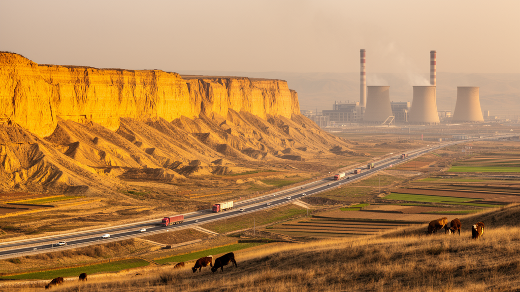
The study area is a county in the southern Datong Basin whose economy rests on two pillars: coal and dairy. Coal mining has traditionally been the pillar industry, although the sampled zone itself involves mainly coal washing and mining-related services rather than large-scale extraction. The county also sits within the 39°N golden dairy belt and is one of northern China’s major high-quality milk-producing areas. A dense network of major transport corridors crosses the region, which borders the prefecture’s central urban area. That combination—coal handling, livestock farming and heavy traffic—makes the county an instructive test case for how mixed rural-industrial land use shapes soil chemistry.
The team collected composite samples at each site by pooling four to six subsamples, then analysed them with atomic fluorescence spectrometry for arsenic and atomic absorption spectrometry for the other metals, following China’s technical specification for soil environmental monitoring. Because soil pH exceeded 7.5 at all sites, the researchers adopted the risk screening values for agricultural land at high pH from China’s national soil contamination standard. Against those benchmarks, the news was reassuring: mean concentrations of all seven metals fell below the risk screening values for Shanxi Province, indicating low overall soil environmental risk.
But the comparison with regional background values told a different story. Mean concentrations of cadmium and lead exceeded their respective soil background values, while the other five metals did not. Cadmium showed the strongest enrichment, with a mean single-factor pollution index of 1.57, followed by lead at 1.31; arsenic, chromium, copper, nickel and zinc all scored below 1. Cadmium was consistently classified as slightly contaminated at every site, and its low coefficient of variation—0.171, the lowest of the seven metals—suggests its accumulation is relatively homogeneous across the region rather than confined to a few hotspots. Lead, by contrast, showed moderate variability, with 70 percent of sites slightly contaminated and 10 percent moderately contaminated—the highest proportion of moderate contamination of any metal.
Two further indices sharpened the picture. The Nemerow comprehensive pollution index, which emphasises the most enriched elements at each site, ranged from 1.05 to 1.97, confirming slight overall contamination. The contaminated sites—numbers 6, 10, 12, 14 and 19—clustered in farmland near factories, industrial parks and major village roads, and showed co-enrichment of several metals. The geo-accumulation index gave cadmium a mean value of 0.045, indicating slight accumulation, with 60 percent of sites above zero; lead and copper peaked at 0.731 and 0.719 respectively, marking notable local enrichment, while chromium and zinc stayed below zero everywhere. The potential ecological risk index ranged from 57.38 to 94.10, with a mean of 74.25—well below the threshold of 150 that separates low from moderate risk. Yet cadmium alone accounted for 63.4 percent of the total risk index, and fifteen of the twenty sites showed moderate ecological risk for this single element.
Spatial mapping by inverse distance weighting revealed that each metal tells its own story. Elevated arsenic and cadmium concentrations were scattered in patchy, multicentric patterns, with cadmium hotspots concentrated near the coal-washing plant in the northwest. High chromium and lead concentrations appeared mainly near major transportation corridors in the southwest, consistent with traffic-related processes such as vehicle-component wear and road-dust resuspension. Nickel hotspots occurred close to industrial facilities, while copper was concentrated in farmland in the southeast—plausibly linked to copper-containing feed additives that pass through livestock into manure spread on fields, given the region’s well-developed dairy industry.
To trace the origins of these metals, the researchers applied positive matrix factorisation, a receptor model that decomposes concentration data into statistical source factors. A four-factor solution proved optimal, with stable factor profiles across repeated runs and bootstrap mapping rates of 80 to 100 percent for the major factors. Factor 1, dominated by copper and zinc, was interpreted as a traffic-related mixed source, since brake wear releases copper and tire wear releases zinc onto roadside soils—relevant in a region where heavy-duty coal trucks and dairy transport share the roads. Factor 2, dominated by arsenic with substantial lead and cadmium, was linked to coal-related activities: arsenic is a common hazardous trace element in coal, and coal washing, coal-gangue handling and coal-dust resuspension all occur locally even without large-scale mining. Factor 3, characterised by cadmium and zinc, was tied to agricultural and livestock inputs, including cadmium-bearing phosphate fertilisers and manure from animals fed copper and zinc supplements. Factor 4, dominated by nickel and chromium, was interpreted as an industrial source associated with local metal smelting, machinery manufacturing and coal-washing facilities.
The authors are careful to stress that these source labels are interpretive hypotheses, not confirmed emissions. PMF resolves statistical factors from elemental covariation, and those factors do not necessarily correspond uniquely to physical sources. To add complementary evidence, the team built random forest models for each metal using environmental predictors—vegetation indices, land use, topography, and distances to roads, industrial enterprises and livestock facilities—and interpreted them with SHAP values. The machine-learning analysis found distinct association patterns: arsenic and lead tracked traffic-related variables, cadmium was most strongly associated with distance to the nearest coal-washing plant, chromium was tied mainly to natural background conditions such as land cover and elevation, copper responded to surface and vegetation conditions, and nickel and zinc reflected industrial and traffic-related influences. The two approaches were not fully consistent, the authors note, because they answer different questions—one identifies statistical factors, the other environmental associations—so RF–SHAP serves as supporting evidence rather than validation.
The study has clear limits. Sampling was purposive and the sample size small, so the results describe representative source-related settings rather than statistically representing the whole county, and the sparse sampling adds uncertainty to the interpolated maps. No local source materials—coal dust, road dust, fertilisers, manure—were analysed, and the risk assessment relied on total metal concentrations without considering chemical speciation, bioavailability or soil-to-crop transfer. The authors recommend stratified or systematic sampling, repeated sampling across seasons, isotopic tracing and in situ sampling of potential source materials to test their source hypotheses.
Subject of Research: Heavy metal contamination, spatial distribution and source apportionment in farmland soils of the southern Datong Basin, Loess Plateau
Article Title: Pollution characteristics and risk assessment of soil heavy metals in the Datong Basin, Loess Plateau
Article References: Fan, M., Liu, H., Zou, J., Ma, S., Wang, Z., & He, H. (2026). Pollution characteristics and risk assessment of soil heavy metals in the Datong Basin, Loess Plateau. Discover Soil, 3(1), 200. https://doi.org/10.1007/s44378-026-00359-x
Image Credits: AI Generated
DOI: 10.1007/s44378-026-00359-x
Keywords: soil heavy metals, cadmium, lead, Datong Basin, Loess Plateau, coal industry, dairy farming, source apportionment, PMF, random forest, ecological risk, farmland soil
News Source: Alan Morgan. (October 27, 2026). Coal, Cows and Traffic Leave a Cadmium Fingerprint in Loess Plateau Soils. Scienmag.