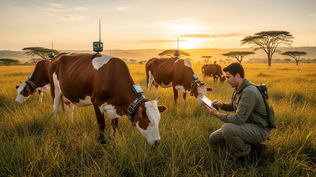
Engineers in Colombia have built and field-tested a low-cost cattle monitoring system that streams temperature, humidity, light, motion and location data from instrumented collars over a LoRaWAN wireless network, and they have published one of the most detailed evaluations yet of how such a network actually performs on a working farm. The system, called IoT4Cows, was developed by Guillermo Guzmán and Wilder Castellanos and validated over a seven-week deployment on a commercial ranch in Guamal, in the Colombian Orinoquía region, where three Simbrah cows wearing the collars generated more than 130,000 uplink messages.
The motivation is rooted in the economics of Colombian livestock farming, which contributes roughly 1.4 percent of national GDP. Yet productivity indicators lag behind international benchmarks: official statistics cited in the study put average milk yield in Colombia at about 5.7 litres per day, compared with 12.2 litres per cow per day in New Zealand, 19.6 in Argentina and 29 in the United States, although the authors caution that differences in breed, feeding, climate and statistical definitions limit direct comparison. On many Colombian farms, animal health is still assessed through visual inspection carried out weekly or fortnightly, and in some extensive operations across the eastern plains only during vaccination campaigns held twice a year. Traditional visual observation detects fewer than half of estrus events, and delayed diagnosis of periparturient diseases such as metritis, mastitis and laminitis increases morbidity and treatment costs. Cattle rustling compounds the problem, with official reports indicating that more than 1.3 million animals were affected by theft and clandestine slaughter during 2024.
Connectivity is the decisive barrier. Extensive grazing systems disperse animals over large rural areas where cellular coverage is often scarce, and conventional short-range wireless technologies cannot reach the distances continuous monitoring requires. LoRaWAN, a low-power wide-area network protocol, offers long communication range with low energy consumption, which is why the researchers built their system around it. Each collar is built on RAK Wireless’s WisBlock modular platform and integrates a temperature and humidity sensor, an ambient light sensor, a three-axis accelerometer, a GNSS module, a 2,550 mAh lithium-polymer battery and a small solar panel, all sealed in an IP67-rated enclosure with an estimated total mass of 516 grams. Data travel to an eight-channel gateway and onward through The Things Network to a cloud platform built on ThingsBoard, which stores telemetry, displays dashboards and triggers alerts, including email notifications for out-of-range temperatures and SMS messages for humidity thresholds and device inactivity.
The field validation took place on a farm with a cadastral extent of 150 hectares, of which the grazing area accessible to the instrumented animals comprised three paddocks totalling 88.54 hectares. The site sits at 525 metres above sea level in a tropical rainforest climate with mean annual temperature of 25.1°C and annual rainfall exceeding 4,200 millimetres. The study was approved by the Institutional Committee for the Care and Use of Animals of Pontificia Universidad Javeriana, and animal welfare was monitored daily by the farm administrator using a checklist covering grazing, rumination, water intake and rest behaviour. No skin abrasions, behavioural alterations or attempts to remove the devices were observed, although the authors note the campaign was too short to assess long-term tolerance or material ageing.
Coverage results were among the study’s headline findings. With a single gateway, successful packet reception was directly verified over 50.3 percent of the 88.54-hectare grazing area, and the longest validated link reached 2.21 kilometres from the gateway, with a received signal strength of −125 dBm, a point that lies beyond the grazing-area boundary and demonstrates a range margin rather than coverage of the farm itself. A fitted log-distance path loss model yielded a path loss exponent of 2.16, close to the free-space value of 2.0, consistent with the open tropical savannah terrain. The measured path loss at the longest link, 156 dB, sat only 4 dB below the theoretical design limit of 160 dB calculated from the link budget. The authors stress that longer ranges reported in other studies, such as 10 to 12 kilometres in mountainous terrain with elevated gateways, depend largely on favourable topography or additional receiving infrastructure, and that the proportion of the grazing area with directly verified reception is the more meaningful practical indicator.
Packet reception ratio, calculated from LoRaWAN frame counters over a 22-day period of continuous functional operation, averaged 0.8949 across the three nodes. Reception was strongest between 100 and 200 metres from the gateway, at 0.971, and degraded from 300 to 400 metres onward, dropping to 0.698 at 400 to 500 metres. An interval around 500 metres was independently confirmed by field inspection to coincide with a terrain depression and dense vegetation cover, consistent with localised signal attenuation. Beyond 800 metres the number of expected transmissions was low and confidence intervals correspondingly wide, so those figures were not treated as reliable estimates. The analysis excluded 446.9 hours of outage across the three nodes, most of which occurred simultaneously and were attributed to node battery depletion and a loss of power at the gateway rather than radio-link failures.
Environmental sensor accuracy was assessed against a SainLogic weather station on the same farm over roughly 24 hours of paired observations. Temperature readings stayed within the manufacturer’s ±2.0°C specification without correction, with a bias of −0.05°C and 95 percent Bland–Altman limits of agreement of −0.87 to 0.77°C. Humidity, however, showed a systematic positive bias of +3.28 percent RH, exceeding the manufacturer’s ±2 percent RH specification before correction, an offset attributed to moisture retention in the vent plug cavity. Because the bias was constant, the researchers compensated it with an additive correction applied in the network-server payload decoder rather than in the node firmware, which reduced the residual bias to +0.18 percent RH and brought 99.3 percent of paired observations within specification. The authors note this correction was derived and evaluated within a single comparison campaign, and independent validation on separately collected data remains necessary.
Battery performance was measured as well as modelled. A coulomb counting model estimated 3.85 days of autonomy under the deployed configuration of a 15-second transmission interval without solar charging, and the measured discharge curve reached the minimum operational threshold after about 4.2 days, a difference of roughly 9 percent attributable to variability between battery units and environmental conditions. With solar charging and a one-minute transmission interval, the projected autonomy extends to 12 to 21 days, supported by a five-day observation of stable daily voltage cycles, although the authors emphasise this is a projection based on the energy model rather than a fully measured outcome. Notably, in the one-minute scenario the GNSS module operating in continuous tracking mode accounts for approximately 87 percent of daily energy consumption, making duty-cycle management of that module the single greatest opportunity for extending battery life in future node versions.
Scalability was assessed through simulation rather than physical deployment. A reimplemented collision model, calibrated with the actual radio parameters and the field-fitted path loss model, estimated that a single gateway could sustain approximately 62 nodes at the deployed SF8 configuration while keeping the data extraction rate above the 0.9 operational threshold, with bounds of 18 nodes for SF10 and 115 nodes for SF7. These estimates, obtained with a conservative 15-second transmission interval, have not been verified experimentally, and the authors caution they may be optimistic in areas with greater obstruction than the surveyed grazing area.
The study’s limitations are explicitly acknowledged: only three animals were instrumented, making the deployment a proof of concept; environmental sensors were validated only under stationary conditions, so collar readings should be interpreted as indicators of the local exposure experienced by the animal rather than calibrated measurements of ambient farm conditions; and validation took place on a single farm over seven weeks. Even so, the authors argue the work fills a genuine gap, since formal evaluation of network metrics such as packet reception ratio, coverage and channel duty cycle is rarely reported in the livestock monitoring literature, and they conclude that transfer to larger operations will require field validation with more simultaneous nodes across different topographical and climatic conditions.
Subject of Research: A LoRaWAN-based cattle monitoring system with multi-sensor collars, evaluated for network coverage, packet reception, sensor accuracy, battery autonomy and simulated scalability during a seven-week field deployment in the Colombian tropics.
Article Title: IoT4Cows: a LoRaWAN system for cattle monitoring in extensive grazing with network performance evaluation
Article References: Guzmán, G., & Castellanos, W. (2026). IoT4Cows: a LoRaWAN system for cattle monitoring in extensive grazing with network performance evaluation. Smart Agricultural Technology, 15, Article 102644. https://doi.org/10.1016/j.atech.2026.102644
Image Credits: AI Generated
DOI: 10.1016/j.atech.2026.102644
Keywords: LoRaWAN, IoT, cattle monitoring, precision livestock farming, Colombia, Orinoquía, wireless sensor networks, battery autonomy, path loss model, packet reception ratio, extensive grazing, animal welfare
News Source: William Thompson. (October 27, 2026). LoRaWAN Collars Track Grazing Cattle Across Colombian Savannah in Field Trial. Scienmag.