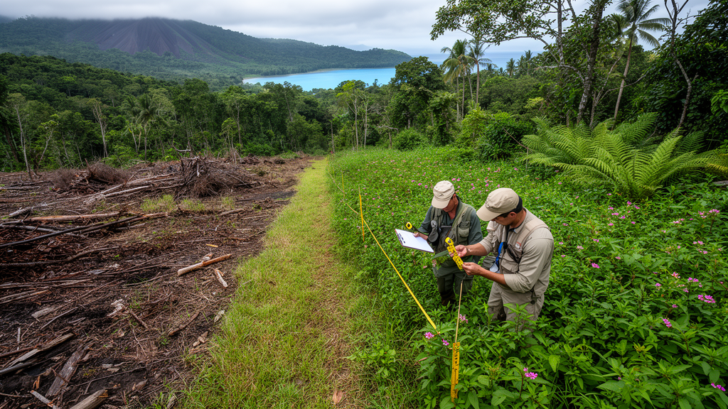
A two-year observational survey of 18 plots on Hengqin Island, China, found that invasive alien plant communities differed markedly among habitat types and were associated with anthropogenic disturbance, whereas season explained little variation in overall community composition. Roadsides and wasteland supported the highest invasive cover, often reaching 50–68%, while forests generally remained below 20% and contained the richest native flora. Across the 58 invasive species recorded, seven dominant invasive plants occupied more habitat-and-season combinations than eight selected native species and showed greater spatial overlap with one another. The results identify persistent differences among urban habitats, but the study did not experimentally establish that habitat conditions or human disturbance caused the observed patterns.
The fieldwork covered six representative habitats in the Guangdong–Macao In-Depth Cooperation Zone, a rapidly developing subtropical landscape in southern Zhuhai. Researchers established three fixed 20-by-20-metre plots in each habitat: forest, wetland, managed park green space, roadside, forest edge and wasteland. Plots within a habitat were at least 500 metres apart, and all 18 were surveyed in every season from March 2023 through December 2024, producing 144 records. Each 400-square-metre plot was divided into sixteen 5-by-5-metre subplots, where investigators identified all vascular plants and estimated abundance, height and canopy cover. The habitats ranged from secondary forest with relatively little recent modification to former construction sites, fallow land, managed lawns and traffic corridors.
Habitat produced the clearest separation in invasive-community composition. A permutational multivariate analysis of variance identified significant differences among the six habitats, with habitat explaining 58.9% of compositional variation; season explained 1.2% and was not significant. Nonmetric multidimensional scaling placed the habitat groups in six distinct, largely nonoverlapping clusters, while samples from the four seasons were extensively intermixed. Forests, parks and roadsides were particularly isolated from one another, whereas forest edges, wetlands and wastelands were positioned closer together in the ordination, although their confidence intervals remained mostly separate. A test of multivariate dispersion found no significant difference in within-habitat spread, supporting the interpretation that the main result reflected differences among group centres rather than unequal variation within groups.
A distance-based redundancy analysis produced a related pattern. Habitat type, season and a continuous disturbance index together accounted for 37.0% of the total variation in invasive-community composition. Habitat and the disturbance index each had significant marginal associations with composition, whereas season had no significant independent effect after habitat and disturbance were considered. The disturbance index combined three indicators: distance to the nearest road, trampling intensity and the abundance of visible anthropogenic traces such as litter, cutting marks, vehicle tracks and construction debris. The first principal component explained 71.7% of the variance among those standardized indicators. Because habitat category and measured disturbance covaried in the observational design, the analysis could not isolate their respective contributions or demonstrate that either was responsible for community differences.
Modelled invasive cover followed a pronounced habitat gradient. Predicted cover was generally 50–65% in wasteland and roadside plots, intermediate in forest edges, parks and wetlands, and usually below 20% in forest. Post hoc comparisons found significantly higher invasive cover in wasteland, roadside and forest-edge habitats than in forest, while park and wetland did not differ significantly from forest. Native community measurements broadly followed the reverse cross-habitat pattern. Forest contained the highest native richness, averaging 34.1 species per plot, compared with 11.2 in forest edge and 11.5 in roadside habitat. Native cover was highest in forest at 78.6% and wetland at 66.3%, but was approximately 37% in both forest edge and park. These associations are compatible with the idea that intact vegetation may provide resistance to invasion, although the study did not test that mechanism experimentally.
Season still affected the amount of invasive cover within particular habitats, even though it did not reorganize whole assemblages. A zero-and-one-inflated beta mixed model accommodated proportional values at both extremes, overdispersion and repeated measurements of the same plots. It detected a significant habitat-by-season interaction, while the independent main effects of habitat and season were not statistically significant. Invasive cover declined significantly from spring to summer in forest edge, park and wetland, with model estimates of 1.26, 1.55 and 1.22, respectively. Seasonal comparisons in roadside and wasteland were not significant, and those habitats maintained approximately 50–68% invasive cover throughout the year. The study therefore found a habitat-dependent seasonal pattern rather than a single annual pulse affecting all sites equally.
Occupancy analysis likewise distinguished the dominant invasive plants from the selected native species. After data from corresponding seasons in 2023 and 2024 were averaged, the researchers evaluated 72 plot-by-season units. Mean Shannon occupancy breadth was 3.00 for the seven invasive species and 2.45 for the eight native species, a significant difference in a Mann–Whitney test. Levins’ index followed the same direction, with means of 17.37 for invasives and 9.74 for natives, although that difference was marginal at p = 0.058. Bidens alba and Leucaena leucocephala were among the species with the broadest occupancy, while Panicum repens had a comparatively narrow distribution. The dominant-species set and principal patterns remained largely unchanged when the occurrence and mean-cover thresholds were varied.
Pairwise Pianka indices provided a second view of spatial structure, with zero indicating no overlap and one indicating complete overlap across the habitat-season units. Invasive–invasive pairs had the highest median value, 0.203, compared with 0.144 for invasive–native pairs and 0.032 for native–native pairs. The invasive–invasive median was significantly greater than the native–native median, and invasive–native overlap also exceeded the native baseline. Although all three medians were below 0.25, the comparison indicates that the selected invasive species occupied more similar habitat-season spaces with one another than the native species did with one another. High-overlap clusters included Bidens alba, Mikania micrantha and Sphagneticola trilobata. These patterns are consistent with environmental filtering in disturbed patches, but the co-occurrence metric does not demonstrate direct competition, displacement or a mechanism of resource use.
Several limitations constrain how broadly the findings can be interpreted. Only three independent plots represented each habitat, so the eight seasonal surveys added temporal replication without increasing spatial replication. The study did not directly measure light, moisture, nutrient availability or other environmental filters, and its disturbance index included semiquantitative disturbance scores. Interobserver agreement was acceptable but not perfect for trampling intensity, with Cohen’s kappa of 0.556, compared with 0.874 for anthropogenic traces. The results are geographically restricted to a compact island of approximately 106 square kilometres undergoing extensive development. Within these constraints, the data show that invasive cover, community composition, native richness and the spatial distributions of dominant species were associated with habitat and disturbance more consistently than with season. Expanded spatial replication and direct environmental measurements would be required to determine which mechanisms underlie those relationships and whether the same patterns occur in other subtropical cities.
Subject of Research: Associations among habitat, anthropogenic disturbance and invasive plant communities in subtropical urban Hengqin Island
Article Title: Habitat Type and Disturbance Intensity Are Associated With Invasive Plant Community Structure Across an Urbanizing Subtropical Island
Article References: Wang, S., Li, M., Guo, Y., Li, J., & Wang, R. (2026). Habitat Type and Disturbance Intensity Are Associated With Invasive Plant Community Structure Across an Urbanizing Subtropical Island. Ecology and Evolution, 16(10), Article e74522. https://doi.org/10.1002/ece3.74522
Image Credits: AI Generated
DOI: 10.1002/ece3.74522
Keywords: plant invasion, urbanization, Hengqin Island, habitat types, anthropogenic disturbance, community composition, occupancy breadth, species co-occurrence, native biodiversity, subtropical ecology, Habitat, Type
News Source: Drew Townsend. (October 22, 2026). Two-year subtropical island survey links habitat and disturbance to invasive plants. Scienmag.